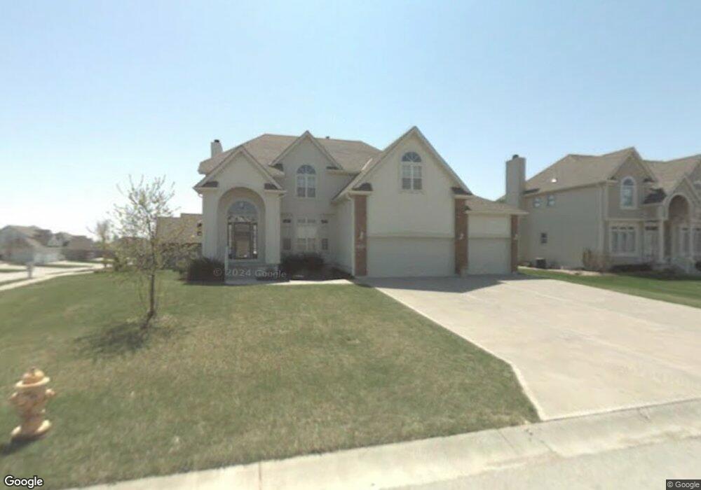
3765 SW Boulder Dr Lees Summit, MO 64082
Estimated Value: $471,000 - $537,000
4
Beds
4
Baths
2,772
Sq Ft
$180/Sq Ft
Est. Value
About This Home
This home is located at 3765 SW Boulder Dr, Lees Summit, MO 64082 and is currently estimated at $499,673, approximately $180 per square foot. 3765 SW Boulder Dr is a home located in Jackson County with nearby schools including Summit Pointe Elementary School, Summit Lakes Middle School, and Lee's Summit West High School.
Ownership History
Date
Name
Owned For
Owner Type
Purchase Details
Closed on
Mar 1, 2005
Sold by
Walker Michael A
Bought by
Frazier Marquita
Current Estimated Value
Purchase Details
Closed on
May 29, 2002
Sold by
Frazier Marquita J
Bought by
Frazier Marquita J and Walker Michael A
Home Financials for this Owner
Home Financials are based on the most recent Mortgage that was taken out on this home.
Original Mortgage
$228,855
Interest Rate
5.75%
Mortgage Type
Purchase Money Mortgage
Create a Home Valuation Report for This Property
The Home Valuation Report is an in-depth analysis detailing your home's value as well as a comparison with similar homes in the area
Home Values in the Area
Average Home Value in this Area
Purchase History
| Date | Buyer | Sale Price | Title Company |
|---|---|---|---|
| Frazier Marquita | -- | -- | |
| Frazier Marquita J | -- | Coffelt Land Title Inc | |
| Frazier Marquita J | -- | Coffelt Land Title Inc |
Source: Public Records
Mortgage History
| Date | Status | Borrower | Loan Amount |
|---|---|---|---|
| Previous Owner | Frazier Marquita J | $228,855 |
Source: Public Records
Tax History
| Year | Tax Paid | Tax Assessment Tax Assessment Total Assessment is a certain percentage of the fair market value that is determined by local assessors to be the total taxable value of land and additions on the property. | Land | Improvement |
|---|---|---|---|---|
| 2025 | $7,509 | $78,900 | $16,481 | $62,419 |
| 2024 | $7,509 | $103,991 | $16,823 | $87,168 |
| 2023 | $7,454 | $103,991 | $13,718 | $90,273 |
| 2022 | $4,816 | $59,660 | $12,274 | $47,386 |
| 2021 | $4,916 | $59,660 | $12,274 | $47,386 |
| 2020 | $4,962 | $59,638 | $12,274 | $47,364 |
| 2019 | $4,827 | $59,638 | $12,274 | $47,364 |
| 2018 | $4,471 | $51,265 | $6,291 | $44,974 |
| 2017 | $4,471 | $51,265 | $6,291 | $44,974 |
| 2016 | $4,264 | $48,393 | $7,448 | $40,945 |
| 2014 | $4,033 | $44,874 | $7,448 | $37,426 |
Source: Public Records
Map
Nearby Homes
- 3796 SW Boulder Dr
- Vacant Lot 3 - SW M-150 Hwy
- 3916 SW Granite Ln
- 4400 Doc Henry Rd
- 1508 SW Arborpark Terrace
- 1512 SW Arborpark Terrace
- 1504 SW Arborpark Terrace
- 1209 SW Wysteria Dr
- 3925 SW Flintrock Dr
- 3940 SW Flintrock Dr
- 1232 SW Wysteria Dr
- 1813 SW Arbormist Dr
- 3474 SW Wysteria Terrace
- 3932 SW Flintrock Dr
- 1801 SW Arbormist Dr
- 1521 SW Arbormill Terrace
- 1542 SW Arbor Park Dr
- 1601 SW Arbor Park Dr
- 1712 SW Arbormist Dr
- 1605 SW Arbor Park Dr
- 3785 SW Sandstone Dr
- 3792 SW Sandstone Dr
- 3772 SW Boulder Dr
- 3760 SW Boulder Dr
- 3789 SW Sandstone Dr
- 3793 SW Boulder Dr
- 3796 SW Sandstone Dr
- 3784 SW Boulder Dr
- 3793 SW Sandstone Dr
- 3776 SW Boulder Dr
- 3780 SW Boulder Dr
- 3797 SW Boulder Dr
- 3788 SW Boulder Dr
- 3797 SW Sandstone Dr
- 3800 SW Sandstone Dr
- 3792 SW Boulder Dr
- 3801 SW Boulder Dr
- 3801 SW Sandstone Dr
- 3804 SW Sandstone Dr
- 3705 SW Granite Ln
Your Personal Tour Guide
Ask me questions while you tour the home.