Estimated Value: $318,064 - $345,000
2
Beds
2
Baths
1,426
Sq Ft
$236/Sq Ft
Est. Value
About This Home
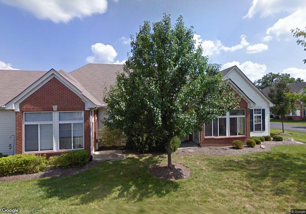
This home is located at 3767 Sandtrap Cir, Mason, OH 45040 and is currently estimated at $336,766, approximately $236 per square foot. 3767 Sandtrap Cir is a home located in Warren County with nearby schools including Mason Intermediate Elementary School, Mason Middle School, and William Mason High School.
Ownership History
Date
Name
Owned For
Owner Type
Purchase Details
Closed on
Jun 15, 2017
Sold by
Wirth David W
Bought by
Cook Alexander I and Valko Kathy L
Current Estimated Value
Purchase Details
Closed on
May 26, 2004
Sold by
Thomas John C and Thomas Darleen R
Bought by
Wirth David W
Home Financials for this Owner
Home Financials are based on the most recent Mortgage that was taken out on this home.
Original Mortgage
$158,000
Interest Rate
6.25%
Mortgage Type
Purchase Money Mortgage
Purchase Details
Closed on
Dec 15, 1999
Sold by
Harrington Inc
Bought by
Thomas John C and Thomas Darleen
Home Financials for this Owner
Home Financials are based on the most recent Mortgage that was taken out on this home.
Original Mortgage
$84,000
Interest Rate
6.88%
Mortgage Type
New Conventional
Create a Home Valuation Report for This Property
The Home Valuation Report is an in-depth analysis detailing your home's value as well as a comparison with similar homes in the area
Home Values in the Area
Average Home Value in this Area
Purchase History
| Date | Buyer | Sale Price | Title Company |
|---|---|---|---|
| Cook Alexander I | $167,500 | None Available | |
| Wirth David W | $158,000 | Lawyers Title Of Cincinnati | |
| Thomas John C | $145,900 | -- |
Source: Public Records
Mortgage History
| Date | Status | Borrower | Loan Amount |
|---|---|---|---|
| Previous Owner | Wirth David W | $158,000 | |
| Previous Owner | Thomas John C | $84,000 |
Source: Public Records
Tax History Compared to Growth
Tax History
| Year | Tax Paid | Tax Assessment Tax Assessment Total Assessment is a certain percentage of the fair market value that is determined by local assessors to be the total taxable value of land and additions on the property. | Land | Improvement |
|---|---|---|---|---|
| 2024 | $3,869 | $95,320 | $29,750 | $65,570 |
| 2023 | $3,379 | $70,329 | $14,455 | $55,874 |
| 2022 | $3,335 | $70,329 | $14,455 | $55,874 |
| 2021 | $3,159 | $70,329 | $14,455 | $55,874 |
| 2020 | $3,123 | $59,602 | $12,250 | $47,352 |
| 2019 | $2,871 | $59,602 | $12,250 | $47,352 |
| 2018 | $2,880 | $59,602 | $12,250 | $47,352 |
| 2017 | $2,545 | $49,158 | $10,266 | $38,892 |
| 2016 | $2,621 | $49,158 | $10,266 | $38,892 |
| 2015 | $1,313 | $49,158 | $10,266 | $38,892 |
| 2014 | $2,683 | $46,820 | $9,780 | $37,040 |
| 2013 | $2,689 | $58,670 | $12,250 | $46,420 |
Source: Public Records
Map
Nearby Homes
- 6309 Inverness Way
- 6415 Eagleview Dr
- 6416 Inverness Way
- 6441 Eagleview Dr
- 6572 Eagle View Dr
- 6486 Prestwick Ct
- 6521 Grand Cypress Way
- 6534 Turtle Point Place
- 6394 Grand Cypress Way
- 4087 Fieldsedge Dr Unit 285E
- 711 Eagle View Ct
- 4154 Fieldsedge Dr
- 3900 St Andrews Ct
- 6668 Pondfield Ln
- 4109 Old Manchester Ct
- 5799 Fairway Dr
- 6674 Villager Place Unit 153D
- 618 Bunker Ln
- 550 Maple Ln
- 6550 Villagefield Dr
- 3769 Sandtrap Cir
- 3763 Sandtrap Cir
- 3765 Sandtrap Cir Unit 3765
- 3775 Sandtrap Cir
- 3771 Sandtrap Cir
- 3768 Sandtrap Cir
- 3801 Sandtrap Cir
- 3797 Sandtrap Cir Unit 3797
- 3764 Sandtrap Cir Unit 3764
- 3799 Sandtrap Cir Unit 3799
- 3805 Sandtrap Cir Unit 3805
- 3770 Sandtrap Cir
- 6325 Inverness Way
- 6321 Inverness Way
- 6329 Inverness Way
- 6317 Inverness Way
- 3766 Sandtrap Cir
- 3766 Sandtrap Cir Unit 1
- 3777 Sandtrap Cir
- 3773 Sandtrap Cir