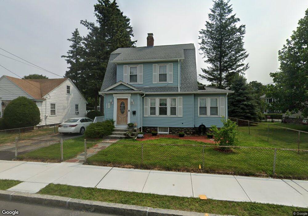
377 Burncoat St Worcester, MA 01606
Burncoat NeighborhoodEstimated Value: $391,930 - $407,000
2
Beds
1
Bath
1,266
Sq Ft
$313/Sq Ft
Est. Value
About This Home
This home is located at 377 Burncoat St, Worcester, MA 01606 and is currently estimated at $396,733, approximately $313 per square foot. 377 Burncoat St is a home located in Worcester County with nearby schools including Jacob Hiatt Magnet School, Chandler Magnet, and Thorndyke Road School.
Ownership History
Date
Name
Owned For
Owner Type
Purchase Details
Closed on
Oct 9, 2008
Sold by
Lamour Maria L
Bought by
Miller Michelle
Current Estimated Value
Purchase Details
Closed on
Jun 9, 2006
Sold by
Wolfe Cling D and Wolfe Zoe
Bought by
Lamour Maria L
Purchase Details
Closed on
Nov 19, 2003
Sold by
Bolduc Marc D
Bought by
Wolfe Clint D and Wolfe Zoe
Purchase Details
Closed on
Dec 27, 1991
Sold by
Oneill Mark J
Bought by
Bolduc Marc D
Create a Home Valuation Report for This Property
The Home Valuation Report is an in-depth analysis detailing your home's value as well as a comparison with similar homes in the area
Home Values in the Area
Average Home Value in this Area
Purchase History
| Date | Buyer | Sale Price | Title Company |
|---|---|---|---|
| Miller Michelle | $155,000 | -- | |
| Lamour Maria L | $244,000 | -- | |
| Wolfe Clint D | $204,000 | -- | |
| Bolduc Marc D | $100,000 | -- |
Source: Public Records
Mortgage History
| Date | Status | Borrower | Loan Amount |
|---|---|---|---|
| Open | Bolduc Marc D | $156,000 | |
| Closed | Bolduc Marc D | $156,170 |
Source: Public Records
Tax History Compared to Growth
Tax History
| Year | Tax Paid | Tax Assessment Tax Assessment Total Assessment is a certain percentage of the fair market value that is determined by local assessors to be the total taxable value of land and additions on the property. | Land | Improvement |
|---|---|---|---|---|
| 2025 | $4,235 | $321,100 | $116,400 | $204,700 |
| 2024 | $4,096 | $297,900 | $116,400 | $181,500 |
| 2023 | $3,919 | $273,300 | $101,200 | $172,100 |
| 2022 | $3,593 | $236,200 | $81,000 | $155,200 |
| 2021 | $3,412 | $209,600 | $64,800 | $144,800 |
| 2020 | $3,283 | $193,100 | $64,800 | $128,300 |
| 2019 | $3,159 | $175,500 | $58,200 | $117,300 |
| 2018 | $3,173 | $167,800 | $58,200 | $109,600 |
| 2017 | $3,062 | $159,300 | $58,200 | $101,100 |
| 2016 | $2,978 | $144,500 | $42,500 | $102,000 |
| 2015 | $2,900 | $144,500 | $42,500 | $102,000 |
| 2014 | $2,824 | $144,500 | $42,500 | $102,000 |
Source: Public Records
Map
Nearby Homes
- 15 Inwood Rd
- 68 Housatonic St
- 43 Fales St
- 14 Housatonic St
- 314 Burncoat St
- 95 Saint Nicholas Ave
- 80 Clark St
- 40 Francis St
- 12 Prudential Rd
- 14 Fales St
- 49 Prudential Rd
- 18 Claffey Ave
- 80 Prudential Rd
- 29 E Mountain
- 3 Granville Ave
- 13 Fatima Ln
- 2 Maria Ln Unit 2
- 134 Whitmarsh Ave
- 28 Brooks St
- 31 Enaya Cir Unit 31
- 379 Burncoat St
- 371 Burncoat St
- 19 Quinapoxet Ln
- 369 Burncoat St Unit 1,2 & 3
- 369 Burncoat St
- 369 Burncoat St Unit 1
- 369 Burncoat St Unit 2
- 14 Quinapoxet Ln
- 383 Burncoat St
- 380 Burncoat St
- 100 Brandon Rd
- 367 Burncoat St
- 385 Burncoat St
- 3 Quinapoxet Ln
- 96 Brandon Rd
- 29 Quinapoxet Ln
- 93 Brandon Rd
- 384 Burncoat St
- 26 Quinapoxet Ln
- 4 Inwood Rd