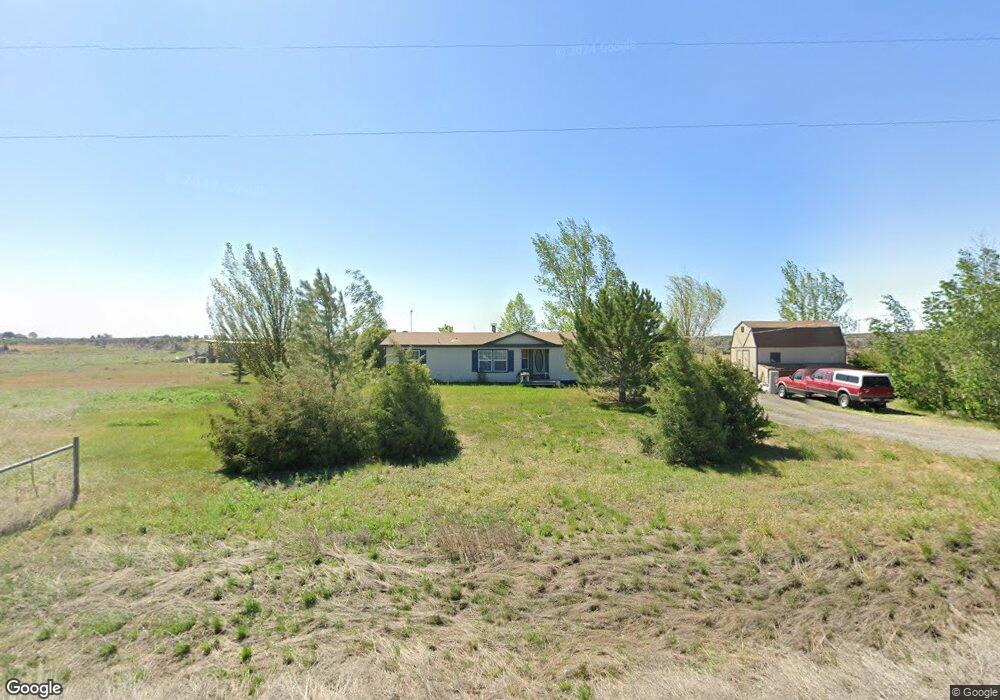
377 E Highway 26 Shoshone, ID 83352
Estimated Value: $216,399 - $347,000
3
Beds
2
Baths
1,456
Sq Ft
$209/Sq Ft
Est. Value
About This Home
This home is located at 377 E Highway 26, Shoshone, ID 83352 and is currently estimated at $303,850, approximately $208 per square foot. 377 E Highway 26 is a home located in Lincoln County with nearby schools including Shoshone Elementary School and Shoshone High School.
Ownership History
Date
Name
Owned For
Owner Type
Purchase Details
Closed on
May 25, 2023
Sold by
Mcknight Sparr G
Bought by
Velasco Freddy and Gonzalez Bibiana
Current Estimated Value
Purchase Details
Closed on
Jul 31, 2012
Sold by
Brown Brandon
Bought by
Hubbs Cameron L
Home Financials for this Owner
Home Financials are based on the most recent Mortgage that was taken out on this home.
Original Mortgage
$57,997
Interest Rate
4.75%
Mortgage Type
FHA
Create a Home Valuation Report for This Property
The Home Valuation Report is an in-depth analysis detailing your home's value as well as a comparison with similar homes in the area
Purchase History
| Date | Buyer | Sale Price | Title Company |
|---|---|---|---|
| Velasco Freddy | -- | Flying S Title And Escrow Of I | |
| Hubbs Cameron L | -- | Land Title & Escrow | |
| Brown Brandon | -- | Land Title & Escrow |
Source: Public Records
Mortgage History
| Date | Status | Borrower | Loan Amount |
|---|---|---|---|
| Previous Owner | Hubbs Cameron L | $57,997 |
Source: Public Records
Tax History
| Year | Tax Paid | Tax Assessment Tax Assessment Total Assessment is a certain percentage of the fair market value that is determined by local assessors to be the total taxable value of land and additions on the property. | Land | Improvement |
|---|---|---|---|---|
| 2025 | $633 | $183,260 | $54,230 | $129,030 |
| 2024 | $556 | $183,260 | $54,230 | $129,030 |
| 2023 | $556 | $183,430 | $54,230 | $129,200 |
| 2022 | $635 | $159,580 | $51,530 | $108,050 |
| 2021 | $594 | $138,270 | $43,030 | $95,240 |
| 2020 | $461 | $98,310 | $38,530 | $59,780 |
| 2019 | $523 | $100,470 | $40,760 | $59,710 |
| 2015 | $520 | $0 | $0 | $0 |
| 2014 | $546 | $0 | $0 | $0 |
| 2013 | $544 | $0 | $0 | $0 |
| 2011 | $634 | $0 | $0 | $0 |
Source: Public Records
Map
Nearby Homes
- TBD S 225 E
- 140 Syringa Loop
- 180 S 550 E (Approx )
- TBD Lots 7 Block 4 Dietrich West Subdivision
- TBD Lot 8 Block 4 Dietrich West Subdivision
- 210 E 2nd St
- 202 E 2nd St
- 450 N Main St
- 522 N Apple St
- 560 U S Highway 26
- 512 S Beverly St
- 415 N Birch St
- 218 E D Street - Lots 1-3
- 249 Mariposa Cir
- 253 Mariposa Cir
- 255 Primrose Way Unit LOT 4 BLOCK 3, GREEN
- TBD Fairfield
- 113 E 450 N
- 0 E Hwy 26 (Parcel1)
- 530 N 170 E
Your Personal Tour Guide
Ask me questions while you tour the home.