Estimated Value: $355,000 - $392,000
--
Bed
--
Bath
3,048
Sq Ft
$122/Sq Ft
Est. Value
About This Home
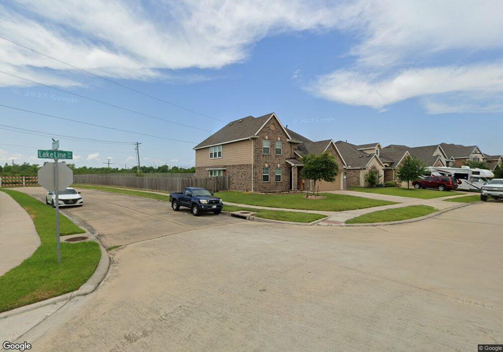
This home is located at 377 Lake Line Dr, Alvin, TX 77511 and is currently estimated at $373,096, approximately $122 per square foot. 377 Lake Line Dr is a home with nearby schools including Mark Twain Elementary School, G.W. Harby Junior High School, and Alvin High School.
Ownership History
Date
Name
Owned For
Owner Type
Purchase Details
Closed on
Nov 25, 2015
Sold by
K Hovnanian Of Houston Ii Llc
Bought by
Damian John A
Current Estimated Value
Home Financials for this Owner
Home Financials are based on the most recent Mortgage that was taken out on this home.
Original Mortgage
$250,967
Outstanding Balance
$197,674
Interest Rate
3.75%
Mortgage Type
FHA
Estimated Equity
$175,423
Purchase Details
Closed on
Feb 17, 2015
Sold by
Jnc Development Inc
Bought by
K Hovnanian Of Houston Iillc
Create a Home Valuation Report for This Property
The Home Valuation Report is an in-depth analysis detailing your home's value as well as a comparison with similar homes in the area
Home Values in the Area
Average Home Value in this Area
Purchase History
| Date | Buyer | Sale Price | Title Company |
|---|---|---|---|
| Damian John A | -- | Alamo Title Co | |
| K Hovnanian Of Houston Iillc | -- | Alamo Title Company |
Source: Public Records
Mortgage History
| Date | Status | Borrower | Loan Amount |
|---|---|---|---|
| Open | Damian John A | $250,967 |
Source: Public Records
Tax History Compared to Growth
Tax History
| Year | Tax Paid | Tax Assessment Tax Assessment Total Assessment is a certain percentage of the fair market value that is determined by local assessors to be the total taxable value of land and additions on the property. | Land | Improvement |
|---|---|---|---|---|
| 2025 | $10,646 | $381,890 | $89,030 | $292,860 |
| 2023 | $10,646 | $372,934 | $89,030 | $327,940 |
| 2022 | $11,639 | $339,031 | $47,300 | $300,050 |
| 2021 | $11,056 | $308,210 | $47,300 | $260,910 |
| 2020 | $10,894 | $300,370 | $47,300 | $253,070 |
| 2019 | $10,722 | $289,500 | $31,160 | $258,340 |
| 2018 | $9,847 | $265,490 | $31,160 | $234,330 |
| 2017 | $9,649 | $257,500 | $31,160 | $226,340 |
| 2016 | $9,735 | $259,790 | $31,160 | $228,630 |
| 2015 | -- | $31,160 | $31,160 | $0 |
Source: Public Records
Map
Nearby Homes
- 4738 Alluvial Cir
- 4706 Alluvial Cir
- 4724 Alluvial Cir
- 726 Rim Water Dr
- 349 Lake Line Dr
- 340 Kendall Crest Dr
- 334 Kendall Crest Dr
- 397 Kendall Crest Dr
- 418 Kendall Crest Dr
- 414 Kendall Crest Dr
- 404 Kendall Crest Dr
- 390 Kendall Crest Dr
- 431 Kendall Crest Dr
- 380 Kendall Crest Dr
- 394 Kendall Crest Dr
- 396 Kendall Crest Dr
- 350 Selah Ct
- 356 Selah Ct
- 415 Kendall Crest Dr
- 406 Kendall Crest Dr
- 379 Lake Line Dr
- 375 Lake Line Dr
- 381 Lake Line Dr
- 373 Lake Line Dr
- 383 Lake Line Dr
- 376 Lake Line Dr
- 378 Lake Line Dr
- 374 Lake Line Dr
- 371 Lake Line Dr
- 380 Lake Line Dr
- 372 Lake Line Dr
- 385 Lake Line Dr
- 4700 Bella Ct
- 370 Lake Line Dr
- 387 Lake Line Dr
- 4702 Bella Ct
- 367 Lake Line Dr
- 386 Lake Line Dr
- 368 Lake Line Dr
- 4704 Bella Ct