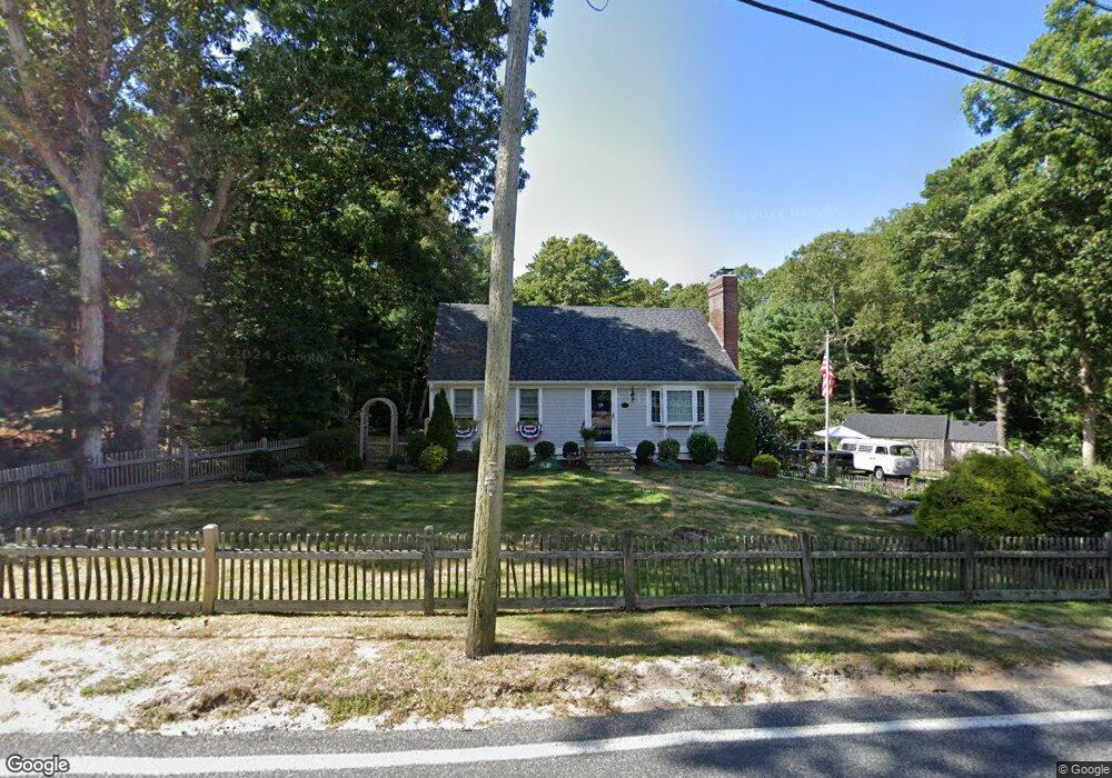
377 N Dennis Rd Yarmouth Port, MA 02675
Yarmouth Port NeighborhoodEstimated Value: $592,000 - $776,000
4
Beds
2
Baths
1,201
Sq Ft
$552/Sq Ft
Est. Value
About This Home
This home is located at 377 N Dennis Rd, Yarmouth Port, MA 02675 and is currently estimated at $662,748, approximately $551 per square foot. 377 N Dennis Rd is a home located in Barnstable County with nearby schools including Dennis-Yarmouth Regional High School and St. Pius X. School.
Ownership History
Date
Name
Owned For
Owner Type
Purchase Details
Closed on
Jul 31, 2000
Sold by
Mcbride Michael J and Mcbride Pauline M
Bought by
Blake Mark J and Blake Christine G
Current Estimated Value
Purchase Details
Closed on
Aug 31, 1998
Sold by
Tsd Rt and Desjardins Robert R
Bought by
Mcbride Michael J
Purchase Details
Closed on
Jun 26, 1991
Sold by
Roche Thomas J and Roche Corrine
Bought by
Desjardins Robert R and Desjardins J
Create a Home Valuation Report for This Property
The Home Valuation Report is an in-depth analysis detailing your home's value as well as a comparison with similar homes in the area
Home Values in the Area
Average Home Value in this Area
Purchase History
| Date | Buyer | Sale Price | Title Company |
|---|---|---|---|
| Blake Mark J | $171,500 | -- | |
| Mcbride Michael J | $124,850 | -- | |
| Desjardins Robert R | $115,000 | -- |
Source: Public Records
Mortgage History
| Date | Status | Borrower | Loan Amount |
|---|---|---|---|
| Open | Desjardins Robert R | $279,500 | |
| Closed | Desjardins Robert R | $248,000 | |
| Closed | Desjardins Robert R | $240,000 |
Source: Public Records
Tax History Compared to Growth
Tax History
| Year | Tax Paid | Tax Assessment Tax Assessment Total Assessment is a certain percentage of the fair market value that is determined by local assessors to be the total taxable value of land and additions on the property. | Land | Improvement |
|---|---|---|---|---|
| 2025 | $3,406 | $481,100 | $142,800 | $338,300 |
| 2024 | $3,356 | $454,700 | $150,500 | $304,200 |
| 2023 | $3,336 | $411,400 | $134,100 | $277,300 |
| 2022 | $3,316 | $361,200 | $120,700 | $240,500 |
| 2021 | $3,265 | $341,500 | $120,700 | $220,800 |
| 2020 | $3,156 | $315,600 | $120,600 | $195,000 |
| 2019 | $2,957 | $292,800 | $120,600 | $172,200 |
| 2018 | $2,783 | $270,500 | $98,300 | $172,200 |
| 2017 | $2,710 | $270,500 | $98,300 | $172,200 |
| 2016 | $2,610 | $261,500 | $89,300 | $172,200 |
| 2015 | $2,502 | $249,200 | $89,300 | $159,900 |
Source: Public Records
Map
Nearby Homes
- 111 Merchant Ave
- 13 Covey Dr
- 6 Nimble Hill Dr
- 118 Driftwood Ln
- 4 Ebb Rd
- 129 Driftwood Ln
- 153 Bayridge Dr
- 4 Old Colony Way
- 44 Stratford Ln
- 11 Uncle Stanleys Way
- 86 Pompano Rd
- 59 Main St Unit 19-2
- 59 Route 6a Unit 29-4
- 43 Canterbury Rd
- 15 Captain Jud Rd
- 34 Kates Path
- 34 Kates Path Unit 34
- 64 Kates Path
- 17 Kates Path Unit A
- 369 N Dennis Rd
- 8 Tasmania Dr
- 115 Merchant Ave
- 12 Tasmania Dr
- 107 Merchant Ave
- 384 N Dennis Rd
- 384A N Dennis Rd
- 384A N Dennis Rd
- 394-A N Dennis Rd
- 361 N Dennis Rd
- 394 N Dennis Rd
- 394 N Dennis Rd Unit A
- 11 Tasmania Dr
- 394A N Dennis Rd
- 121 Merchant Ave
- 16 Tasmania Dr
- 15 Tasmania Dr
- 102 Merchant Ave
- 8 Australian Dr
- 352 N Dennis Rd