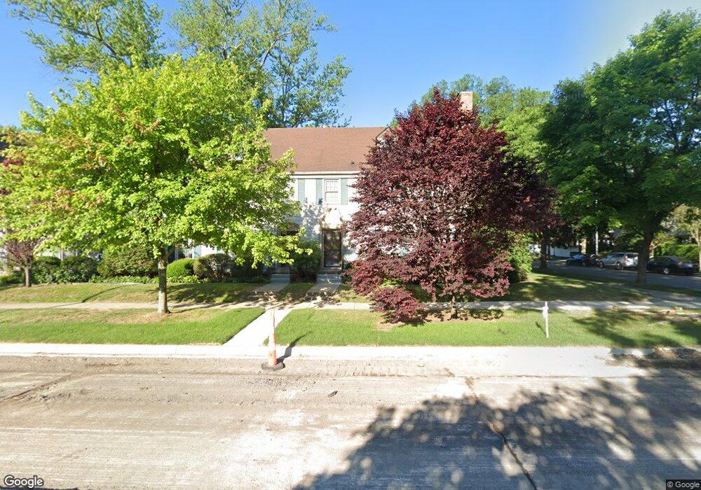
377 Rivard Blvd #3 Grosse Pointe Farms, MI 48230
Estimated Value: $388,938 - $551,000
4
Beds
2
Baths
2,800
Sq Ft
$157/Sq Ft
Est. Value
About This Home
This home is located at 377 Rivard Blvd #3, Grosse Pointe Farms, MI 48230 and is currently estimated at $440,235, approximately $157 per square foot. 377 Rivard Blvd #3 is a home located in Wayne County with nearby schools including Richard Elementary School, Brownell Middle School, and Grosse Pointe South High School.
Ownership History
Date
Name
Owned For
Owner Type
Purchase Details
Closed on
May 25, 2018
Sold by
Wilson Gary and Chasen Holdings Llc
Bought by
The Werner U Spitz Trust and Spitz Condominium Llc
Current Estimated Value
Purchase Details
Closed on
Jul 21, 2010
Sold by
Opdyke Suzanne M
Bought by
Federal National Mortgage Association
Create a Home Valuation Report for This Property
The Home Valuation Report is an in-depth analysis detailing your home's value as well as a comparison with similar homes in the area
Home Values in the Area
Average Home Value in this Area
Purchase History
| Date | Buyer | Sale Price | Title Company |
|---|---|---|---|
| The Werner U Spitz Trust | $240,000 | Ata Natl Title Group Llc | |
| Federal National Mortgage Association | $121,118 | None Available |
Source: Public Records
Tax History Compared to Growth
Tax History
| Year | Tax Paid | Tax Assessment Tax Assessment Total Assessment is a certain percentage of the fair market value that is determined by local assessors to be the total taxable value of land and additions on the property. | Land | Improvement |
|---|---|---|---|---|
| 2025 | $3,353 | $162,000 | $0 | $0 |
| 2024 | $3,353 | $144,300 | $0 | $0 |
| 2023 | $3,197 | $129,600 | $0 | $0 |
| 2022 | $5,861 | $121,400 | $0 | $0 |
| 2021 | $5,706 | $113,600 | $0 | $0 |
| 2020 | $5,659 | $98,000 | $0 | $0 |
| 2019 | $5,616 | $83,800 | $0 | $0 |
| 2018 | $2,496 | $79,800 | $0 | $0 |
| 2017 | $4,337 | $79,000 | $0 | $0 |
| 2016 | $4,575 | $79,800 | $0 | $0 |
| 2015 | $7,124 | $77,500 | $0 | $0 |
| 2013 | $6,902 | $70,900 | $0 | $0 |
| 2012 | -- | $67,400 | $0 | $0 |
Source: Public Records
Map
Nearby Homes
- 296 Rivard Blvd
- 379 Lakeland St
- 425 Rivard Blvd
- 320 Neff Rd
- 277 Lincoln Rd
- 355 Lincoln Rd
- 17680 E Jefferson Ave
- 29 Fisher Rd
- 497 Neff Rd
- 459 Washington Rd
- 4 Cameron Place
- 11 Dodge Place
- 386 Notre Dame St
- 16935 Maumee Ave
- 25 Village Ln
- 43 Cranford Ln
- 616 Cadieux Rd
- 674 Neff Rd
- 76 Grosse Pointe Blvd
- 180 Fisher Rd
- 377 Rivard Blvd Unit Bldg-Unit
- 377 Rivard Blvd Unit 3
- 373 Rivard Blvd Unit 2
- 381 Rivard Blvd
- 369 Rivard Blvd
- 17450 Maumee Ave
- 17450 Maumee Ave Unit 5
- 17450 Maumee Ave Unit 5
- 17430 Maumee Ave
- 365 Rivard Blvd
- 361 Rivard Blvd
- 374 University Place
- 17449 Maumee Ave
- 17431 Maumee Ave
- 17431 Maumee Ave Unit 37
- 364 University Place
- 374 Rivard Blvd
- 380 Rivard Blvd
- 17441 Maumee Ave
- 368 Rivard Blvd