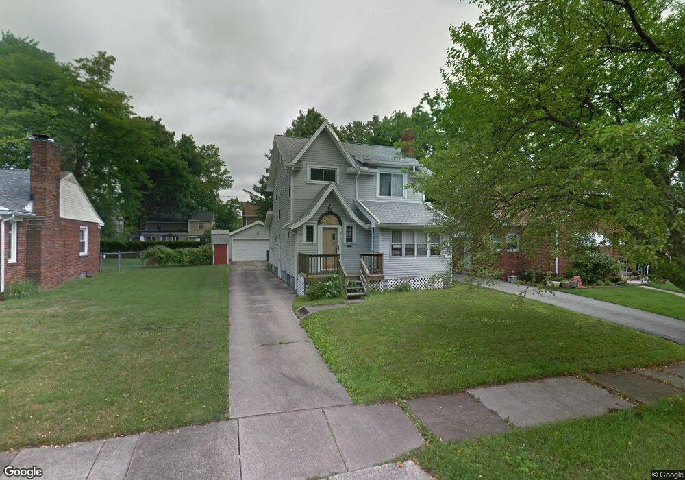
377 Selden Ave Akron, OH 44301
Firestone Park NeighborhoodEstimated Value: $151,488 - $176,000
3
Beds
2
Baths
1,284
Sq Ft
$125/Sq Ft
Est. Value
About This Home
This home is located at 377 Selden Ave, Akron, OH 44301 and is currently estimated at $160,122, approximately $124 per square foot. 377 Selden Ave is a home located in Summit County with nearby schools including Kenmore Garfield Community Learning Center, Main Preparatory Academy, and Eagle Elementary.
Ownership History
Date
Name
Owned For
Owner Type
Purchase Details
Closed on
Aug 5, 2008
Sold by
Rinear Linda K and Rinear Linda K
Bought by
Ames David S
Current Estimated Value
Purchase Details
Closed on
Jan 18, 2007
Sold by
Rinear Linda K
Bought by
Ames David S and Rinear Linda K
Purchase Details
Closed on
Dec 8, 1998
Sold by
Atherton Gladys and Hamilton Russell J
Bought by
Rinear Linda K
Home Financials for this Owner
Home Financials are based on the most recent Mortgage that was taken out on this home.
Original Mortgage
$50,300
Interest Rate
6.8%
Create a Home Valuation Report for This Property
The Home Valuation Report is an in-depth analysis detailing your home's value as well as a comparison with similar homes in the area
Home Values in the Area
Average Home Value in this Area
Purchase History
| Date | Buyer | Sale Price | Title Company |
|---|---|---|---|
| Ames David S | -- | None Available | |
| Ames David S | -- | Lawyers Title Ins | |
| Rinear Linda K | $53,000 | Endress/Lawyers Title |
Source: Public Records
Mortgage History
| Date | Status | Borrower | Loan Amount |
|---|---|---|---|
| Previous Owner | Rinear Linda K | $50,300 |
Source: Public Records
Tax History Compared to Growth
Tax History
| Year | Tax Paid | Tax Assessment Tax Assessment Total Assessment is a certain percentage of the fair market value that is determined by local assessors to be the total taxable value of land and additions on the property. | Land | Improvement |
|---|---|---|---|---|
| 2025 | $2,273 | $42,302 | $8,684 | $33,618 |
| 2024 | $2,273 | $42,302 | $8,684 | $33,618 |
| 2023 | $2,273 | $42,302 | $8,684 | $33,618 |
| 2022 | $2,122 | $30,944 | $6,293 | $24,651 |
| 2021 | $2,124 | $30,944 | $6,293 | $24,651 |
| 2020 | $2,093 | $30,940 | $6,290 | $24,650 |
| 2019 | $1,845 | $24,600 | $6,290 | $18,310 |
| 2018 | $1,821 | $24,600 | $6,290 | $18,310 |
| 2017 | $1,849 | $24,600 | $6,290 | $18,310 |
| 2016 | $1,851 | $24,600 | $6,290 | $18,310 |
| 2015 | $1,849 | $24,600 | $6,290 | $18,310 |
| 2014 | $1,835 | $24,600 | $6,290 | $18,310 |
| 2013 | $1,868 | $24,600 | $6,290 | $18,310 |
Source: Public Records
Map
Nearby Homes
- 369 Mission Dr
- 361 Mission Dr
- 1699 Redwood Ave
- 1614 Glenmount Ave
- 739 S Firestone Blvd
- 1698 Sunset Ave
- 1663 Sunset Ave
- 1604 Oakwood Ave
- 1708 Highview Ave
- 437 Palmetto Ave
- 1571 Redwood Ave
- 1560 Redwood Ave
- 1731 Highview Ave
- 1882 Gless Ave
- 1642 Highview Ave
- 1637 Rockford St
- 1861 & 1863 Highview Ave
- 1500 Beardsley St
- 1575 Highview Ave
- 440 Palm Ave
- 371 Selden Ave
- 378 Clinton Ave
- 382 Clinton Ave
- 622 S Firestone Blvd
- 616 S Firestone Blvd
- 372 Clinton Ave
- 365 Selden Ave
- 368 Clinton Ave
- 612 S Firestone Blvd
- 378 Selden Ave
- 384 Selden Ave
- 374 Selden Ave
- 361 Selden Ave
- 390 Selden Ave
- 370 Selden Ave
- 604 S Firestone Blvd
- 364 Clinton Ave
- 357 Selden Ave
- 366 Selden Ave
- 640 S Firestone Blvd