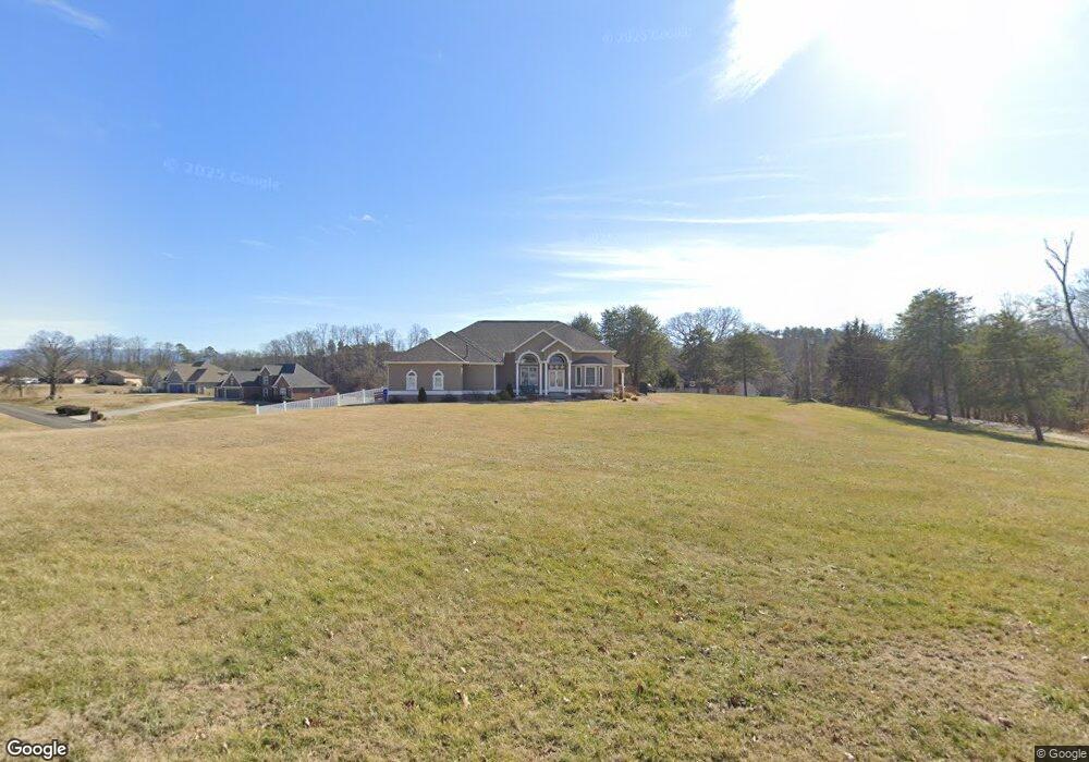
377 Terry Point Rd Dandridge, TN 37725
Estimated Value: $879,000 - $956,857
Studio
4
Baths
2,328
Sq Ft
$391/Sq Ft
Est. Value
About This Home
This home is located at 377 Terry Point Rd, Dandridge, TN 37725 and is currently estimated at $909,952, approximately $390 per square foot. 377 Terry Point Rd is a home located in Jefferson County.
Ownership History
Date
Name
Owned For
Owner Type
Purchase Details
Closed on
Aug 13, 2019
Sold by
Hubbard David A
Bought by
Molter Lori S and Molter Jason K
Current Estimated Value
Home Financials for this Owner
Home Financials are based on the most recent Mortgage that was taken out on this home.
Original Mortgage
$228,000
Outstanding Balance
$199,252
Interest Rate
3.7%
Mortgage Type
New Conventional
Estimated Equity
$710,700
Purchase Details
Closed on
Apr 19, 2004
Sold by
Kay Garrison Linda
Bought by
King James G
Purchase Details
Closed on
Jan 20, 1995
Bought by
Garrison George R and Garrison Linda Kay
Create a Home Valuation Report for This Property
The Home Valuation Report is an in-depth analysis detailing your home's value as well as a comparison with similar homes in the area
Home Values in the Area
Average Home Value in this Area
Purchase History
| Date | Buyer | Sale Price | Title Company |
|---|---|---|---|
| Molter Lori S | $240,000 | Concord Title | |
| King James G | $410,000 | -- | |
| Garrison George R | $35,000 | -- |
Source: Public Records
Mortgage History
| Date | Status | Borrower | Loan Amount |
|---|---|---|---|
| Open | Molter Lori S | $228,000 |
Source: Public Records
Tax History
| Year | Tax Paid | Tax Assessment Tax Assessment Total Assessment is a certain percentage of the fair market value that is determined by local assessors to be the total taxable value of land and additions on the property. | Land | Improvement |
|---|---|---|---|---|
| 2025 | $2,941 | $205,675 | $65,925 | $139,750 |
| 2023 | $1,647 | $71,600 | $0 | $0 |
| 2022 | $1,568 | $71,600 | $27,425 | $44,175 |
| 2021 | $1,568 | $71,600 | $27,425 | $44,175 |
| 2020 | $1,568 | $71,600 | $27,425 | $44,175 |
| 2019 | $1,568 | $71,600 | $27,425 | $44,175 |
| 2018 | $2,346 | $99,825 | $27,550 | $72,275 |
| 2017 | $2,346 | $99,825 | $27,550 | $72,275 |
| 2016 | $2,346 | $99,825 | $27,550 | $72,275 |
| 2015 | $2,346 | $99,825 | $27,550 | $72,275 |
| 2014 | $2,346 | $99,825 | $27,550 | $72,275 |
Source: Public Records
Map
Nearby Homes
- 1710 Ferry Hill Rd
- Lots 1&2 Ferry Hill Rd
- 312 Economy Cir
- 1605 Rolling Hills Dr
- 430 Filet Ln
- 407 Riverbend (Lot 63) Dr
- 1032 Southwind Cir
- 116 Crosslake Ln
- 407 Riverbend Dr
- 162 Scenic Shores Dr
- 429 Filet Ln
- 719 Riveredge Ln
- 719 Riveredge (Lot 60) Ln
- Lot 61 River Bend Dr
- 428 River Bend Dr
- 433 Riverbend Dr
- 1928 Bouldercrest Dr
- 468 Trotline Rd
- 450 Riverbend Dr
- 556 Highway 139
- 1711 Sams Dr
- 1681 Sams Dr
- 381 Terry Point Rd
- 373 Terry Point Rd
- 370 Terry Point Rd
- 1721 Sams Dr
- 382 Terry Point Rd
- 369 Terry Point Rd
- 387 Terry Point Rd
- 1667 Sams Dr
- 1724 Sams Dr
- 366 Terry Point Rd
- 1663 Sams Dr
- 388 Terry Point Rd
- 1672 Sams Dr
- 1672 Sams Dr Unit 37
- 0 Sams Dr
- 1659 Sams Dr
- 1734 Sams Dr
- 1666 Sams Dr
Your Personal Tour Guide
Ask me questions while you tour the home.