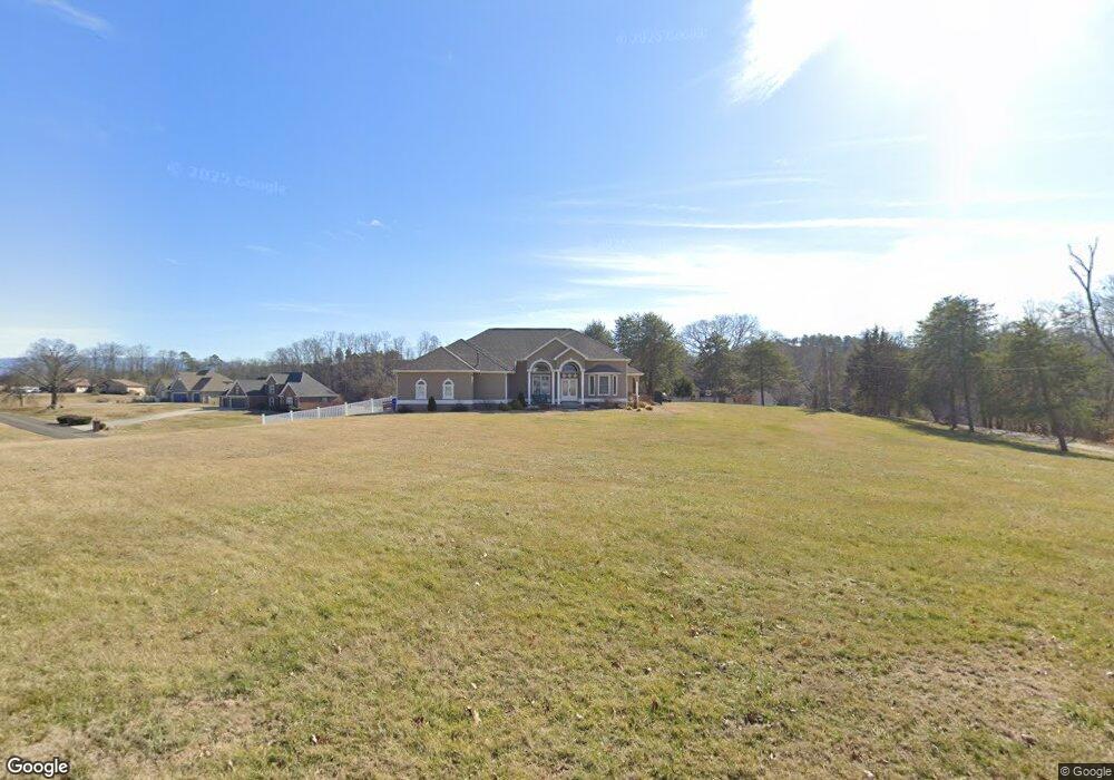
377 Terry Point Rd Dandridge, TN 37725
Estimated Value: $855,000 - $917,000
About This Home
This home is located at 377 Terry Point Rd, Dandridge, TN 37725 and is currently estimated at $892,978, approximately $383 per square foot. 377 Terry Point Rd is a home located in Jefferson County.
Ownership History
We collect this data history from publicly available records. To have your information removed, we recommend requesting removal directly through your county’s website.
Purchase Details
Home Financials for this Owner
Home Financials are based on the most recent Mortgage that was taken out on this home.Purchase Details
Purchase Details
Home Values in the Area
Average Home Value in this Area
Purchase History
We collect this data history from publicly available records. To have your information removed, we recommend requesting removal directly through your county’s website.
| Date | Buyer | Sale Price | Title Company |
|---|---|---|---|
| $240,000 | Concord Title | ||
| $410,000 | -- | ||
| $35,000 | -- |
Mortgage History
We collect this data history from publicly available records. To have your information removed, we recommend requesting removal directly through your county’s website.
| Date | Status | Borrower | Loan Amount |
|---|---|---|---|
| Open | $228,000 |
Tax History
We collect this data history from publicly available records. To have your information removed, we recommend requesting removal directly through your county’s website.
| Year | Tax Paid | Tax Assessment Tax Assessment Total Assessment is a certain percentage of the fair market value that is determined by local assessors to be the total taxable value of land and additions on the property. | Land | Improvement |
|---|---|---|---|---|
| 2025 | $2,941 | $205,675 | $65,925 | $139,750 |
| 2023 | $1,647 | $71,600 | $0 | $0 |
| 2022 | $1,568 | $71,600 | $27,425 | $44,175 |
| 2021 | $1,568 | $71,600 | $27,425 | $44,175 |
| 2020 | $1,568 | $71,600 | $27,425 | $44,175 |
| 2019 | $1,568 | $71,600 | $27,425 | $44,175 |
| 2018 | $2,346 | $99,825 | $27,550 | $72,275 |
| 2017 | $2,346 | $99,825 | $27,550 | $72,275 |
| 2016 | $2,346 | $99,825 | $27,550 | $72,275 |
| 2015 | $2,346 | $99,825 | $27,550 | $72,275 |
| 2014 | $2,346 | $99,825 | $27,550 | $72,275 |
Map
- 1710 Ferry Hill Rd
- Lots 1&2 Ferry Hill Rd
- 1836 Range Rd
- 1682 Brookview Dr
- 1040 Southwind Cir
- 211 Mariners Way
- 407 Riverbend (Lot 63) Dr
- 1018 Southwind Cir
- 116 Crosslake Ln
- 407 Riverbend Dr
- 614 Watercrest Ln
- 429 Filet Ln
- 719 Riveredge Ln
- 719 Riveredge (Lot 60) Ln
- Lot 61 River Bend Dr
- 428 River Bend Dr
- 433 Riverbend Dr
- 1928 Bouldercrest Dr
- 1845 Bouldercrest Dr
- 468 Trotline Rd
- 1711 Sams Dr
- 1681 Sams Dr
- 381 Terry Point Rd
- 373 Terry Point Rd
- 370 Terry Point Rd
- 1721 Sams Dr
- 382 Terry Point Rd
- 369 Terry Point Rd
- 387 Terry Point Rd
- 1667 Sams Dr
- 1724 Sams Dr
- 366 Terry Point Rd
- 1663 Sams Dr
- 388 Terry Point Rd
- 1672 Sams Dr
- 1672 Sams Dr Unit 37
- 0 Sams Dr
- 1659 Sams Dr
- 1734 Sams Dr
- 1666 Sams Dr
Ask me questions while you tour the home.