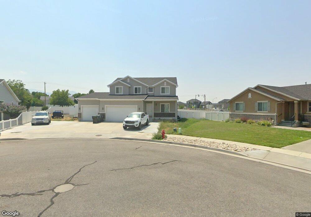
377 W 2030 N Tooele, UT 84074
Estimated Value: $547,000 - $646,000
--
Bed
--
Bath
3,974
Sq Ft
$147/Sq Ft
Est. Value
About This Home
This home is located at 377 W 2030 N, Tooele, UT 84074 and is currently estimated at $583,973, approximately $146 per square foot. 377 W 2030 N is a home with nearby schools including Overlake Elementary School, Clarke N. Johnsen Junior High School, and Stansbury High School.
Ownership History
Date
Name
Owned For
Owner Type
Purchase Details
Closed on
Mar 30, 2021
Sold by
Lewis Joshua
Bought by
Lewis Joshua and Lewis Kelli
Current Estimated Value
Home Financials for this Owner
Home Financials are based on the most recent Mortgage that was taken out on this home.
Original Mortgage
$350,020
Outstanding Balance
$315,001
Interest Rate
2.8%
Mortgage Type
FHA
Estimated Equity
$268,972
Purchase Details
Closed on
Dec 12, 2016
Sold by
Hallmark Homes And Development
Bought by
Lewis Joshua
Home Financials for this Owner
Home Financials are based on the most recent Mortgage that was taken out on this home.
Original Mortgage
$288,492
Interest Rate
3.54%
Mortgage Type
FHA
Purchase Details
Closed on
Jul 27, 2016
Sold by
Unknown Unknown
Bought by
Unknown Unknown
Create a Home Valuation Report for This Property
The Home Valuation Report is an in-depth analysis detailing your home's value as well as a comparison with similar homes in the area
Home Values in the Area
Average Home Value in this Area
Purchase History
| Date | Buyer | Sale Price | Title Company |
|---|---|---|---|
| Lewis Joshua | -- | Us Title Insurance Agency | |
| Lewis Joshua | -- | Metro National Title | |
| Unknown Unknown | -- | Metro National Title |
Source: Public Records
Mortgage History
| Date | Status | Borrower | Loan Amount |
|---|---|---|---|
| Open | Lewis Joshua | $350,020 | |
| Closed | Lewis Joshua | $288,492 |
Source: Public Records
Tax History Compared to Growth
Tax History
| Year | Tax Paid | Tax Assessment Tax Assessment Total Assessment is a certain percentage of the fair market value that is determined by local assessors to be the total taxable value of land and additions on the property. | Land | Improvement |
|---|---|---|---|---|
| 2025 | $3,787 | $305,199 | $50,600 | $254,599 |
| 2024 | $3,741 | $276,631 | $50,600 | $226,031 |
| 2023 | $3,741 | $313,545 | $48,177 | $265,368 |
| 2022 | $3,790 | $313,212 | $48,950 | $264,262 |
| 2021 | $3,244 | $222,859 | $19,580 | $203,279 |
| 2020 | $3,123 | $377,820 | $35,600 | $342,220 |
| 2019 | $2,895 | $346,709 | $35,600 | $311,109 |
| 2018 | $2,879 | $328,064 | $40,000 | $288,064 |
| 2017 | $2,434 | $328,064 | $40,000 | $288,064 |
Source: Public Records
Map
Nearby Homes
- 1913 N 370 W
- 1969 N 270 W
- Franklin Plan at Compass Point
- Ash Plan at Compass Point
- Chapman Plan at Compass Point
- Kennedy Plan at Compass Point
- McKinley Plan at Compass Point
- Hickory Plan at Compass Point
- Spruce Pantry Plan at Compass Point
- Holly Plan at Compass Point
- Basswood Plan at Compass Point
- Merriwood Plan at Compass Point
- Hancock Plan at Compass Point
- Harrison Plan at Compass Point
- Cedar Plan at Compass Point
- Monroe Plan at Compass Point
- Mesquite Plan at Compass Point
- Washington Plan at Compass Point
- Cleveland Plan at Compass Point
- Alpine Plan at Compass Point
- 381 W 2030 N
- 365 W 2030 N
- 409 W 2030 N
- 502 W 2030 N
- 603 W 2030 N Unit 17
- 351 W 2030 N
- 376 W 2030 N
- 362 W 2030 N
- 429 W 2030 N Unit 32A
- 358 W 2030 N
- 368 W 1950 N
- 1955 N 370 W
- 341 W 2030 N
- 2036 N 425 W Unit 33
- 348 W 2030 N
- 352 W 1950 N
- 431 W 2030 N Unit 31
- 1958 N 425 W Unit 108
- 331 W 2030 N
- 336 W 2030 N