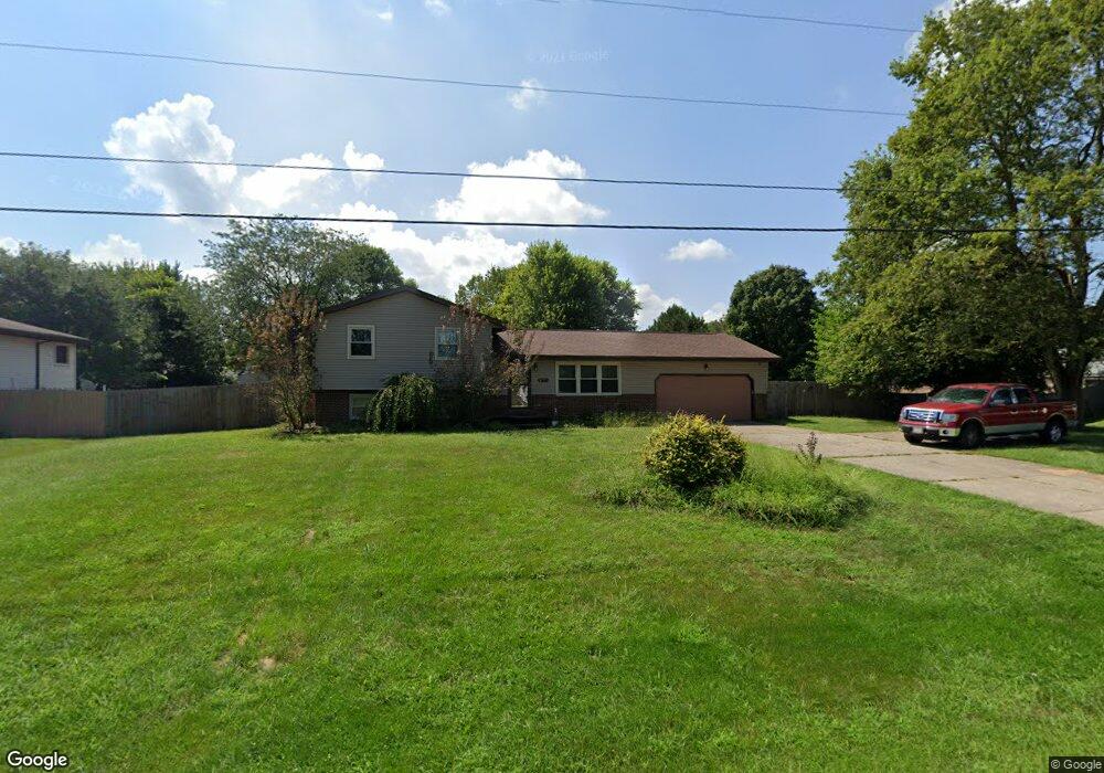
3771 Shakertown Rd Beavercreek, OH 45430
Estimated Value: $323,000 - $337,000
3
Beds
2
Baths
1,284
Sq Ft
$257/Sq Ft
Est. Value
About This Home
This home is located at 3771 Shakertown Rd, Beavercreek, OH 45430 and is currently estimated at $330,351, approximately $257 per square foot. 3771 Shakertown Rd is a home located in Greene County with nearby schools including Valley Elementary School, Herman K Ankeney Middle School, and Beavercreek High School.
Ownership History
Date
Name
Owned For
Owner Type
Purchase Details
Closed on
Sep 28, 2012
Sold by
Seman Robert L and Seman Debra L
Bought by
Seman Debra L
Current Estimated Value
Purchase Details
Closed on
May 20, 2005
Sold by
Reagan Thomas S and Reagan Martha A
Bought by
Seman Robert L and Seman Debra L
Home Financials for this Owner
Home Financials are based on the most recent Mortgage that was taken out on this home.
Original Mortgage
$136,320
Interest Rate
5.82%
Mortgage Type
Fannie Mae Freddie Mac
Create a Home Valuation Report for This Property
The Home Valuation Report is an in-depth analysis detailing your home's value as well as a comparison with similar homes in the area
Home Values in the Area
Average Home Value in this Area
Purchase History
| Date | Buyer | Sale Price | Title Company |
|---|---|---|---|
| Seman Debra L | -- | None Available | |
| Seman Robert L | $170,400 | -- |
Source: Public Records
Mortgage History
| Date | Status | Borrower | Loan Amount |
|---|---|---|---|
| Previous Owner | Seman Robert L | $136,320 | |
| Closed | Seman Robert L | $17,000 |
Source: Public Records
Tax History Compared to Growth
Tax History
| Year | Tax Paid | Tax Assessment Tax Assessment Total Assessment is a certain percentage of the fair market value that is determined by local assessors to be the total taxable value of land and additions on the property. | Land | Improvement |
|---|---|---|---|---|
| 2024 | $5,484 | $83,990 | $22,000 | $61,990 |
| 2023 | $5,484 | $83,990 | $22,000 | $61,990 |
| 2022 | $4,657 | $62,970 | $16,920 | $46,050 |
| 2021 | $4,562 | $62,970 | $16,920 | $46,050 |
| 2020 | $4,597 | $62,970 | $16,920 | $46,050 |
| 2019 | $4,087 | $51,100 | $11,740 | $39,360 |
| 2018 | $3,607 | $51,100 | $11,740 | $39,360 |
| 2017 | $3,344 | $51,100 | $11,740 | $39,360 |
| 2016 | $3,345 | $45,910 | $11,740 | $34,170 |
| 2015 | $3,325 | $45,910 | $11,740 | $34,170 |
| 2014 | $3,275 | $45,910 | $11,740 | $34,170 |
Source: Public Records
Map
Nearby Homes
- 3667 Creekwood Ct
- 615 Bendwood Way
- 4020 E Patterson Rd
- 3700 Napanee Dr
- 989 River Hills Rd
- 3534 Sunset Bluff Dr
- 3998 Willowcrest Rd
- 3608 Roselawn Dr
- 4134 Cambridge Trail
- 3392 Greenburn Rd Unit 3392
- 4011 Willow Run Dr
- 3917 E Summit Ridge Dr
- 4174 White Hawk Ct
- 3597 Echo Hill Ln
- 3961 Ephrata Ct
- 684 Newton Dr
- 3363 Maplewood Dr
- 564 Plattner Trail
- 527 Viking Landing Ct
- 185 Rosillo Dr
- 3761 Shakertown Rd
- 740 Burntwood Dr
- 730 Burntwood Dr
- 3751 Shakertown Rd
- 3756 Woodford Place
- 720 Burntwood Dr
- 3767 Harvest Creek Ct
- 747 Autumn Leaf Dr
- 3757 Woodford Place
- 3741 Shakertown Rd
- 3746 Woodford Place
- 741 Burntwood Dr
- 3775 Harvest Creek Ct
- 731 Burntwood Dr
- 710 Burntwood Dr
- 759 Autumn Leaf Dr
- 3731 Shakertown Rd
- 777 Harvest Creek Ct
- 3736 Woodford Place
- 3825 Woodhurst Ct