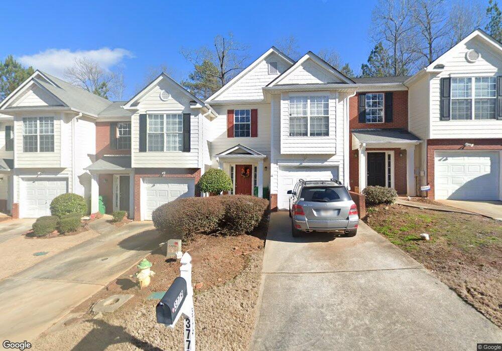
3779 Harvest Dr Decatur, GA 30034
Southwest DeKalb NeighborhoodEstimated Value: $190,000 - $210,000
2
Beds
3
Baths
1,457
Sq Ft
$136/Sq Ft
Est. Value
About This Home
This home is located at 3779 Harvest Dr, Decatur, GA 30034 and is currently estimated at $198,865, approximately $136 per square foot. 3779 Harvest Dr is a home located in DeKalb County with nearby schools including Bob Mathis Elementary School, Chapel Hill Middle School, and Southwest Dekalb High School.
Ownership History
Date
Name
Owned For
Owner Type
Purchase Details
Closed on
Jun 5, 2009
Sold by
Us Bank Trust 2005-14He
Bought by
Sydnor Stefane A
Current Estimated Value
Home Financials for this Owner
Home Financials are based on the most recent Mortgage that was taken out on this home.
Original Mortgage
$51,920
Interest Rate
5.37%
Mortgage Type
New Conventional
Purchase Details
Closed on
Dec 2, 2008
Sold by
Moss Yasmine B
Bought by
Us Bank Na 2005-14He
Create a Home Valuation Report for This Property
The Home Valuation Report is an in-depth analysis detailing your home's value as well as a comparison with similar homes in the area
Home Values in the Area
Average Home Value in this Area
Purchase History
| Date | Buyer | Sale Price | Title Company |
|---|---|---|---|
| Sydnor Stefane A | $64,900 | -- | |
| Us Bank Na 2005-14He | $112,623 | -- |
Source: Public Records
Mortgage History
| Date | Status | Borrower | Loan Amount |
|---|---|---|---|
| Previous Owner | Sydnor Stefane A | $51,920 |
Source: Public Records
Tax History Compared to Growth
Tax History
| Year | Tax Paid | Tax Assessment Tax Assessment Total Assessment is a certain percentage of the fair market value that is determined by local assessors to be the total taxable value of land and additions on the property. | Land | Improvement |
|---|---|---|---|---|
| 2025 | $4,347 | $89,360 | $20,000 | $69,360 |
| 2024 | $4,320 | $88,800 | $20,000 | $68,800 |
| 2023 | $4,320 | $88,200 | $20,000 | $68,200 |
| 2022 | $3,199 | $65,360 | $7,200 | $58,160 |
| 2021 | $2,456 | $48,440 | $7,200 | $41,240 |
| 2020 | $2,372 | $46,520 | $7,200 | $39,320 |
| 2019 | $2,173 | $42,000 | $7,200 | $34,800 |
| 2018 | $1,613 | $34,920 | $4,800 | $30,120 |
| 2017 | $1,450 | $25,400 | $4,800 | $20,600 |
| 2016 | $1,452 | $25,400 | $2,880 | $22,520 |
| 2014 | $937 | $13,400 | $2,880 | $10,520 |
Source: Public Records
Map
Nearby Homes
- 3777 Harvest Dr
- 3756 Harvest Dr
- 3704 Harvest Dr
- 3702 Harvest Dr Unit 93
- 3700 Harvest Dr
- 3801 Cherry Ridge Blvd
- 3608 Shepherds Path
- 3622 Shepherds Path Unit 3622
- 3515 Shepherds Path
- 3477 Shepherds Path
- 3826 Brandeis Way
- 3592 Hancock View
- 3480 Shepherds Path Unit 3480
- 3620 Spring Trace
- 3625 Cherry Ridge Blvd
- 3683 Brown Dr
- 3428 Chapel Park Dr
- 4024 Waldrop Hills Dr
- 4084 Waldrop Hills Dr
- 3783 Harvest Dr
- 3783 Harvest Dr Unit 3783
- 3785 Harvest Dr
- 3785 Harvest Dr Unit 3785
- 3775 Harvest Dr
- 3787 Harvest Dr Unit 51
- 3787 Harvest Dr
- 3773 Harvest Dr
- 3771 Harvest Dr
- 3769 Harvest Dr
- 3769 Harvest Dr Unit 42
- 3767 Harvest Dr
- 3767 Harvest Dr Unit 3767
- 3778 Harvest Dr
- 3772 Harvest Dr
- 3772 Harvest Dr Unit 3772
- 3772 Harvest Dr Unit 58
- 3772 Harvest Dr
- 3776 Harvest Dr
- 3780 Harvest Dr