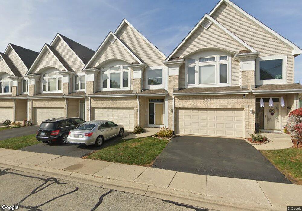
378 Aaron Ln Bolingbrook, IL 60440
East Bolingbrook NeighborhoodEstimated Value: $314,722 - $344,000
2
Beds
2
Baths
1,768
Sq Ft
$185/Sq Ft
Est. Value
About This Home
This home is located at 378 Aaron Ln, Bolingbrook, IL 60440 and is currently estimated at $326,431, approximately $184 per square foot. 378 Aaron Ln is a home located in Will County with nearby schools including Jonas E Salk Elementary School, Hubert H Humphrey Middle School, and Brooks Middle School.
Ownership History
Date
Name
Owned For
Owner Type
Purchase Details
Closed on
Jan 31, 2014
Sold by
Wiers Michael J and Wiers Lisa T
Bought by
Doughty Thomas N and Doughty June M
Current Estimated Value
Purchase Details
Closed on
Apr 30, 2002
Sold by
Midwest Bank & Trust Company
Bought by
Ruple Davidemir W
Home Financials for this Owner
Home Financials are based on the most recent Mortgage that was taken out on this home.
Original Mortgage
$173,850
Interest Rate
6.75%
Create a Home Valuation Report for This Property
The Home Valuation Report is an in-depth analysis detailing your home's value as well as a comparison with similar homes in the area
Home Values in the Area
Average Home Value in this Area
Purchase History
| Date | Buyer | Sale Price | Title Company |
|---|---|---|---|
| Doughty Thomas N | $56,000 | Fidelity National Title | |
| Ruple Davidemir W | $185,000 | Greater Illinois Title Compa |
Source: Public Records
Mortgage History
| Date | Status | Borrower | Loan Amount |
|---|---|---|---|
| Previous Owner | Ruple Davidemir W | $173,850 |
Source: Public Records
Tax History Compared to Growth
Tax History
| Year | Tax Paid | Tax Assessment Tax Assessment Total Assessment is a certain percentage of the fair market value that is determined by local assessors to be the total taxable value of land and additions on the property. | Land | Improvement |
|---|---|---|---|---|
| 2024 | $8,094 | $95,640 | $9,615 | $86,025 |
| 2023 | $8,094 | $86,053 | $8,651 | $77,402 |
| 2022 | $7,075 | $77,581 | $7,799 | $69,782 |
| 2021 | $6,699 | $72,539 | $7,292 | $65,247 |
| 2020 | $6,489 | $70,154 | $7,052 | $63,102 |
| 2019 | $6,274 | $66,813 | $6,716 | $60,097 |
| 2018 | $6,019 | $63,948 | $6,428 | $57,520 |
| 2017 | $5,724 | $60,614 | $6,093 | $54,521 |
| 2016 | $5,552 | $57,700 | $5,800 | $51,900 |
| 2015 | $5,482 | $55,400 | $5,600 | $49,800 |
| 2014 | $5,482 | $55,400 | $5,600 | $49,800 |
| 2013 | $5,482 | $51,700 | $5,200 | $46,500 |
Source: Public Records
Map
Nearby Homes
- 231 Charlotte Ln
- 451 Alcester Ct
- 601 Derbyshire Ln
- 2 Vermont Cir
- 419 Charlestown Dr
- 557 Monroe Rd
- 427 Charlestown Dr
- 209 Monroe Rd Unit 66
- 424 Van Gogh Cir Unit 1
- 338 Stafford Way
- 208 Porter Ln
- 460 Michelangelo Dr
- Kenmore Plan at Bluebell Ridge
- Lockwood Plan at Bluebell Ridge
- 488 Ridge Ln
- 490 Ridge Ln
- 492 Ridge Ln
- 462 Ridge Ln
- 535 Jordan Way
- 556 Leslie Ln