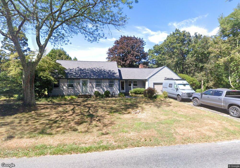
378 Broad Rock Rd Wakefield, RI 02879
Estimated Value: $689,422 - $789,000
4
Beds
2
Baths
2,121
Sq Ft
$344/Sq Ft
Est. Value
About This Home
This home is located at 378 Broad Rock Rd, Wakefield, RI 02879 and is currently estimated at $729,356, approximately $343 per square foot. 378 Broad Rock Rd is a home located in Washington County with nearby schools including South Kingstown High School, Monsignor Matthew Clarke Catholic Regional School, and Bradley School-South.
Ownership History
Date
Name
Owned For
Owner Type
Purchase Details
Closed on
Apr 7, 1994
Sold by
Nixon Mary L
Bought by
Dimartino Ii Michael and Dimartino Mary
Current Estimated Value
Create a Home Valuation Report for This Property
The Home Valuation Report is an in-depth analysis detailing your home's value as well as a comparison with similar homes in the area
Home Values in the Area
Average Home Value in this Area
Purchase History
| Date | Buyer | Sale Price | Title Company |
|---|---|---|---|
| Dimartino Ii Michael | $160,000 | -- |
Source: Public Records
Mortgage History
| Date | Status | Borrower | Loan Amount |
|---|---|---|---|
| Open | Dimartino Ii Michael | $243,000 | |
| Closed | Dimartino Ii Michael | $259,300 | |
| Closed | Dimartino Ii Michael | $262,000 | |
| Closed | Dimartino Ii Michael | $175,000 |
Source: Public Records
Tax History
| Year | Tax Paid | Tax Assessment Tax Assessment Total Assessment is a certain percentage of the fair market value that is determined by local assessors to be the total taxable value of land and additions on the property. | Land | Improvement |
|---|---|---|---|---|
| 2025 | $4,627 | $517,600 | $174,500 | $343,100 |
| 2024 | $4,648 | $420,600 | $134,100 | $286,500 |
| 2023 | $4,648 | $420,600 | $134,100 | $286,500 |
| 2022 | $4,606 | $420,600 | $134,100 | $286,500 |
| 2021 | $4,825 | $333,900 | $116,600 | $217,300 |
| 2020 | $4,809 | $332,800 | $116,600 | $216,200 |
| 2019 | $4,809 | $332,800 | $116,600 | $216,200 |
| 2018 | $4,491 | $286,400 | $108,400 | $178,000 |
| 2017 | $4,385 | $286,400 | $108,400 | $178,000 |
| 2016 | $4,322 | $286,400 | $108,400 | $178,000 |
| 2015 | $4,391 | $282,900 | $106,000 | $176,900 |
| 2014 | $4,379 | $282,900 | $106,000 | $176,900 |
Source: Public Records
Map
Nearby Homes
- 22 Beech Tree Place
- 3 Larkin St
- 918 Saugatucket Rd
- 48 Stone Bridge Dr
- 53 Rocky Brook Way
- 45 Cherry Ln Unit C
- 128 Rodman St
- 39 Hazard Ave
- 1808 Kingstown Rd
- 44 Vespia Ln
- 56 Vespia Ln
- 0 Indian Trail Trail S Unit 1389828
- 23 Rockland Dr
- 35 Abbey Rd
- 260 Sweet Allen Farm Rd Unit 3
- 0 Indian Run Trail Unit 1403300
- 66 Christopher St
- 39 Secluded Dr
- 35 Whittier Dr
- 37 Whittier Dr
- 390 Broad Rock Rd
- 424 Oakwoods Dr
- 384 Oakwoods Dr
- 372 Oakwoods Dr
- 400 Oakwoods Dr
- 364 Oakwoods Dr
- 415 Broad Rock Rd
- 375 Oakwoods Dr
- 425 Oakwoods Dr
- 391 Oakwoods Dr
- 415 Oakwoods Dr
- 369 Oakwoods Dr
- 401 Oakwoods Dr
- 431 Broad Rock Rd
- 322 Broad Rock Rd
- 15 Arbor Way
- 63 Beech Hill Rd
- 77 Beech Hill Rd
- 87 Arbor Way
- 27 Arbor Way