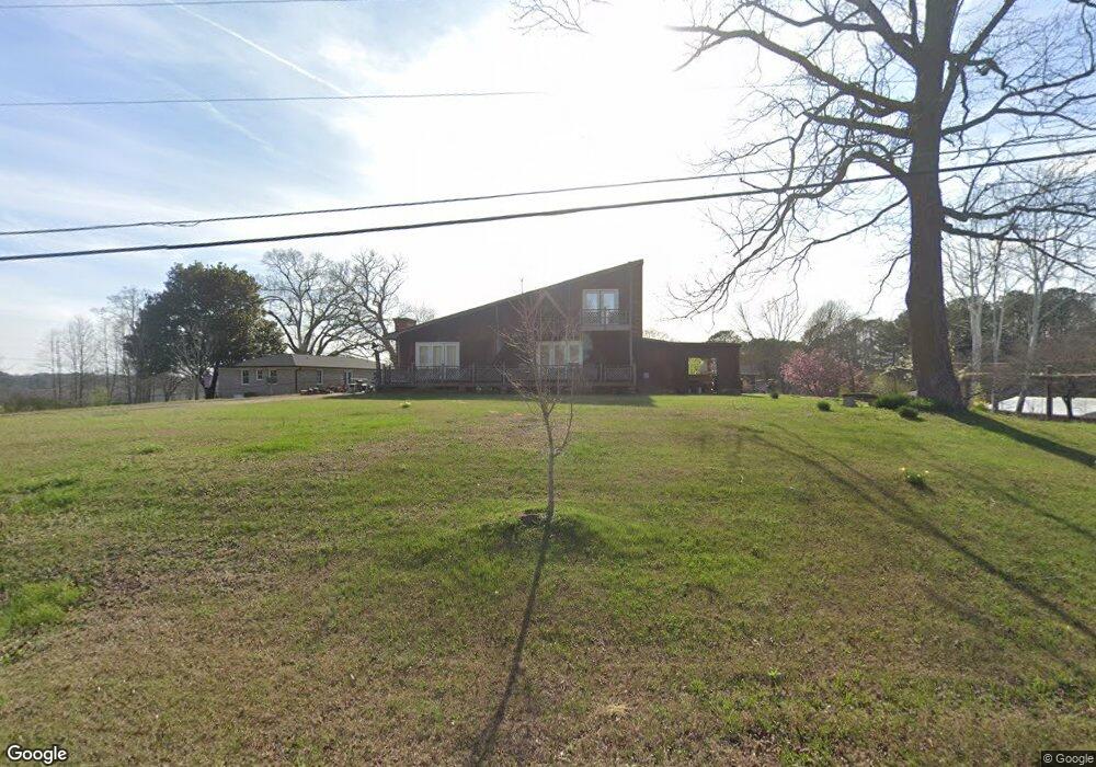
378 Broad St Tallapoosa, GA 30176
Estimated Value: $239,000 - $315,000
3
Beds
3
Baths
2,394
Sq Ft
$117/Sq Ft
Est. Value
About This Home
This home is located at 378 Broad St, Tallapoosa, GA 30176 and is currently estimated at $279,224, approximately $116 per square foot. 378 Broad St is a home located in Haralson County with nearby schools including Haralson County High School.
Ownership History
Date
Name
Owned For
Owner Type
Purchase Details
Closed on
Jun 9, 1987
Sold by
Windom Windom J and Windom Frances
Bought by
Benefield Andy
Current Estimated Value
Purchase Details
Closed on
Aug 26, 1978
Sold by
Jackson William J
Bought by
Benefield Andy
Purchase Details
Closed on
Jan 14, 1977
Sold by
Robinson Charles L
Bought by
Jackson William J
Purchase Details
Closed on
Apr 1, 1975
Sold by
Gac Finance Inc Of
Bought by
Windom Windom J and Windom Frances
Purchase Details
Closed on
Oct 1, 1973
Sold by
Windom Windom J and Windom Frances
Bought by
Robinson Charles L
Create a Home Valuation Report for This Property
The Home Valuation Report is an in-depth analysis detailing your home's value as well as a comparison with similar homes in the area
Home Values in the Area
Average Home Value in this Area
Purchase History
| Date | Buyer | Sale Price | Title Company |
|---|---|---|---|
| Benefield Andy | -- | -- | |
| Benefield Andy | $14,000 | -- | |
| Jackson William J | $40,000 | -- | |
| Windom Windom J | -- | -- | |
| Robinson Charles L | $2,500 | -- |
Source: Public Records
Tax History Compared to Growth
Tax History
| Year | Tax Paid | Tax Assessment Tax Assessment Total Assessment is a certain percentage of the fair market value that is determined by local assessors to be the total taxable value of land and additions on the property. | Land | Improvement |
|---|---|---|---|---|
| 2024 | $2,162 | $70,217 | $4,834 | $65,383 |
| 2023 | $1,610 | $82,990 | $4,560 | $78,430 |
| 2022 | $1,698 | $67,786 | $4,560 | $63,226 |
| 2021 | $1,671 | $64,000 | $4,560 | $59,440 |
| 2020 | $1,731 | $66,016 | $4,560 | $61,456 |
| 2019 | $1,746 | $64,237 | $4,560 | $59,677 |
| 2018 | $1,087 | $40,284 | $4,560 | $35,724 |
| 2017 | $1,058 | $35,982 | $4,560 | $31,422 |
| 2016 | $994 | $36,114 | $4,560 | $31,554 |
| 2015 | $977 | $35,355 | $4,560 | $30,795 |
| 2014 | $1,115 | $38,951 | $7,676 | $31,275 |
Source: Public Records
Map
Nearby Homes
- 110 Dunson Rd
- 77 McDonald Rd
- 28 McDonald Ridge
- 194 Faye St
- 174 Faye St
- 711 Kay St
- 135 Oakland Ct
- 622 Cedartown Ave
- 438 Bowdon St
- 0 Creek Dr Unit 148038
- 0 Cherokee Dr Unit 148037
- 0 Providence Lake Rd Unit 10576961
- 0 Georgia 120 Unit 7646686
- 0 Georgia 120 Unit 10600882
- 244 Monroe St
- 871 Cherokee Dr
- 250 Kiker St
- 0 Broad St Unit 10614514
- 0 Broad St Unit 10614479
- --- Steadman #32 Rd
- 25 Dunson Rd
- 5 Shady Lane Dr
- 33 Dunson Rd
- 373 Broad St
- 22 Shady Lane Dr
- 383 Broad St
- 23 Shady Ln
- 0 Dunson Rd Unit 8322326
- 0 Dunson Rd Unit 9013565
- 0 Dunson Rd Unit 9013669
- 0 Dunson Rd Unit 8280374
- 363 Broad St
- 375 Broad St
- 31 Shady Ln
- 385 Broad St
- 393 Broad St
- 35 Shady Ln
- 4 Main Dr
- 411 Broad St
- 411 Broad Streets