Estimated Value: $256,000 - $314,000
4
Beds
4
Baths
2,392
Sq Ft
$122/Sq Ft
Est. Value
About This Home
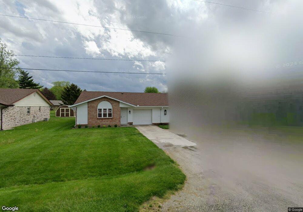
This home is located at 378 Monroe Concord Rd, Troy, OH 45373 and is currently estimated at $291,908, approximately $122 per square foot. 378 Monroe Concord Rd is a home located in Miami County with nearby schools including Concord Elementary School, Van Cleve Elementary School, and Troy Junior High School.
Ownership History
Date
Name
Owned For
Owner Type
Purchase Details
Closed on
Jul 7, 2009
Sold by
Klys Adam J and Klys Christa R
Bought by
Shaeffer Tomala K
Current Estimated Value
Home Financials for this Owner
Home Financials are based on the most recent Mortgage that was taken out on this home.
Original Mortgage
$138,481
Outstanding Balance
$88,292
Interest Rate
4.86%
Mortgage Type
FHA
Estimated Equity
$203,616
Purchase Details
Closed on
Jan 1, 1990
Sold by
Shaeffer Tomala K
Bought by
Klys Adam J
Create a Home Valuation Report for This Property
The Home Valuation Report is an in-depth analysis detailing your home's value as well as a comparison with similar homes in the area
Home Values in the Area
Average Home Value in this Area
Purchase History
| Date | Buyer | Sale Price | Title Company |
|---|---|---|---|
| Shaeffer Tomala K | $148,000 | -- | |
| Klys Adam J | -- | -- |
Source: Public Records
Mortgage History
| Date | Status | Borrower | Loan Amount |
|---|---|---|---|
| Open | Shaeffer Tomala K | $138,481 |
Source: Public Records
Tax History Compared to Growth
Tax History
| Year | Tax Paid | Tax Assessment Tax Assessment Total Assessment is a certain percentage of the fair market value that is determined by local assessors to be the total taxable value of land and additions on the property. | Land | Improvement |
|---|---|---|---|---|
| 2024 | $2,817 | $66,680 | $14,420 | $52,260 |
| 2023 | $2,817 | $66,680 | $14,420 | $52,260 |
| 2022 | $2,397 | $66,680 | $14,420 | $52,260 |
| 2021 | $1,814 | $49,390 | $10,680 | $38,710 |
| 2020 | $1,817 | $49,390 | $10,680 | $38,710 |
| 2019 | $1,832 | $49,390 | $10,680 | $38,710 |
| 2018 | $1,771 | $45,510 | $11,310 | $34,200 |
| 2017 | $1,787 | $45,510 | $11,310 | $34,200 |
| 2016 | $1,732 | $45,510 | $11,310 | $34,200 |
| 2015 | $1,679 | $42,950 | $10,680 | $32,270 |
| 2014 | $1,679 | $42,950 | $10,680 | $32,270 |
| 2013 | $1,690 | $42,950 | $10,680 | $32,270 |
Source: Public Records
Map
Nearby Homes
- 445 Wisteria Dr
- 660 Wisteria Dr
- 2765 Silver Maple Ct
- 1701 Chevington Chase
- 1117 Honeydew Dr
- 1216 Wind Rock Ct
- Spruce Plan at Summit Landing
- Norway Plan at Summit Landing
- Chestnut Plan at Summit Landing
- Juniper Plan at Summit Landing
- Palmetto Plan at Summit Landing
- Ashton Plan at Summit Landing
- Empress Plan at Summit Landing
- Ironwood Plan at Summit Landing
- Aspen II Plan at Summit Landing
- Walnut Plan at Summit Landing
- Bradford Plan at Summit Landing
- Cooper Plan at Summit Landing
- 768 Stonehenge Dr
- 0 Lincolnshire Unit 939331
- 366 Monroe Concord Rd
- 388 Monroe Concord Rd
- 3100 Honeysuckle Dr
- 354 Monroe Concord Rd
- 410 Monroe Concord Rd
- 3080 Honeysuckle Dr
- 3112 Honeysuckle Dr
- 480 Brookwood Dr
- 338 Monroe Concord Rd
- 424 Brookwood Dr
- 3072 Honeysuckle Dr
- 3128 Honeysuckle Dr
- 500 Brookwood Dr
- 3018 Dogwood Dr
- 3085 Honeysuckle Dr
- 3050 Honeysuckle Dr
- 3135 Honeysuckle Dr
- 3138 Honeysuckle Dr
- 2965 Merrimont Dr
- 530 Brookwood Dr