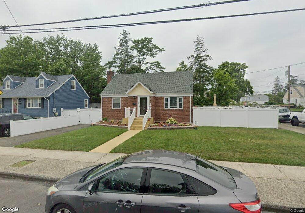
378 Newport Rd Uniondale, NY 11553
Estimated Value: $561,000 - $635,515
3
Beds
1
Bath
1,221
Sq Ft
$490/Sq Ft
Est. Value
About This Home
This home is located at 378 Newport Rd, Uniondale, NY 11553 and is currently estimated at $598,258, approximately $489 per square foot. 378 Newport Rd is a home located in Nassau County with nearby schools including California Avenue Elementary School, Lawrence Road Middle School, and Uniondale High School.
Ownership History
Date
Name
Owned For
Owner Type
Purchase Details
Closed on
Mar 30, 2016
Sold by
Mosquera Richard and Mccolgan Theresa Anne
Bought by
Charles Jason and Hunter Charles Marissa
Current Estimated Value
Home Financials for this Owner
Home Financials are based on the most recent Mortgage that was taken out on this home.
Original Mortgage
$328,932
Outstanding Balance
$265,025
Interest Rate
4.12%
Mortgage Type
FHA
Estimated Equity
$333,233
Purchase Details
Closed on
Sep 8, 2015
Sold by
Mccolgan Edward M and Mccolgan Theresa Anne
Bought by
Mosquera Richard and Mccolgan Theresa Anne
Create a Home Valuation Report for This Property
The Home Valuation Report is an in-depth analysis detailing your home's value as well as a comparison with similar homes in the area
Home Values in the Area
Average Home Value in this Area
Purchase History
| Date | Buyer | Sale Price | Title Company |
|---|---|---|---|
| Charles Jason | $335,000 | None Available | |
| Mosquera Richard | $150,000 | Attorney |
Source: Public Records
Mortgage History
| Date | Status | Borrower | Loan Amount |
|---|---|---|---|
| Open | Charles Jason | $328,932 |
Source: Public Records
Tax History Compared to Growth
Tax History
| Year | Tax Paid | Tax Assessment Tax Assessment Total Assessment is a certain percentage of the fair market value that is determined by local assessors to be the total taxable value of land and additions on the property. | Land | Improvement |
|---|---|---|---|---|
| 2025 | $8,273 | $353 | $138 | $215 |
| 2024 | $3,082 | $353 | $138 | $215 |
| 2023 | $6,805 | $353 | $138 | $215 |
| 2022 | $6,805 | $353 | $138 | $215 |
| 2021 | $8,469 | $372 | $146 | $226 |
| 2020 | $6,944 | $469 | $389 | $80 |
| 2019 | $6,641 | $591 | $496 | $95 |
| 2018 | $7,973 | $591 | $0 | $0 |
| 2017 | $3,719 | $591 | $496 | $95 |
| 2016 | $6,593 | $591 | $496 | $95 |
| 2015 | $2,692 | $591 | $496 | $95 |
| 2014 | $2,692 | $591 | $496 | $95 |
| 2013 | $2,600 | $591 | $496 | $95 |
Source: Public Records
Map
Nearby Homes
- 666 Lowell Rd
- 641 Lowell Rd
- 737 Lowell Rd
- 730 Goodrich St
- 537 Duryea Ave
- 399 Hawthorne Ave
- 546 Clark Place
- 692 Beck St
- 727 Beck St
- 363 Clarendon Rd
- 335 Locust Ave
- 240 Bedford Ave
- 541 Bedford Ave
- 305 Crowell St
- 112 Rutland Rd
- 727 Windsor Rd
- 178 Rutland Rd
- 1033 Tulsa St
- 388 Maplegrove Ave
- 165 Lenox Ave
- 386 Newport Rd
- 383 Maple Ave
- 390 Newport Rd
- 629 Webster Ave
- 377 Maple Ave Unit 1+Atti
- 377 Maple Ave Unit 1+B
- 377 Maple Ave
- 387 Maple Ave
- 369 Maple Ave
- 396 Newport Rd
- 393 Maple Ave
- 360 Newport Rd
- 367 Newport Rd
- 397 Maple Ave
- 402 Newport Rd
- 359 Maple Ave
- 359 Maple Ave
- 401 Maple Ave
- 590 Webster Ave
- 384 Maple Ave