Estimated Value: $301,000 - $371,000
2
Beds
2
Baths
2,015
Sq Ft
$166/Sq Ft
Est. Value
About This Home
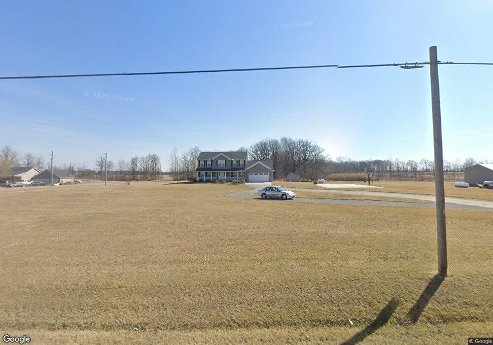
This home is located at 378 State Route 235, Ada, OH 45810 and is currently estimated at $335,153, approximately $166 per square foot. 378 State Route 235 is a home located in Hardin County with nearby schools including Ada Elementary School and Ada High School.
Ownership History
Date
Name
Owned For
Owner Type
Purchase Details
Closed on
Jan 29, 2019
Sold by
Mowery Helen
Bought by
Richards Mark and Richards Lesley
Current Estimated Value
Home Financials for this Owner
Home Financials are based on the most recent Mortgage that was taken out on this home.
Original Mortgage
$201,000
Outstanding Balance
$175,657
Interest Rate
4.6%
Mortgage Type
VA
Estimated Equity
$159,496
Purchase Details
Closed on
Nov 13, 2018
Sold by
Estate Of Charles Wesley Mowery
Bought by
Mowery Helen
Purchase Details
Closed on
Feb 20, 2004
Bought by
Mowery Charles W and Mowery Helen
Purchase Details
Closed on
Oct 23, 2001
Bought by
Mcnulty September L
Purchase Details
Closed on
Jul 27, 2000
Bought by
Galloway Land Co
Create a Home Valuation Report for This Property
The Home Valuation Report is an in-depth analysis detailing your home's value as well as a comparison with similar homes in the area
Purchase History
| Date | Buyer | Sale Price | Title Company |
|---|---|---|---|
| Richards Mark | $217,900 | First Lima Title Agency Inc | |
| Mowery Helen | -- | Superior Title Llc | |
| Mowery Charles W | $16,000 | -- | |
| Mcnulty September L | $12,300 | -- | |
| Galloway Land Co | -- | -- |
Source: Public Records
Mortgage History
| Date | Status | Borrower | Loan Amount |
|---|---|---|---|
| Open | Richards Mark | $201,000 |
Source: Public Records
Tax History
| Year | Tax Paid | Tax Assessment Tax Assessment Total Assessment is a certain percentage of the fair market value that is determined by local assessors to be the total taxable value of land and additions on the property. | Land | Improvement |
|---|---|---|---|---|
| 2024 | $3,055 | $82,160 | $15,030 | $67,130 |
| 2023 | $3,038 | $82,160 | $15,030 | $67,130 |
| 2022 | $2,936 | $69,130 | $8,170 | $60,960 |
| 2021 | $3,257 | $69,130 | $8,170 | $60,960 |
| 2020 | $3,279 | $69,130 | $8,170 | $60,960 |
| 2019 | $2,501 | $62,080 | $7,960 | $54,120 |
| 2018 | $2,446 | $62,080 | $7,960 | $54,120 |
| 2017 | $2,297 | $62,080 | $7,960 | $54,120 |
| 2016 | $2,211 | $61,030 | $7,430 | $53,600 |
| 2015 | $2,547 | $61,030 | $7,430 | $53,600 |
| 2014 | $2,155 | $61,030 | $7,430 | $53,600 |
| 2013 | $2,299 | $61,430 | $7,430 | $54,000 |
Source: Public Records
Map
Nearby Homes
- 3769 County Road 304
- 746 N Main St Unit 61
- 746 N Main St Unit 63
- 746 N Main St Unit 74
- 746 N Main St Unit 9
- 746 N Main St Unit 35
- 746 N Main St Unit 5
- 746 N Main St Unit 39
- 22694 County Road 12
- 724 N Main St
- 629 N Main St
- 503 E North Ave
- 327 W North Ave
- 530 N Main St
- 442 Edwards St
- 420 N Simon St
- 210 N Gilbert St
- 211 S Main St
- 308-310 S Simon St
- 510 E Lehr Ave Unit 510R
Your Personal Tour Guide
Ask me questions while you tour the home.