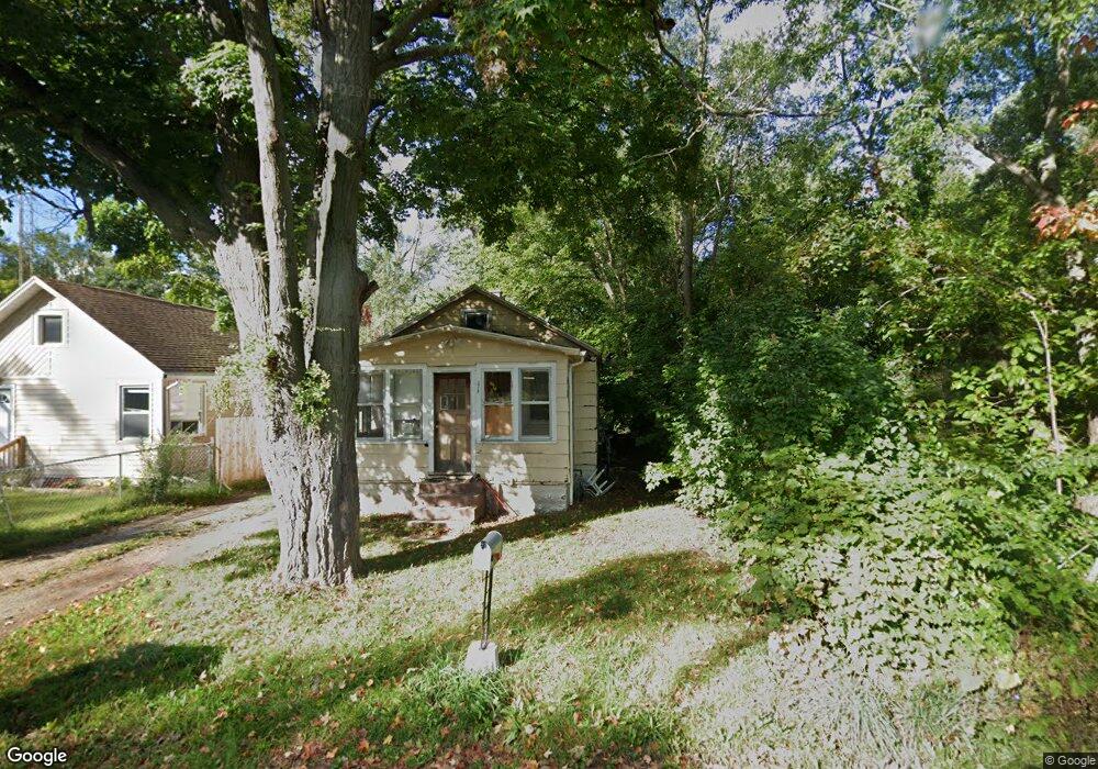
378 Walnut St Benton Harbor, MI 49022
Benton Heights NeighborhoodEstimated Value: $58,124 - $96,000
2
Beds
1
Bath
780
Sq Ft
$101/Sq Ft
Est. Value
About This Home
This home is located at 378 Walnut St, Benton Harbor, MI 49022 and is currently estimated at $78,781, approximately $101 per square foot. 378 Walnut St is a home located in Berrien County with nearby schools including Fair Plain Middle School, Benton Harbor High School, and Mildred C. Wells Preparatory Academy.
Ownership History
Date
Name
Owned For
Owner Type
Purchase Details
Closed on
Jan 3, 2024
Sold by
Abundant Life Homes Llc
Bought by
Eash Matt
Current Estimated Value
Purchase Details
Closed on
Jan 1, 2022
Sold by
Futurevestments Llc
Bought by
Abundant Life Homes Llc
Purchase Details
Closed on
Dec 17, 2019
Sold by
Steward Dorothy J
Bought by
Futurevestments Llc
Purchase Details
Closed on
Dec 12, 2019
Sold by
Steward Dorothy J
Bought by
Future Vestments Llc
Purchase Details
Closed on
May 30, 1997
Purchase Details
Closed on
Jun 16, 1995
Purchase Details
Closed on
Dec 9, 1994
Purchase Details
Closed on
Apr 10, 1986
Purchase Details
Closed on
Oct 26, 1978
Purchase Details
Closed on
Sep 18, 1978
Purchase Details
Closed on
Aug 15, 1978
Create a Home Valuation Report for This Property
The Home Valuation Report is an in-depth analysis detailing your home's value as well as a comparison with similar homes in the area
Home Values in the Area
Average Home Value in this Area
Purchase History
| Date | Buyer | Sale Price | Title Company |
|---|---|---|---|
| Eash Matt | -- | None Listed On Document | |
| Eash Matt | -- | None Listed On Document | |
| Abundant Life Homes Llc | -- | -- | |
| Futurevestments Llc | $2,750 | New Title Company Name | |
| Future Vestments Llc | $2,750 | Ata National Title Group Llc | |
| -- | -- | -- | |
| -- | -- | -- | |
| -- | -- | -- | |
| -- | $4,000 | -- | |
| -- | $100 | -- | |
| -- | $100 | -- | |
| -- | $5,300 | -- |
Source: Public Records
Tax History
| Year | Tax Paid | Tax Assessment Tax Assessment Total Assessment is a certain percentage of the fair market value that is determined by local assessors to be the total taxable value of land and additions on the property. | Land | Improvement |
|---|---|---|---|---|
| 2025 | $2,818 | $28,400 | $0 | $0 |
| 2024 | $863 | $24,300 | $0 | $0 |
| 2023 | $822 | $23,000 | $0 | $0 |
| 2022 | $571 | $21,800 | $0 | $0 |
| 2021 | $1,397 | $20,800 | $900 | $19,900 |
| 2020 | $1,256 | $20,500 | $0 | $0 |
| 2019 | $1,368 | $15,900 | $600 | $15,300 |
| 2018 | $1,142 | $15,900 | $0 | $0 |
| 2017 | $1,131 | $14,700 | $0 | $0 |
| 2016 | $1,347 | $14,500 | $0 | $0 |
| 2015 | $749 | $18,200 | $0 | $0 |
| 2014 | $491 | $17,600 | $0 | $0 |
Source: Public Records
Map
Nearby Homes
- 394 Linden St
- 137 Cornelia St
- 992 Highland Ave
- 831 La Salle St
- 770 Territorial Rd
- 470 N Mccord St
- 810 Thresher Ave
- 185 Felton St
- 696 Highland Ave
- 1626 Territorial Rd
- 710 Buss Ave
- 575 Cass St
- 612 N Crystal Ave
- 490 Territorial Rd
- 363 Brunson Ave
- 1636 E Britain Ave
- 309 High St
- 561 Heck Ct
- 378 Pipestone St
- 179 Collins Ave
Your Personal Tour Guide
Ask me questions while you tour the home.