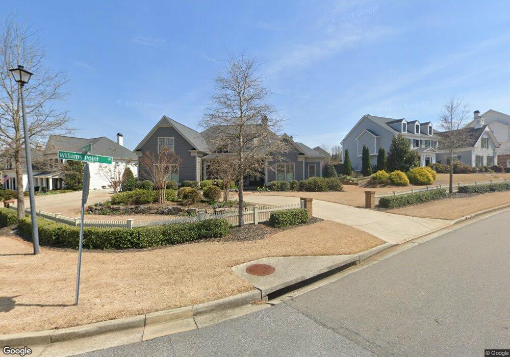
3780 3780 Williams Point Dr Cumming, GA 30028
Estimated Value: $737,421 - $852,000
4
Beds
4
Baths
3,516
Sq Ft
$231/Sq Ft
Est. Value
About This Home
This home is located at 3780 3780 Williams Point Dr, Cumming, GA 30028 and is currently estimated at $811,855, approximately $230 per square foot. 3780 3780 Williams Point Dr is a home located in Forsyth County with nearby schools including Poole's Mill Elementary School, Liberty Middle School, and North Forsyth High School.
Ownership History
Date
Name
Owned For
Owner Type
Purchase Details
Closed on
Dec 12, 2019
Sold by
Ferro Gregory P
Bought by
Lee E Scott E and Lee Amanda C
Current Estimated Value
Purchase Details
Closed on
Jul 14, 2016
Sold by
Sr Homes Llc
Bought by
Ferro Gregory P
Home Financials for this Owner
Home Financials are based on the most recent Mortgage that was taken out on this home.
Original Mortgage
$417,000
Interest Rate
3.54%
Mortgage Type
New Conventional
Purchase Details
Closed on
Sep 29, 2015
Sold by
Williams Point Properties Llc
Bought by
South Downs Properties Llc
Purchase Details
Closed on
Sep 27, 2015
Sold by
South Downs Properties Llc
Bought by
Sr Homes Llc
Create a Home Valuation Report for This Property
The Home Valuation Report is an in-depth analysis detailing your home's value as well as a comparison with similar homes in the area
Home Values in the Area
Average Home Value in this Area
Purchase History
| Date | Buyer | Sale Price | Title Company |
|---|---|---|---|
| Lee E Scott E | $520,000 | -- | |
| Ferro Gregory P | $484,900 | -- | |
| South Downs Properties Llc | $165,000 | -- | |
| Sr Homes Llc | $165,000 | -- |
Source: Public Records
Mortgage History
| Date | Status | Borrower | Loan Amount |
|---|---|---|---|
| Previous Owner | Ferro Gregory P | $417,000 |
Source: Public Records
Tax History Compared to Growth
Tax History
| Year | Tax Paid | Tax Assessment Tax Assessment Total Assessment is a certain percentage of the fair market value that is determined by local assessors to be the total taxable value of land and additions on the property. | Land | Improvement |
|---|---|---|---|---|
| 2025 | $1,495 | $292,384 | $54,000 | $238,384 |
| 2024 | $1,495 | $279,372 | $50,000 | $229,372 |
| 2023 | $5,545 | $266,880 | $40,000 | $226,880 |
| 2022 | $5,600 | $203,160 | $36,000 | $167,160 |
| 2021 | $5,427 | $203,160 | $36,000 | $167,160 |
| 2020 | $5,194 | $191,860 | $28,000 | $163,860 |
| 2019 | $5,143 | $189,868 | $22,000 | $167,868 |
| 2018 | $4,685 | $172,588 | $22,000 | $150,588 |
| 2017 | $5,115 | $187,448 | $22,000 | $165,448 |
| 2016 | $2,130 | $76,728 | $22,000 | $54,728 |
| 2015 | $500 | $18,000 | $18,000 | $0 |
| 2014 | $477 | $18,000 | $18,000 | $0 |
Source: Public Records
Map
Nearby Homes
- 3705 Williams Point Dr
- 3435 Summerdale Walk
- 3330 Summerpoint Crossing
- 3945 Silverthorn Trace
- 3675 Summerpoint Crossing
- 3880 Deer Run Dr
- 3930 Pheasant Run Trace
- 3375 Hillshire Dr
- 3390 Hillshire Dr
- Harvard II Plan at Hillshire
- Hampton Plan at Hillshire
- Wesley Plan at Hillshire
- Longwood Plan at Hillshire
- Vanderbilt Plan at Hillshire
- 3335 Hillshire Dr
- 3330 Hillshire Dr
- 3975 Haven Way
- 3985 Haven Way
- 3350 Hillshire Dr
- 3965 Haven Way
- 3785 Williams Point Dr
- 3790 Williams Point Dr
- 3810 Williams Point Dr Unit 60
- 3810 Williams Point Dr
- 3780 Williams Point Dr Unit 41
- 3780 Williams Point Dr
- 3810 Williams Point Dr Unit 60
- 3810 Williams Point Dr
- 3795 Williams Point Dr Unit 32
- 3795 Williams Point Dr
- 3795 Williams Point Dr
- 3775 Williams Point Dr
- 3815 Williams Point Dr Unit 31
- 3815 Williams Point Dr
- 3820 Williams Point Dr Unit 59
- 3820 Williams Point Dr
- 3815 Williams Point Dr
- 4170 Williams Point Dr Unit 42
- 4170 Williams Point Dr
- 4175 Williams Point Dr