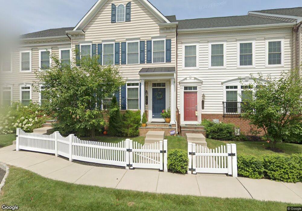
3781 William Daves Rd Doylestown, PA 18902
Plumstead NeighborhoodEstimated Value: $521,337 - $638,000
3
Beds
2
Baths
1,920
Sq Ft
$305/Sq Ft
Est. Value
About This Home
This home is located at 3781 William Daves Rd, Doylestown, PA 18902 and is currently estimated at $584,834, approximately $304 per square foot. 3781 William Daves Rd is a home with nearby schools including Groveland Elementary School, Tohickon Middle School, and Central Bucks High School-West.
Ownership History
Date
Name
Owned For
Owner Type
Purchase Details
Closed on
Nov 26, 2012
Sold by
Nvr Inc
Bought by
Kydonieus Katherine
Current Estimated Value
Home Financials for this Owner
Home Financials are based on the most recent Mortgage that was taken out on this home.
Original Mortgage
$110,000
Outstanding Balance
$20,272
Interest Rate
3.4%
Mortgage Type
New Conventional
Estimated Equity
$564,562
Purchase Details
Closed on
Jun 18, 2012
Sold by
Carriage Hill Jv Llc
Bought by
Nvr Inc and Nv Homes
Create a Home Valuation Report for This Property
The Home Valuation Report is an in-depth analysis detailing your home's value as well as a comparison with similar homes in the area
Home Values in the Area
Average Home Value in this Area
Purchase History
| Date | Buyer | Sale Price | Title Company |
|---|---|---|---|
| Kydonieus Katherine | $385,649 | None Available | |
| Nvr Inc | $810,000 | None Available |
Source: Public Records
Mortgage History
| Date | Status | Borrower | Loan Amount |
|---|---|---|---|
| Open | Kydonieus Katherine | $110,000 |
Source: Public Records
Tax History
| Year | Tax Paid | Tax Assessment Tax Assessment Total Assessment is a certain percentage of the fair market value that is determined by local assessors to be the total taxable value of land and additions on the property. | Land | Improvement |
|---|---|---|---|---|
| 2025 | $6,663 | $38,350 | $2,640 | $35,710 |
| 2024 | $6,663 | $38,350 | $2,640 | $35,710 |
| 2023 | $6,452 | $38,350 | $2,640 | $35,710 |
| 2022 | $6,380 | $38,350 | $2,640 | $35,710 |
| 2021 | $6,308 | $38,350 | $2,640 | $35,710 |
| 2020 | $6,308 | $38,350 | $2,640 | $35,710 |
| 2019 | $6,270 | $38,350 | $2,640 | $35,710 |
| 2018 | $6,270 | $38,350 | $2,640 | $35,710 |
| 2017 | $6,184 | $38,350 | $2,640 | $35,710 |
| 2016 | $6,184 | $38,350 | $2,640 | $35,710 |
| 2015 | -- | $38,350 | $2,640 | $35,710 |
| 2014 | -- | $38,350 | $2,640 | $35,710 |
Source: Public Records
Map
Nearby Homes
- 3688 Christopher Day Rd
- 3622 Alley E
- 3910 Cephas Child Rd Unit 6
- 3970 Salome Rd
- 4570 Louise Saint Claire Dr
- 4215 Ferguson Dr
- 30 John Dyer Way
- 4317 Kleinot Dr
- 4464 Kleinot Dr
- 4330 Kleinot Dr
- 4246 Kleinot Dr
- 4298 Kleinot Dr
- 4306 Kleinot Dr
- 117 Cottonwood Ct
- 807 N Broad St
- 4 Windey Way Ln
- 333 Lacey Ave Unit B9
- 102 Clear Springs Ct
- 4745 Nottingham Way
- 4179 Miladies Ln
- 3777 William Daves Rd
- 3785 William Daves Rd
- 3789 William Daves Rd
- 3773 William Daves Rd
- 3793 William Daves Rd
- 3769 William Daves Rd
- 3797 William Daves Rd
- 3910 William Daves Rd
- 3765 William Daves Rd
- 3761 William Daves Rd
- 3782 Christopher Day Rd
- 3776 Christopher Day Rd
- 3757 William Daves Rd Unit 107
- 3757 William Daves Rd
- 3764 Christopher Day Rd
- 3784 William Daves Rd Unit 11
- 3784 William Daves Rd Unit 6
- 3784 William Daves Rd
- 3784 William Daves Rd Unit 8
- 3784 William Daves Rd Unit 12
Your Personal Tour Guide
Ask me questions while you tour the home.