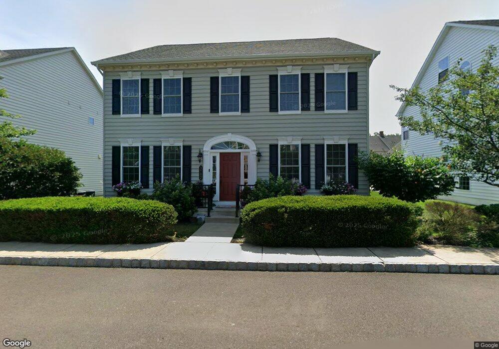
3782 Christopher Day Rd Doylestown, PA 18902
Plumstead NeighborhoodEstimated Value: $781,767 - $834,000
4
Beds
3
Baths
2,843
Sq Ft
$284/Sq Ft
Est. Value
About This Home
This home is located at 3782 Christopher Day Rd, Doylestown, PA 18902 and is currently estimated at $808,442, approximately $284 per square foot. 3782 Christopher Day Rd is a home with nearby schools including Groveland Elementary School, Tohickon Middle School, and Central Bucks High School-West.
Ownership History
Date
Name
Owned For
Owner Type
Purchase Details
Closed on
Jul 24, 2012
Sold by
Nvr Inc
Bought by
Pierson Myrnaivette and Pierson Robert
Current Estimated Value
Home Financials for this Owner
Home Financials are based on the most recent Mortgage that was taken out on this home.
Original Mortgage
$417,000
Outstanding Balance
$288,801
Interest Rate
3.74%
Mortgage Type
New Conventional
Estimated Equity
$519,641
Purchase Details
Closed on
Mar 21, 2012
Sold by
Carriage Hill Jv Llc
Bought by
Nvr Inc and Nv Homes
Create a Home Valuation Report for This Property
The Home Valuation Report is an in-depth analysis detailing your home's value as well as a comparison with similar homes in the area
Home Values in the Area
Average Home Value in this Area
Purchase History
| Date | Buyer | Sale Price | Title Company |
|---|---|---|---|
| Pierson Myrnaivette | $467,315 | None Available | |
| Nvr Inc | $680,000 | None Available |
Source: Public Records
Mortgage History
| Date | Status | Borrower | Loan Amount |
|---|---|---|---|
| Open | Pierson Myrnaivette | $417,000 |
Source: Public Records
Tax History Compared to Growth
Tax History
| Year | Tax Paid | Tax Assessment Tax Assessment Total Assessment is a certain percentage of the fair market value that is determined by local assessors to be the total taxable value of land and additions on the property. | Land | Improvement |
|---|---|---|---|---|
| 2025 | $9,078 | $52,250 | $5,070 | $47,180 |
| 2024 | $9,078 | $52,250 | $5,070 | $47,180 |
| 2023 | $8,790 | $52,250 | $5,070 | $47,180 |
| 2022 | $8,692 | $52,250 | $5,070 | $47,180 |
| 2021 | $8,595 | $52,250 | $5,070 | $47,180 |
| 2020 | $8,595 | $52,250 | $5,070 | $47,180 |
| 2019 | $8,542 | $52,250 | $5,070 | $47,180 |
| 2018 | $8,542 | $52,250 | $5,070 | $47,180 |
| 2017 | $8,425 | $52,250 | $5,070 | $47,180 |
| 2016 | $8,425 | $52,250 | $5,070 | $47,180 |
| 2015 | -- | $52,250 | $5,070 | $47,180 |
| 2014 | -- | $52,250 | $5,070 | $47,180 |
Source: Public Records
Map
Nearby Homes
- 3765 William Daves Rd
- 3723 William Daves Rd
- 4748 Bishop Cir
- 3838 Jacob Stout Rd
- 3711 Jacob Stout Rd Unit 5
- 5437 Rinker Cir Unit 283
- 3923 Ferry Rd
- 301 Windy Run Rd
- 100 Bishops Gate Ln Unit 67
- 114 Blackfriars Cir
- 194 Victoria Ct Unit 143
- 4263 Kleinot Dr
- 4317 Kleinot Dr
- 4464 Kleinot Dr
- 4330 Kleinot Dr
- 4246 Kleinot Dr
- 4298 Kleinot Dr
- 4306 Kleinot Dr
- 90 Chapman Ave
- 418 North St
- 3776 Christopher Day Rd
- 3790 Christopher Day Rd
- 3764 Christopher Day Rd
- 3785 William Daves Rd
- 3789 William Daves Rd
- 3777 William Daves Rd
- 3793 William Daves Rd
- 3781 William Daves Rd
- 3783 Christopher Day Rd
- 3758 Christopher Day Rd
- 3773 William Daves Rd
- 3791 Christopher Day Rd
- 3797 William Daves Rd
- 3777 Christopher Day Rd
- 3769 William Daves Rd
- 3761 William Daves Rd
- 3799 Christopher Day Rd
- 3765 Christopher Day Rd
- 4749 Abraham Freed Rd
- 3910 William Daves Rd