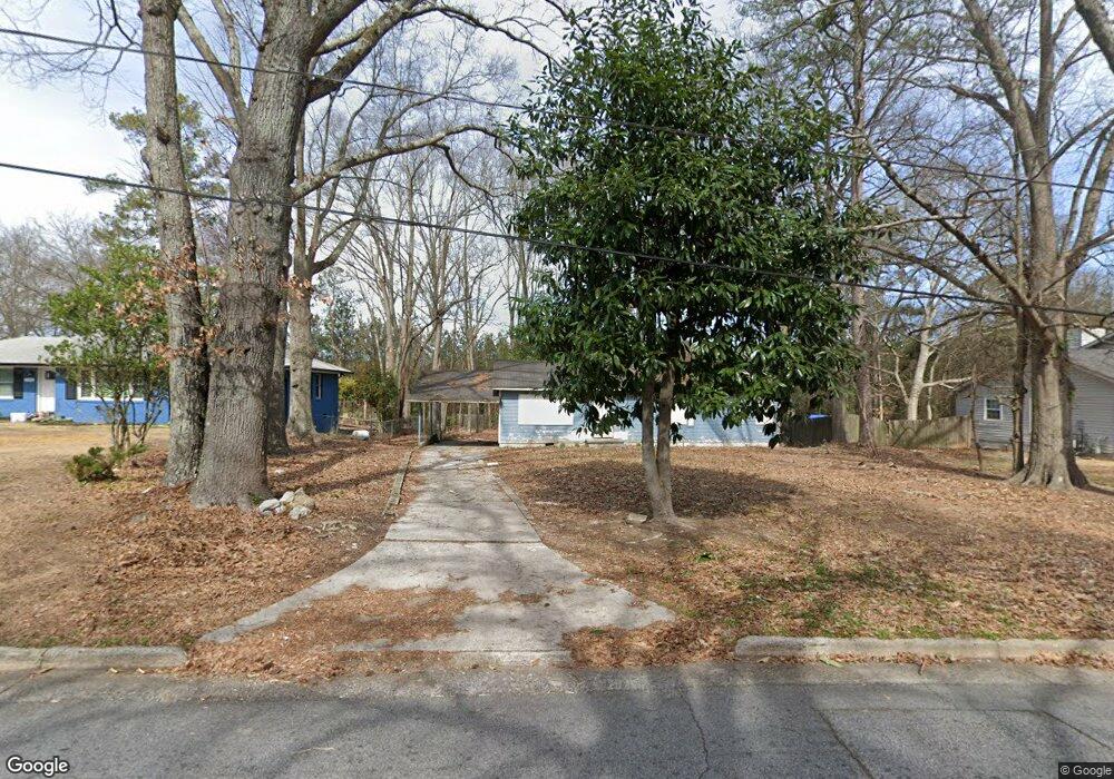
3783 Adamsville Dr SW Atlanta, GA 30331
Adamsville NeighborhoodEstimated Value: $190,000 - $217,000
3
Beds
2
Baths
1,144
Sq Ft
$176/Sq Ft
Est. Value
About This Home
This home is located at 3783 Adamsville Dr SW, Atlanta, GA 30331 and is currently estimated at $201,264, approximately $175 per square foot. 3783 Adamsville Dr SW is a home located in Fulton County with nearby schools including L.P. Miles Elementary School, Young Middle School, and Mays High School.
Ownership History
Date
Name
Owned For
Owner Type
Purchase Details
Closed on
Dec 29, 2014
Sold by
Adamsville Properties 1 Llc
Bought by
Dungloe Holdings Llc
Current Estimated Value
Purchase Details
Closed on
Apr 22, 2010
Sold by
Horan Patrick
Bought by
Adamsville Properties 1 Llc
Purchase Details
Closed on
Jun 6, 2008
Sold by
Bank Of New York Trust Co Na
Bought by
Horan Patrick B
Purchase Details
Closed on
Feb 6, 2007
Sold by
Holmes Ronnie L
Bought by
Bank Of New York Trust Co Na
Create a Home Valuation Report for This Property
The Home Valuation Report is an in-depth analysis detailing your home's value as well as a comparison with similar homes in the area
Home Values in the Area
Average Home Value in this Area
Purchase History
| Date | Buyer | Sale Price | Title Company |
|---|---|---|---|
| Dungloe Holdings Llc | -- | -- | |
| Adamsville Properties 1 Llc | -- | -- | |
| Horan Patrick B | $18,400 | -- | |
| Bank Of New York Trust Co Na | $60,000 | -- |
Source: Public Records
Tax History Compared to Growth
Tax History
| Year | Tax Paid | Tax Assessment Tax Assessment Total Assessment is a certain percentage of the fair market value that is determined by local assessors to be the total taxable value of land and additions on the property. | Land | Improvement |
|---|---|---|---|---|
| 2025 | $1,864 | $50,520 | $22,920 | $27,600 |
| 2023 | $2,128 | $51,400 | $6,080 | $45,320 |
| 2022 | $1,832 | $45,280 | $18,120 | $27,160 |
| 2021 | $1,304 | $32,200 | $11,880 | $20,320 |
| 2020 | $1,086 | $26,520 | $8,960 | $17,560 |
| 2019 | $491 | $19,240 | $5,080 | $14,160 |
| 2018 | $540 | $13,040 | $2,920 | $10,120 |
| 2017 | $523 | $12,120 | $5,240 | $6,880 |
| 2016 | $525 | $12,120 | $5,240 | $6,880 |
| 2015 | $1,018 | $12,120 | $5,240 | $6,880 |
| 2014 | $550 | $12,120 | $5,240 | $6,880 |
Source: Public Records
Map
Nearby Homes
- 3727 Bakers Ferry Rd SW
- 3798 Bakers Ferry Rd SW
- 3669 Martin Luther King Junior Dr SW
- 3833 Bakers Ferry Rd SW
- 3911 Cornell Blvd SW
- 294 Leland Place SW
- 3961 Cornell Blvd SW
- 3981 Rutgers Dr SW
- 246 Argus Cir NW
- 3781 Martin Luther King jr Dr SW
- 285 Argus Cir NW
- 437 Fairlock Ln NW
- 230 Argus Cir NW
- 3877 Bakers Ferry
- 491 Bolton Rd NW
- 317 Argus Cir NW
- 3808 Martin Luther King Junior Dr SW
- 306 Ard Place NW
- 3597 Fairlane Dr NW
- 3857 Kenner Dr SW
- 3791 Adamsville Dr SW
- 3781 Adamsville Dr SW
- 3795 Adamsville Dr SW
- 3797 Adamsville Dr SW
- 3805 Adamsville Dr SW
- 3753 Adamsville Dr SW
- 3790 Adamsville Dr SW
- 3798 Adamsville Dr SW
- 3811 Adamsville Dr SW
- 3758 Adamsville Dr SW
- 3804 Adamsville Dr SW
- 3821 Adamsville Dr SW
- 3810 Adamsville Dr SW
- 3810 Adamsville Dr SW Unit 1
- 3750 Adamsville Dr SW
- 3750 Adamsville Dr SW Unit 50/51
- 3794 Adamsville Dr SW
- 3748 Adamsville Dr SW
- 3737 Bakers Ferry Rd SW
- 3824 Adamsville Dr SW