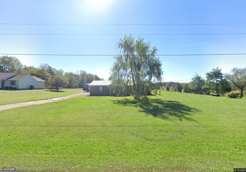
3786 Woodsdale Rd Shepherdsville, KY 40165
Estimated Value: $351,660 - $413,000
3
Beds
2
Baths
1,300
Sq Ft
$293/Sq Ft
Est. Value
About This Home
This home is located at 3786 Woodsdale Rd, Shepherdsville, KY 40165 and is currently estimated at $381,165, approximately $293 per square foot. 3786 Woodsdale Rd is a home located in Bullitt County with nearby schools including Cedar Grove Elementary School, Bernheim Middle School, and Bullitt Central High School.
Ownership History
Date
Name
Owned For
Owner Type
Purchase Details
Closed on
Feb 16, 2021
Sold by
Peck Eugene P and Peck Stacy J
Bought by
Price Megan and Price Waylon
Current Estimated Value
Home Financials for this Owner
Home Financials are based on the most recent Mortgage that was taken out on this home.
Original Mortgage
$235,653
Outstanding Balance
$210,766
Interest Rate
2.7%
Mortgage Type
FHA
Estimated Equity
$170,399
Create a Home Valuation Report for This Property
The Home Valuation Report is an in-depth analysis detailing your home's value as well as a comparison with similar homes in the area
Home Values in the Area
Average Home Value in this Area
Purchase History
| Date | Buyer | Sale Price | Title Company |
|---|---|---|---|
| Price Megan | $240,000 | Louisville Title | |
| Price Megan | $240,000 | Louisville Title |
Source: Public Records
Mortgage History
| Date | Status | Borrower | Loan Amount |
|---|---|---|---|
| Open | Price Megan | $235,653 | |
| Closed | Price Megan | $235,653 |
Source: Public Records
Tax History Compared to Growth
Tax History
| Year | Tax Paid | Tax Assessment Tax Assessment Total Assessment is a certain percentage of the fair market value that is determined by local assessors to be the total taxable value of land and additions on the property. | Land | Improvement |
|---|---|---|---|---|
| 2024 | $2,791 | $240,000 | $0 | $240,000 |
| 2023 | $2,772 | $240,000 | $0 | $240,000 |
| 2022 | $2,801 | $240,000 | $0 | $240,000 |
| 2021 | $1,882 | $160,000 | $0 | $0 |
| 2020 | $1,843 | $160,000 | $0 | $0 |
| 2019 | $1,807 | $160,000 | $0 | $0 |
| 2018 | $1,210 | $105,020 | $0 | $0 |
| 2017 | $1,192 | $105,020 | $0 | $0 |
| 2016 | $1,087 | $105,020 | $0 | $0 |
| 2015 | $1,044 | $105,020 | $0 | $0 |
| 2014 | $1,044 | $105,020 | $0 | $0 |
Source: Public Records
Map
Nearby Homes
- 875 Cedar Grove Rd
- 525 Cedar Grove Rd
- 7995 New Shepherdsville Rd
- 141 Durango Dr
- 139 Durango Dr
- 110 Flagstaff Dr
- 108 Flagstaff Dr
- 113 Amarillo Ln
- 76 Cormans Crossing Blvd
- 161 Peabody Loop
- 79 Cormans Crossing Blvd
- 154 Peabody Loop
- 7160 New Shepherdsville Rd
- 150 Peabody Loop
- 113 Nashville Dr
- 107 Pennyrile Dr
- 122 Chesapeake Trail
- 113 Chesapeake Trail
- 442 Clarks Ln
- 3130 Mobley Mill Rd
- 3748 Woodsdale Rd
- 3828 Woodsdale Rd
- 155 Pinoak Dr
- 217 Pinoak Dr
- 3886 Woodsdale Rd
- 172 Pinoak Dr
- 3913 Woodsdale Rd
- Lot 17 Pinoak Dr
- Lot 20 Pinoak Dr
- 0 Pinoak Dr
- 2 Pinoak Dr
- 6 Pinoak Dr
- Lot D Woodsdale Rd
- 287 Pin Oak Dr
- 214 Pinoak Dr
- 3620 Woodsdale Rd
- 4000 Woodsdale Rd
- Tract F Woodsdale Rd
- 3592 Woodsdale Rd
- 373 Pin Oak Dr