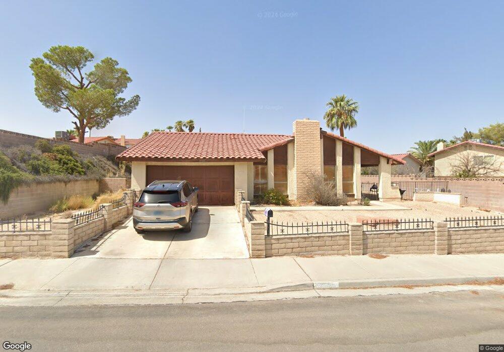
3789 Spitze Dr Las Vegas, NV 89103
Estimated Value: $507,000 - $546,000
4
Beds
2
Baths
2,320
Sq Ft
$227/Sq Ft
Est. Value
About This Home
This home is located at 3789 Spitze Dr, Las Vegas, NV 89103 and is currently estimated at $525,772, approximately $226 per square foot. 3789 Spitze Dr is a home located in Clark County with nearby schools including C H Decker Elementary School, Kenny C Guinn Middle School, and Ed W Clark High School.
Ownership History
Date
Name
Owned For
Owner Type
Purchase Details
Closed on
Feb 21, 1997
Sold by
Rogers Larry F and Rogers Brenda J
Bought by
Dentice Scott A and Dentice Lori M
Current Estimated Value
Home Financials for this Owner
Home Financials are based on the most recent Mortgage that was taken out on this home.
Original Mortgage
$142,400
Outstanding Balance
$16,536
Interest Rate
7.86%
Estimated Equity
$509,236
Create a Home Valuation Report for This Property
The Home Valuation Report is an in-depth analysis detailing your home's value as well as a comparison with similar homes in the area
Home Values in the Area
Average Home Value in this Area
Purchase History
| Date | Buyer | Sale Price | Title Company |
|---|---|---|---|
| Dentice Scott A | $150,000 | First American Title Co |
Source: Public Records
Mortgage History
| Date | Status | Borrower | Loan Amount |
|---|---|---|---|
| Open | Dentice Scott A | $142,400 |
Source: Public Records
Tax History Compared to Growth
Tax History
| Year | Tax Paid | Tax Assessment Tax Assessment Total Assessment is a certain percentage of the fair market value that is determined by local assessors to be the total taxable value of land and additions on the property. | Land | Improvement |
|---|---|---|---|---|
| 2025 | $1,702 | $86,560 | $40,950 | $45,610 |
| 2024 | $1,653 | $86,560 | $40,950 | $45,610 |
| 2023 | $1,349 | $86,237 | $40,950 | $45,287 |
| 2022 | $1,605 | $73,773 | $31,500 | $42,273 |
| 2021 | $1,558 | $71,471 | $30,450 | $41,021 |
| 2020 | $1,510 | $69,390 | $28,000 | $41,390 |
| 2019 | $1,466 | $65,940 | $24,500 | $41,440 |
| 2018 | $1,423 | $63,646 | $23,100 | $40,546 |
| 2017 | $1,871 | $63,791 | $22,050 | $41,741 |
| 2016 | $1,349 | $59,995 | $17,150 | $42,845 |
| 2015 | $1,345 | $53,309 | $10,500 | $42,809 |
| 2014 | $1,306 | $43,198 | $10,500 | $32,698 |
Source: Public Records
Map
Nearby Homes
- 5162 Winston St
- 3941 Delos Dr Unit 3
- 3947 Delos Dr
- 4794 Via Renaldo
- 3641 Ala Dr
- 3996 Tirana Way
- 4015 Delos Dr
- 4795 Via San Andros
- 4664 W Twain Ave
- 4008 Spitze Dr
- 3929 Calle Esquina
- 4054 Crete Ln Unit C
- 4016 Calle Paula
- 4000 Camas Ct
- 4610 Elk Springs Ave
- 5191 Pioneer Ave Unit 101
- 0 Spring Mountain Rd Unit 2562224
- 0 Spring Mountain Rd Unit 2562221
- 4594 Via Torino
- 5480 Cabrito Dr
- 5071 Cartaro Dr
- 5100 Winston St
- 5086 Winston St
- 5055 Cartaro Dr
- 5112 Winston St
- 3794 Spitze Dr
- 3786 Spitze Dr
- 5107 Cartaro Dr
- 3802 Spitze Dr
- 3810 Spitze Dr
- 3770 Spitze Dr
- 5126 Winston St
- 3827 Spitze Dr
- 5125 Cartaro Dr
- 5066 Cartaro Dr
- 5046 Leota Ct
- 5048 Cartaro Dr
- 5086 Cartaro Dr
- 5086 Cartaro Dr Unit `
- 3818 Spitze Dr