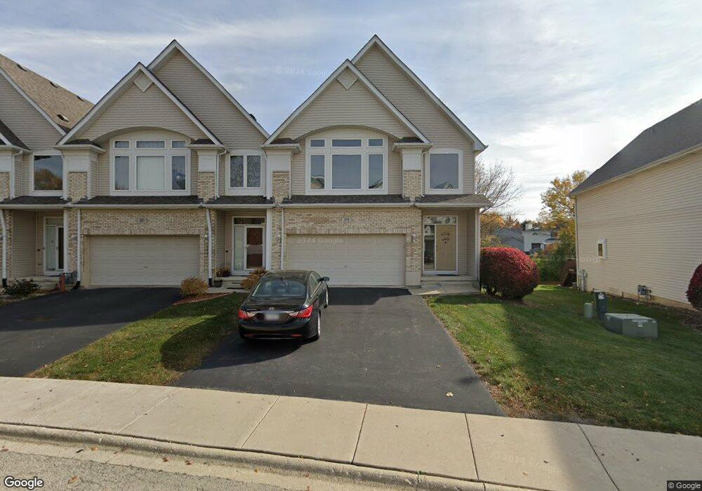
379 Aaron Ln Bolingbrook, IL 60440
East Bolingbrook NeighborhoodEstimated Value: $326,000 - $355,000
2
Beds
3
Baths
1,918
Sq Ft
$176/Sq Ft
Est. Value
About This Home
This home is located at 379 Aaron Ln, Bolingbrook, IL 60440 and is currently estimated at $337,335, approximately $175 per square foot. 379 Aaron Ln is a home located in Will County with nearby schools including Jonas E Salk Elementary School, Hubert H Humphrey Middle School, and Brooks Middle School.
Ownership History
Date
Name
Owned For
Owner Type
Purchase Details
Closed on
Mar 23, 2023
Sold by
Pittam Claire M
Bought by
Claire M Pittam Trust
Current Estimated Value
Purchase Details
Closed on
Nov 30, 2001
Sold by
Midwest Bank & Trust Company
Bought by
Pittam David and Pittam Claire M
Home Financials for this Owner
Home Financials are based on the most recent Mortgage that was taken out on this home.
Original Mortgage
$158,828
Interest Rate
6.68%
Create a Home Valuation Report for This Property
The Home Valuation Report is an in-depth analysis detailing your home's value as well as a comparison with similar homes in the area
Home Values in the Area
Average Home Value in this Area
Purchase History
| Date | Buyer | Sale Price | Title Company |
|---|---|---|---|
| Claire M Pittam Trust | -- | -- | |
| Pittam David | $199,000 | Greater Illinois Title Compa |
Source: Public Records
Mortgage History
| Date | Status | Borrower | Loan Amount |
|---|---|---|---|
| Previous Owner | Pittam David | $158,828 |
Source: Public Records
Tax History
| Year | Tax Paid | Tax Assessment Tax Assessment Total Assessment is a certain percentage of the fair market value that is determined by local assessors to be the total taxable value of land and additions on the property. | Land | Improvement |
|---|---|---|---|---|
| 2024 | $8,258 | $105,418 | $9,615 | $95,803 |
| 2023 | $8,258 | $94,851 | $8,651 | $86,200 |
| 2022 | $7,365 | $85,513 | $7,799 | $77,714 |
| 2021 | $6,942 | $79,956 | $7,292 | $72,664 |
| 2020 | $6,709 | $77,327 | $7,052 | $70,275 |
| 2019 | $6,463 | $73,645 | $6,716 | $66,929 |
| 2018 | $6,179 | $70,487 | $6,428 | $64,059 |
| 2017 | $5,850 | $66,812 | $6,093 | $60,719 |
| 2016 | $5,649 | $63,600 | $5,800 | $57,800 |
| 2015 | $5,549 | $61,000 | $5,600 | $55,400 |
| 2014 | $5,549 | $61,000 | $5,600 | $55,400 |
| 2013 | $5,549 | $57,000 | $5,200 | $51,800 |
Source: Public Records
Map
Nearby Homes
- 354 Aaron Ln
- 598 Miner Dr
- 411 Assembly Dr
- 555 Monroe Rd
- 421 N Ashbury Ave
- 7 Purchase Ct
- 221 Monroe Rd Unit 8
- 424 Van Gogh Cir Unit 1
- 417 Monet Cir
- 168 Winston Dr
- 519 Charlestown Dr
- 156 Winston Dr
- 526 King Arthur Way
- 404 Galahad Rd
- 574 Norman Rd
- 490 Ridge Ln
- 462 Ridge Ln
- 458 Ridge Ln
- BUILDING 14 Ridge Ln
- 456 Ridge Ln
Your Personal Tour Guide
Ask me questions while you tour the home.