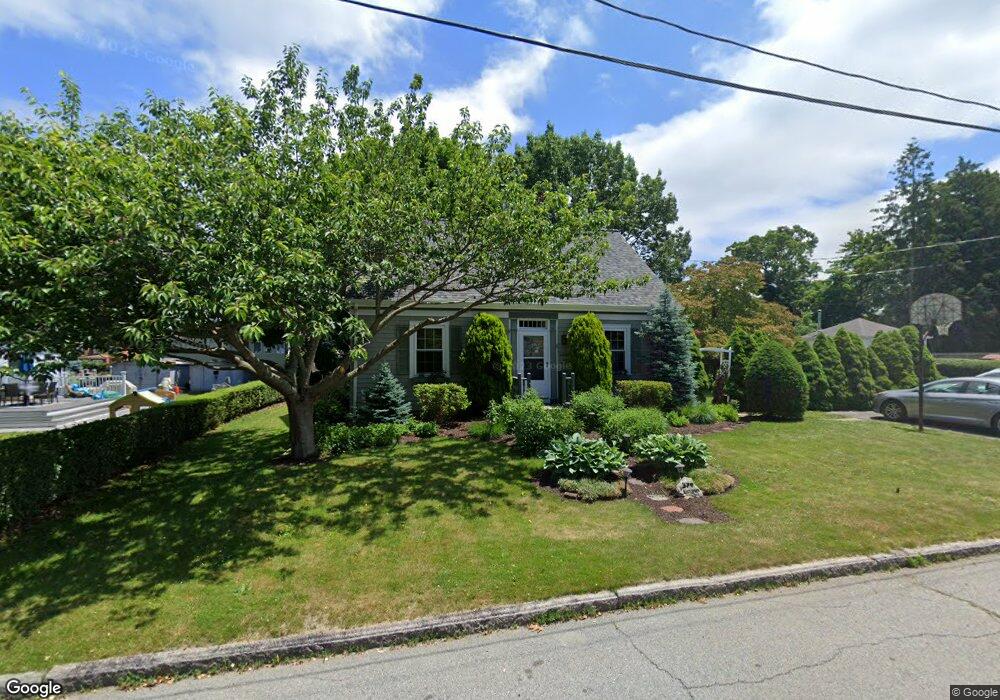
379 Kenyon St Fall River, MA 02720
Bank Street NeighborhoodEstimated Value: $445,820 - $477,000
2
Beds
2
Baths
1,347
Sq Ft
$345/Sq Ft
Est. Value
About This Home
This home is located at 379 Kenyon St, Fall River, MA 02720 and is currently estimated at $464,705, approximately $344 per square foot. 379 Kenyon St is a home located in Bristol County with nearby schools including Spencer Borden Elementary School, Morton Middle School, and B M C Durfee High School.
Ownership History
Date
Name
Owned For
Owner Type
Purchase Details
Closed on
Mar 27, 1990
Sold by
Wilson Edward W
Bought by
Lheureux James M
Current Estimated Value
Create a Home Valuation Report for This Property
The Home Valuation Report is an in-depth analysis detailing your home's value as well as a comparison with similar homes in the area
Home Values in the Area
Average Home Value in this Area
Purchase History
| Date | Buyer | Sale Price | Title Company |
|---|---|---|---|
| Lheureux James M | $115,000 | -- |
Source: Public Records
Mortgage History
| Date | Status | Borrower | Loan Amount |
|---|---|---|---|
| Open | Lheureux James M | $65,000 | |
| Closed | Lheureux James M | $40,000 | |
| Closed | Lheureux James M | $85,100 | |
| Closed | Lheureux James M | $62,000 |
Source: Public Records
Tax History
| Year | Tax Paid | Tax Assessment Tax Assessment Total Assessment is a certain percentage of the fair market value that is determined by local assessors to be the total taxable value of land and additions on the property. | Land | Improvement |
|---|---|---|---|---|
| 2025 | $4,759 | $415,600 | $137,300 | $278,300 |
| 2024 | $4,503 | $391,900 | $132,000 | $259,900 |
| 2023 | $4,336 | $353,400 | $118,500 | $234,900 |
| 2022 | $3,867 | $306,400 | $109,700 | $196,700 |
| 2021 | $4,224 | $305,400 | $103,600 | $201,800 |
| 2020 | $3,377 | $233,700 | $99,700 | $134,000 |
| 2019 | $3,340 | $229,100 | $99,700 | $129,400 |
| 2018 | $3,303 | $225,900 | $99,700 | $126,200 |
| 2017 | $3,130 | $223,600 | $99,700 | $123,900 |
| 2016 | $2,960 | $217,200 | $99,700 | $117,500 |
| 2015 | $2,757 | $210,800 | $93,300 | $117,500 |
| 2014 | $2,652 | $210,800 | $93,300 | $117,500 |
Source: Public Records
Map
Nearby Homes
- 295 Newbury St
- 36 Fordney St
- 742 New Boston Rd
- 677 Oak Grove Ave
- 60 Wingold St
- 108 Garden St
- 168 Windsor St
- 243 Oak Grove Ave
- 45 Read St
- 27 Kane St
- 45-47 Shawmut St
- 1231 Robeson St
- 301 Madison St
- 545 Robeson St
- 499 Hanover St
- 217 Plain St
- 503 Highland Ave
- 247 Albany St
- 230 College Park Rd
- 243 Robeson St Unit 6
- 955 New Boston Rd
- 351 Kenyon St
- 977 New Boston Rd
- 979 New Boston Rd
- 925 New Boston Rd Unit 927
- 925 New Boston Rd Unit 1
- 358 Kenyon St
- 343 Kenyon St
- 930 New Boston Rd
- 911 New Boston Rd
- 954 New Boston Rd
- 991 New Boston Rd
- 344 Kenyon St
- 335 Newbury St
- 13 Elsbree St
- 331 Kenyon St
- 370 Doherty St
- 926 New Boston Rd
- 903 New Boston Rd
- 978 New Boston Rd
Your Personal Tour Guide
Ask me questions while you tour the home.