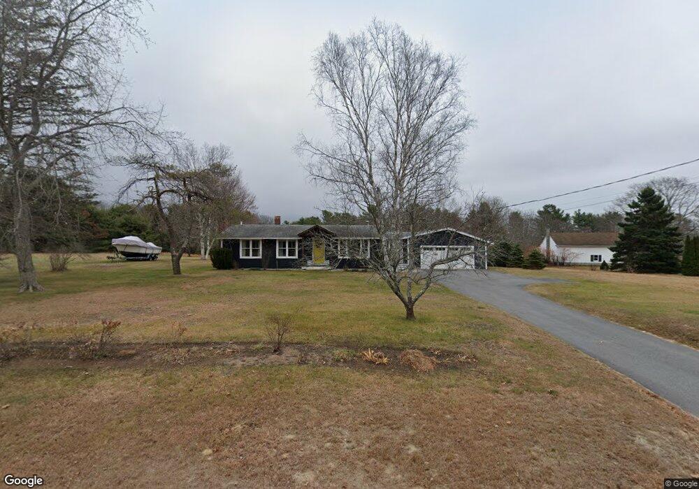
379 Maquoit Rd Brunswick, ME 04011
Estimated Value: $561,544 - $767,000
4
Beds
2
Baths
1,820
Sq Ft
$368/Sq Ft
Est. Value
About This Home
This home is located at 379 Maquoit Rd, Brunswick, ME 04011 and is currently estimated at $670,136, approximately $368 per square foot. 379 Maquoit Rd is a home located in Cumberland County with nearby schools including Kate Furbish Elementary School, Brunswick Jr High School, and Brunswick High School.
Ownership History
Date
Name
Owned For
Owner Type
Purchase Details
Closed on
May 25, 2018
Sold by
Schartel Egon F Est
Bought by
Verhey Jacob C
Current Estimated Value
Home Financials for this Owner
Home Financials are based on the most recent Mortgage that was taken out on this home.
Original Mortgage
$200,000
Interest Rate
4.4%
Mortgage Type
Unknown
Create a Home Valuation Report for This Property
The Home Valuation Report is an in-depth analysis detailing your home's value as well as a comparison with similar homes in the area
Home Values in the Area
Average Home Value in this Area
Purchase History
| Date | Buyer | Sale Price | Title Company |
|---|---|---|---|
| Verhey Jacob C | -- | -- |
Source: Public Records
Mortgage History
| Date | Status | Borrower | Loan Amount |
|---|---|---|---|
| Closed | Verhey Jacob C | $200,000 |
Source: Public Records
Tax History Compared to Growth
Tax History
| Year | Tax Paid | Tax Assessment Tax Assessment Total Assessment is a certain percentage of the fair market value that is determined by local assessors to be the total taxable value of land and additions on the property. | Land | Improvement |
|---|---|---|---|---|
| 2024 | $5,908 | $247,700 | $72,200 | $175,500 |
| 2023 | $5,767 | $247,600 | $72,200 | $175,400 |
| 2022 | $5,349 | $246,600 | $72,200 | $174,400 |
| 2021 | $5,144 | $246,600 | $72,200 | $174,400 |
| 2020 | $5 | $240,000 | $78,200 | $161,800 |
| 2019 | $1,176 | $240,000 | $78,200 | $161,800 |
| 2018 | $2,638 | $240,000 | $78,200 | $161,800 |
| 2017 | $1,075 | $240,000 | $78,200 | $161,800 |
| 2016 | $4 | $143,000 | $31,600 | $111,400 |
| 2015 | $4,055 | $143,000 | $31,600 | $111,400 |
| 2014 | $3,918 | $143,000 | $31,600 | $111,400 |
| 2013 | $3,795 | $143,000 | $31,600 | $111,400 |
Source: Public Records
Map
Nearby Homes
- 564 Mere Point Rd
- 650 Mere Point Rd
- 0 Gundalo Gap Rd Unit 1638108
- 384 Mere Point Rd
- 80 Scarponi Dr
- 66 Gleed Dr
- 19 Lynch St
- 6 Chebeague Ln
- 24 Elwell Ln
- 5 Round Hill Ln
- 10 Kitt St
- 6 Sagamore Ln
- 360 Church Rd
- 853 Mere Point Rd
- 890 Mere Point Rd
- 0 Melden Dr
- 6 Melden Dr
- Lot #0 Church Rd
- 2 Foxglove Way Unit 89
- 60 County Crossing
- 385 Maquoit Rd
- 382 Maquoit Rd
- 393 Maquoit Rd
- 371 Maquoit Rd
- 374 Maquoit Rd
- 362 Maquoit Rd
- 356 Maquoit Rd
- 481 Woodside Rd
- 499 Woodside Rd
- 467 Woodside Rd
- 343 Maquoit Rd
- 484 Woodside Rd
- 348 Maquoit Rd
- 478 Woodside Rd
- 352 Maquoit Rd
- 344 Maquoit Rd
- 335 Maquoit Rd
- 459 Woodside Rd
- 468 Woodside Rd
- 453 Woodside Rd