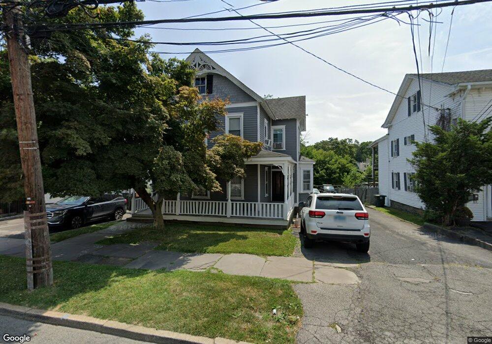
379 N Main St Port Chester, NY 10573
Estimated Value: $518,000 - $649,000
3
Beds
2
Baths
1,701
Sq Ft
$326/Sq Ft
Est. Value
About This Home
This home is located at 379 N Main St, Port Chester, NY 10573 and is currently estimated at $555,002, approximately $326 per square foot. 379 N Main St is a home located in Westchester County with nearby schools including Port Chester Middle School, Port Chester Senior High School, and Corpus Christi Holy Rosary School.
Ownership History
Date
Name
Owned For
Owner Type
Purchase Details
Closed on
Jan 2, 2025
Sold by
Delvalle John
Bought by
Catalano Michael and Catalano Michael
Current Estimated Value
Create a Home Valuation Report for This Property
The Home Valuation Report is an in-depth analysis detailing your home's value as well as a comparison with similar homes in the area
Home Values in the Area
Average Home Value in this Area
Purchase History
| Date | Buyer | Sale Price | Title Company |
|---|---|---|---|
| Catalano Michael | $500,000 | Catic Title |
Source: Public Records
Tax History Compared to Growth
Tax History
| Year | Tax Paid | Tax Assessment Tax Assessment Total Assessment is a certain percentage of the fair market value that is determined by local assessors to be the total taxable value of land and additions on the property. | Land | Improvement |
|---|---|---|---|---|
| 2024 | $12,844 | $581,700 | $204,200 | $377,500 |
| 2023 | $12,102 | $534,300 | $194,500 | $339,800 |
| 2022 | $10,417 | $504,100 | $194,500 | $309,600 |
| 2021 | $11,067 | $424,600 | $194,500 | $230,100 |
| 2020 | $10,888 | $416,300 | $194,500 | $221,800 |
| 2019 | $14,458 | $373,600 | $151,000 | $222,600 |
| 2018 | $7,491 | $349,900 | $152,200 | $197,700 |
| 2017 | $1,514 | $362,200 | $140,700 | $221,500 |
| 2016 | $13,619 | $343,800 | $134,000 | $209,800 |
| 2015 | -- | $356,700 | $147,400 | $209,300 |
| 2014 | -- | $264,200 | $112,900 | $151,300 |
| 2013 | -- | $264,200 | $112,900 | $151,300 |
Source: Public Records
Map
Nearby Homes
- 16 Rollhaus Place
- 412 Orchard St
- 131 Henry St
- 1 Landmark Square Unit 235
- 1 Landmark Square Unit 411
- 1 Landmark Square Unit 613
- 1 Landmark Square Unit 530
- 1 Landmark Square Unit 302
- 1 Landmark Square Unit 601
- 1 Landmark Square Unit 233
- 95 Byram Rd
- 340 Locust Ave
- 25 Henry St Unit B
- 9 S Water St
- 18 Beech St
- 30 High St
- 180 Madison Ave
- 220 Chestnut St Unit 2K
- 315 King St Unit 6A
- 315 King St Unit 1L