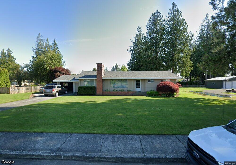
379 N Park St Lynden, WA 98264
Estimated Value: $591,706 - $649,000
3
Beds
2
Baths
1,485
Sq Ft
$420/Sq Ft
Est. Value
About This Home
This home is located at 379 N Park St, Lynden, WA 98264 and is currently estimated at $623,677, approximately $419 per square foot. 379 N Park St is a home located in Whatcom County with nearby schools including Lynden High School, Lynden Christian School, and Lynden Christian Schools: Administration.
Ownership History
Date
Name
Owned For
Owner Type
Purchase Details
Closed on
Sep 23, 2003
Sold by
Rb Development
Bought by
Roberts Jeffrey A
Current Estimated Value
Home Financials for this Owner
Home Financials are based on the most recent Mortgage that was taken out on this home.
Original Mortgage
$59,625
Outstanding Balance
$27,527
Interest Rate
6.17%
Mortgage Type
Purchase Money Mortgage
Estimated Equity
$596,150
Create a Home Valuation Report for This Property
The Home Valuation Report is an in-depth analysis detailing your home's value as well as a comparison with similar homes in the area
Home Values in the Area
Average Home Value in this Area
Purchase History
| Date | Buyer | Sale Price | Title Company |
|---|---|---|---|
| Roberts Jeffrey A | -- | Chicago Title Insurance |
Source: Public Records
Mortgage History
| Date | Status | Borrower | Loan Amount |
|---|---|---|---|
| Open | Roberts Jeffrey A | $59,625 |
Source: Public Records
Tax History Compared to Growth
Tax History
| Year | Tax Paid | Tax Assessment Tax Assessment Total Assessment is a certain percentage of the fair market value that is determined by local assessors to be the total taxable value of land and additions on the property. | Land | Improvement |
|---|---|---|---|---|
| 2024 | $4,262 | $597,876 | $266,750 | $331,126 |
| 2023 | $4,262 | $593,390 | $275,000 | $318,390 |
| 2022 | $3,728 | $489,624 | $162,459 | $327,165 |
| 2021 | $3,656 | $404,643 | $134,262 | $270,381 |
| 2020 | $3,203 | $361,298 | $119,880 | $241,418 |
| 2019 | $2,849 | $331,370 | $110,070 | $221,300 |
| 2018 | $3,114 | $302,194 | $100,269 | $201,925 |
| 2017 | $2,952 | $271,245 | $90,000 | $181,245 |
| 2016 | $2,790 | $273,540 | $93,500 | $180,040 |
| 2015 | $2,473 | $257,127 | $89,930 | $167,197 |
| 2014 | -- | $248,413 | $86,870 | $161,543 |
| 2013 | -- | $246,543 | $85,000 | $161,543 |
Source: Public Records
Map
Nearby Homes
- 891 W Park St
- 804 S Park Ct
- 301 S Park St
- 902 Captain Bay Ct
- 761 Sunrise Dr
- 518 Edson St
- 1725 Harrison Place Unit 104
- 107 Springview Dr
- 872 Sunrise Dr
- 0 Benson Rd Unit NWM2378945
- 209 Liberty St
- 908 Glenning St
- 1739 Emerald Way
- 8780 Depot Rd Unit 309
- 8780 Depot Rd Unit 308
- 8780 Depot Rd Unit 207
- 211 Maple St
- 1584 Main St
- 200 8th St
- 126 E Grover St Unit 6