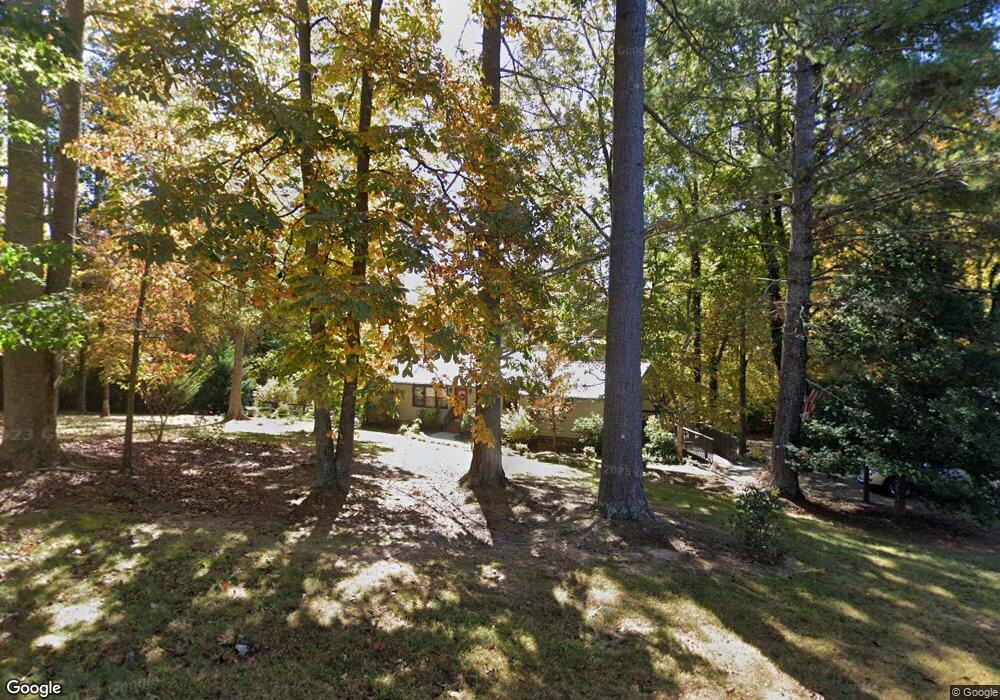
379 Riverbend Rd Blairsville, GA 30512
Estimated Value: $550,000 - $849,831
3
Beds
3
Baths
1,964
Sq Ft
$339/Sq Ft
Est. Value
About This Home
This home is located at 379 Riverbend Rd, Blairsville, GA 30512 and is currently estimated at $666,208, approximately $339 per square foot. 379 Riverbend Rd is a home located in Union County with nearby schools including Union County Primary School, Union County Elementary School, and Union County Middle School.
Ownership History
Date
Name
Owned For
Owner Type
Purchase Details
Closed on
Oct 28, 2015
Sold by
Henderson Robert
Bought by
Henderson Jerry L and Henderson Karen M
Current Estimated Value
Purchase Details
Closed on
Feb 23, 2012
Sold by
Henderson Jerry L
Bought by
Henderson Robert
Purchase Details
Closed on
Dec 22, 2008
Sold by
Henderson Jerry L
Bought by
Henderson Jerry L
Purchase Details
Closed on
Jun 1, 2007
Sold by
Henderson Jerry L
Bought by
Henderson Jerry L and Henderson Karen M
Purchase Details
Closed on
Mar 31, 1987
Bought by
Henderson Jerry L
Create a Home Valuation Report for This Property
The Home Valuation Report is an in-depth analysis detailing your home's value as well as a comparison with similar homes in the area
Home Values in the Area
Average Home Value in this Area
Purchase History
| Date | Buyer | Sale Price | Title Company |
|---|---|---|---|
| Henderson Jerry L | -- | -- | |
| Henderson Robert | -- | -- | |
| Henderson Robert | -- | -- | |
| Henderson Jerry L | -- | -- | |
| Henderson Jerry L | -- | -- | |
| Henderson Jerry L | -- | -- | |
| Henderson Jerry L | $20,000 | -- |
Source: Public Records
Tax History Compared to Growth
Tax History
| Year | Tax Paid | Tax Assessment Tax Assessment Total Assessment is a certain percentage of the fair market value that is determined by local assessors to be the total taxable value of land and additions on the property. | Land | Improvement |
|---|---|---|---|---|
| 2024 | $4,077 | $347,280 | $46,440 | $300,840 |
| 2023 | $4,563 | $344,720 | $46,440 | $298,280 |
| 2022 | $3,740 | $282,928 | $46,440 | $236,488 |
| 2021 | $3,699 | $236,736 | $46,440 | $190,296 |
| 2020 | $3,721 | $198,672 | $61,200 | $137,472 |
| 2019 | $3,517 | $198,672 | $61,200 | $137,472 |
| 2018 | $3,490 | $198,672 | $61,200 | $137,472 |
| 2017 | $3,455 | $198,672 | $61,200 | $137,472 |
| 2016 | $3,493 | $200,768 | $63,296 | $137,472 |
| 2015 | $2,163 | $124,015 | $42,594 | $81,421 |
| 2013 | -- | $124,015 | $42,594 | $81,420 |
Source: Public Records
Map
Nearby Homes
- 0 Holly Dr Unit 7556538
- 36 Flying Owl Rd
- 0 Ridge Peak View Unit LOT 62 10312280
- Lot 28 Loftis Mountain
- Lot 2 Serenity Ridge
- Lot 18 Bruce Mountain
- 0 Highland Park Unit LT 112 10554117
- Lot 38 the Hills at Queens Gap
- Lot 13 Thirteen Hundred Unit 13
- Lot 39 the Hills at Queens Gap
- 0 Enchanted Woods Unit 7643437
- Lot 13 Thirteen Hundred
- n/a Wildwood Ln
- Lot 35 Middle Creek Rd
- 171 Mountain Top Rd
- L 10&16 Josie Dr
- 102 Summit Way
- 399 Pinebrook Dr
- Lot 47 Mountain Top Rd
- 34 Mountain Valley Ln
- 379 Riverbend Rd
- 120 Holly Dr
- 0 Riverbend Rd Unit 9A 7623521
- 0 Riverbend Rd Unit 8768915
- 0 Riverbend Rd Unit Lot 9A 8859410
- 0 Riverbend Rd Unit G&H 8809040
- 0 Riverbend Rd Unit 3120704
- 0 Riverbend Rd Unit Lot 9A 8686586
- 0 Riverbend Rd Unit 9B 8598051
- LT 8A Holly Dr
- 0 Holly Dr Unit LOT 7 7054139
- 0 Holly Dr Unit 10013023
- 0 Holly Dr Unit 10222334
- 630 Holly Dr
- 347 Riverbend Rd
- 20 Holly Dr
- 51 Jr Duckworth Dr
- 451 Riverbend Rd
- LT 7 Holly Dr
- Lot 8-A Holly Dr