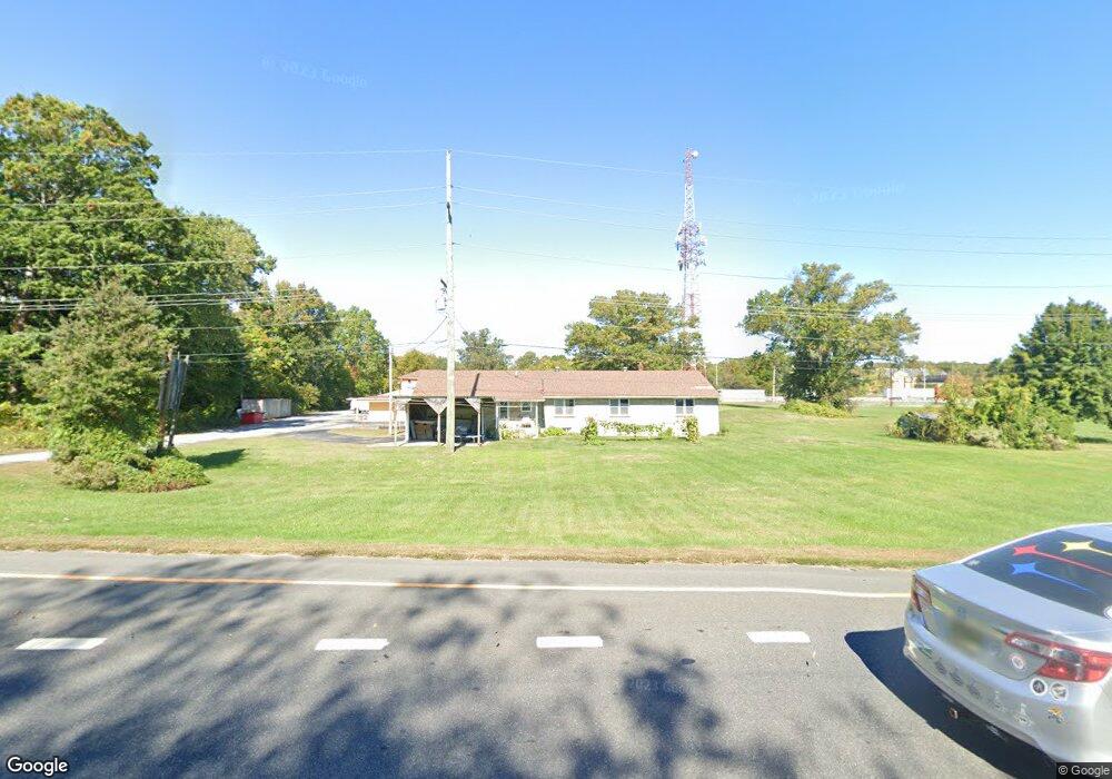
379 Route 40 Carneys Point, NJ 08069
Estimated Value: $311,000 - $412,000
--
Bed
--
Bath
1,715
Sq Ft
$203/Sq Ft
Est. Value
About This Home
This home is located at 379 Route 40, Carneys Point, NJ 08069 and is currently estimated at $349,000, approximately $203 per square foot. 379 Route 40 is a home located in Salem County with nearby schools including Lafayette-Pershing Elementary School, Paul W. Carleton Elementary School, and Field Street Elementary School.
Ownership History
Date
Name
Owned For
Owner Type
Purchase Details
Closed on
Dec 28, 2007
Sold by
Patel Maganbhai and Patel Manju
Bought by
Shivam Properties Inc
Current Estimated Value
Home Financials for this Owner
Home Financials are based on the most recent Mortgage that was taken out on this home.
Original Mortgage
$650,000
Outstanding Balance
$410,507
Interest Rate
6.17%
Mortgage Type
Credit Line Revolving
Estimated Equity
-$61,507
Purchase Details
Closed on
Nov 16, 2004
Sold by
Jeker Josefina
Bought by
Patel Maganbhai and Patel Manju
Create a Home Valuation Report for This Property
The Home Valuation Report is an in-depth analysis detailing your home's value as well as a comparison with similar homes in the area
Home Values in the Area
Average Home Value in this Area
Purchase History
| Date | Buyer | Sale Price | Title Company |
|---|---|---|---|
| Shivam Properties Inc | $223,000 | -- | |
| Patel Maganbhai | $165,000 | -- |
Source: Public Records
Mortgage History
| Date | Status | Borrower | Loan Amount |
|---|---|---|---|
| Open | Shivam Properties Inc | $650,000 |
Source: Public Records
Tax History Compared to Growth
Tax History
| Year | Tax Paid | Tax Assessment Tax Assessment Total Assessment is a certain percentage of the fair market value that is determined by local assessors to be the total taxable value of land and additions on the property. | Land | Improvement |
|---|---|---|---|---|
| 2025 | $7,702 | $342,500 | $77,500 | $265,000 |
| 2024 | $7,437 | $208,900 | $59,600 | $149,300 |
| 2023 | $7,437 | $208,900 | $59,600 | $149,300 |
| 2022 | $6,998 | $208,900 | $59,600 | $149,300 |
| 2021 | $6,931 | $208,900 | $59,600 | $149,300 |
| 2020 | $6,992 | $208,900 | $59,600 | $149,300 |
| 2019 | $7,050 | $208,900 | $59,600 | $149,300 |
| 2018 | $7,161 | $227,400 | $116,600 | $110,800 |
| 2017 | $6,676 | $227,400 | $116,600 | $110,800 |
| 2016 | $6,433 | $227,400 | $116,600 | $110,800 |
| 2015 | $6,133 | $227,400 | $116,600 | $110,800 |
| 2014 | $5,806 | $227,400 | $116,600 | $110,800 |
Source: Public Records
Map
Nearby Homes
- 371 40 Route
- 371 Route 40
- 613 Soders Rd
- 609 Hawks Bridge Rd
- 613 Hawks Bridge Rd
- 604 Hawks Bridge Rd
- 17 Sportsman Rd
- 1 Victory Ave Unit 84
- 1 Victory Ave Unit 82
- 1 Victory Ave Unit 74
- 1 Victory Ave Unit 72
- 1 Victory Ave Unit 8
- 1 Victory Ave Unit 93
- 1 Victory Ave
- 1 Victory Ave Unit 56
- 1 Victory Ave Unit 22
- 62 Penns Ave
- 107 Plant St
- 16 Pine St
- 239 Pin Oak Dr
- 367-369 Route 40
- 369 Route 40
- 369-01 Route 40
- 517 S Pennsville Auburn Rd
- 580 Orchard Dr
- 628 Soders Rd
- 624 Soders Rd
- 584 Orchard Dr
- 622 Soders Rd
- 611 Cedar Crest Dr
- 603 Cedar Crest Dr
- 601 Cedar Crest Dr
- 637 Soders Rd
- 612 Soders Rd
- 367 (01) U S 40
- 367 (001) Route 40
- 613 Cedar Crest Dr
- 600 Cedar Crest Dr
- 610 Soders Rd
- 602 Cedar Crest Dr