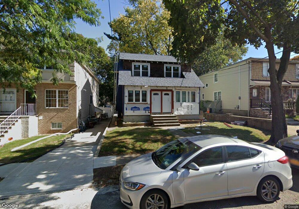
379 Sheffield St Unit 381 Staten Island, NY 10310
West Brighton NeighborhoodEstimated Value: $504,000 - $712,000
--
Bed
--
Bath
1,540
Sq Ft
$396/Sq Ft
Est. Value
About This Home
This home is located at 379 Sheffield St Unit 381, Staten Island, NY 10310 and is currently estimated at $609,295, approximately $395 per square foot. 379 Sheffield St Unit 381 is a home located in Richmond County with nearby schools including P.S. 45 John Tyler, Intermediate School 27, and Susan E Wagner High School.
Ownership History
Date
Name
Owned For
Owner Type
Purchase Details
Closed on
Mar 20, 2019
Sold by
Vikara Elaine and Meyer Joan
Bought by
Meyer James
Current Estimated Value
Home Financials for this Owner
Home Financials are based on the most recent Mortgage that was taken out on this home.
Original Mortgage
$210,000
Outstanding Balance
$184,250
Interest Rate
4.3%
Mortgage Type
New Conventional
Estimated Equity
$425,045
Purchase Details
Closed on
Sep 19, 2002
Sold by
Meyer Anna
Bought by
Meyer Francis Joseph and Meyer Anna
Create a Home Valuation Report for This Property
The Home Valuation Report is an in-depth analysis detailing your home's value as well as a comparison with similar homes in the area
Home Values in the Area
Average Home Value in this Area
Purchase History
| Date | Buyer | Sale Price | Title Company |
|---|---|---|---|
| Meyer James | $280,000 | Simplicity Abstract Inc | |
| Meyer Francis Joseph | -- | None Available |
Source: Public Records
Mortgage History
| Date | Status | Borrower | Loan Amount |
|---|---|---|---|
| Open | Meyer James | $210,000 |
Source: Public Records
Tax History Compared to Growth
Tax History
| Year | Tax Paid | Tax Assessment Tax Assessment Total Assessment is a certain percentage of the fair market value that is determined by local assessors to be the total taxable value of land and additions on the property. | Land | Improvement |
|---|---|---|---|---|
| 2025 | $5,059 | $27,480 | $11,483 | $15,997 |
| 2024 | $5,059 | $29,340 | $10,147 | $19,193 |
| 2023 | $4,825 | $23,760 | $9,752 | $14,008 |
| 2022 | $4,743 | $27,300 | $11,820 | $15,480 |
| 2021 | $4,963 | $23,700 | $11,820 | $11,880 |
| 2020 | $4,709 | $26,220 | $11,820 | $14,400 |
| 2019 | $4,390 | $22,800 | $11,820 | $10,980 |
| 2018 | $4,036 | $19,800 | $11,820 | $7,980 |
| 2017 | $4,036 | $19,800 | $11,820 | $7,980 |
| 2016 | $4,614 | $23,079 | $11,718 | $11,361 |
| 2015 | $4,148 | $22,255 | $12,447 | $9,808 |
| 2014 | $4,148 | $21,612 | $12,341 | $9,271 |
Source: Public Records
Map
Nearby Homes
- 386 N Burgher Ave
- 432 Pelton Ave
- 335 Oakland Ave
- 331 Oakland Ave
- 943 Castleton Ave
- 56 South St
- 401 Broadway
- 253 Elm St
- 361 Broadway
- 305 Broadway
- 45 Giacomo Ln
- 31 Giacomo Ln
- 207 N Burgher Ave
- 1064 Castleton Ave
- 244 Delafield Ave
- 46 Winegar Ln
- 698 Henderson Ave
- 718 Henderson Ave
- 20 Baker Place
- 354 Hoyt Ave
- 379-381 Sheffield St
- 383 Sheffield St
- 377 Sheffield St
- 385 Sheffield St
- 375 Sheffield St
- 375 Sheffield St Unit 1
- 369 Sheffield St
- 389 Sheffield St
- 400 Bement Ave
- 365 Sheffield St
- 404 Bement Ave
- 378 Sheffield St
- 396 Bement Ave
- 406 Bement Ave
- 382 Sheffield St
- 353 Sheffield St
- 390 Bement Ave
- 364-366 Sheffield St
- 384 Sheffield St
- 366 Sheffield St