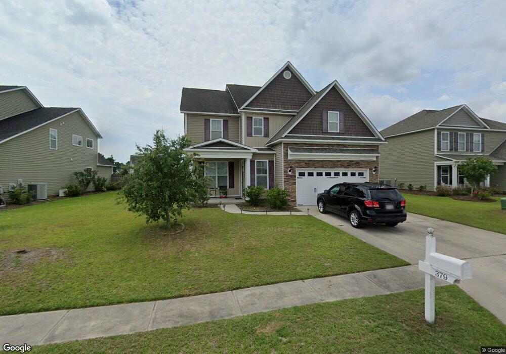
379 St Kitts Way Winnabow, NC 28479
Estimated Value: $457,000 - $495,000
3
Beds
4
Baths
3,107
Sq Ft
$151/Sq Ft
Est. Value
About This Home
This home is located at 379 St Kitts Way, Winnabow, NC 28479 and is currently estimated at $468,704, approximately $150 per square foot. 379 St Kitts Way is a home located in Brunswick County with nearby schools including Belville Elementary School, Leland Middle School, and North Brunswick High School.
Ownership History
Date
Name
Owned For
Owner Type
Purchase Details
Closed on
Nov 18, 2011
Sold by
Stevens Building Company
Bought by
Reid Edward A and Reid Karen T
Current Estimated Value
Home Financials for this Owner
Home Financials are based on the most recent Mortgage that was taken out on this home.
Original Mortgage
$223,451
Outstanding Balance
$154,054
Interest Rate
4.25%
Mortgage Type
FHA
Estimated Equity
$314,650
Purchase Details
Closed on
Aug 24, 2011
Sold by
Stevens Home Investments Inc
Bought by
Stevens Building Company
Create a Home Valuation Report for This Property
The Home Valuation Report is an in-depth analysis detailing your home's value as well as a comparison with similar homes in the area
Home Values in the Area
Average Home Value in this Area
Purchase History
| Date | Buyer | Sale Price | Title Company |
|---|---|---|---|
| Reid Edward A | $230,000 | None Available | |
| Stevens Building Company | $45,000 | None Available |
Source: Public Records
Mortgage History
| Date | Status | Borrower | Loan Amount |
|---|---|---|---|
| Open | Reid Edward A | $223,451 |
Source: Public Records
Tax History Compared to Growth
Tax History
| Year | Tax Paid | Tax Assessment Tax Assessment Total Assessment is a certain percentage of the fair market value that is determined by local assessors to be the total taxable value of land and additions on the property. | Land | Improvement |
|---|---|---|---|---|
| 2025 | $3,167 | $419,430 | $54,000 | $365,430 |
| 2024 | $3,167 | $419,430 | $54,000 | $365,430 |
| 2023 | $2,415 | $419,430 | $54,000 | $365,430 |
| 2022 | $2,415 | $261,210 | $50,000 | $211,210 |
| 2021 | $2,415 | $261,210 | $50,000 | $211,210 |
| 2020 | $2,310 | $261,210 | $50,000 | $211,210 |
| 2019 | $2,265 | $51,060 | $50,000 | $1,060 |
| 2018 | $2,205 | $26,230 | $25,000 | $1,230 |
| 2017 | $2,205 | $26,230 | $25,000 | $1,230 |
| 2016 | $2,060 | $26,230 | $25,000 | $1,230 |
| 2015 | $1,976 | $263,280 | $25,000 | $238,280 |
| 2014 | $1,734 | $241,400 | $25,000 | $216,400 |
Source: Public Records
Map
Nearby Homes
- 376 St Kitts Way
- 3330 Hemlock Way Unit Lot 128
- 420 Saint Kitts Way
- 335 St Kitts Way
- 734 Pine Cone Dr
- 5308 Black Oak Ct
- 350 Heartwood Dr Unit 4
- 342 Heartwood Dr Unit 2
- 346 Heartwood Dr Unit 3
- 195 N Palm Dr
- 1206 Birkdale Dr
- 363 Heartwood Dr
- 222 Bimini Dr
- 6440 Pinnacle Point
- 1234 Birkdale Dr
- 3045 Smeades Dr
- 1315 Star Grass Way
- 1007 Ringlet Ct
- 151 Kellerton Ct
- 796 Beachwalk Dr
- 383 St Kitts Way
- 375 St Kitts Way
- 365 St Kitts Way
- 1156 South Brook Rd
- 3325 Hemlock Way Unit Lot 4
- 3321 Hemlock Way Unit Lot 3
- 3329 Hemlock Way Unit Lot 5
- 361 St Kitts Way
- 1156 S Brook Rd
- 3333 Hemlock Way
- 3333 Hemlock Way Unit Lot 6
- 380 St Kitts Way
- 384 St Kitts Way
- 372 St Kitts Way
- 1160 S Brook Rd
- 1160 South Brook Rd
- 1155 South Brook Rd
- 368 Saint Kitts Way
- 1155 S Brook Rd
- 3337 Hemlock Way