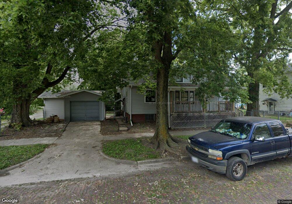
379 W King St Decatur, IL 62522
Estimated Value: $28,000 - $57,000
4
Beds
1
Bath
2,780
Sq Ft
$16/Sq Ft
Est. Value
About This Home
This home is located at 379 W King St, Decatur, IL 62522 and is currently estimated at $44,007, approximately $15 per square foot. 379 W King St is a home located in Macon County with nearby schools including Hope Academy, St. Patrick School, and Teen Challenge-Home For Girls.
Ownership History
Date
Name
Owned For
Owner Type
Purchase Details
Closed on
Sep 4, 2024
Sold by
God Shelter Of Love
Bought by
Buey Brenda
Current Estimated Value
Purchase Details
Closed on
Aug 19, 2005
Sold by
Wilson Frances E and Dechart Marilyn
Bought by
Gods Shelter Of Love
Create a Home Valuation Report for This Property
The Home Valuation Report is an in-depth analysis detailing your home's value as well as a comparison with similar homes in the area
Home Values in the Area
Average Home Value in this Area
Purchase History
| Date | Buyer | Sale Price | Title Company |
|---|---|---|---|
| Buey Brenda | -- | None Listed On Document | |
| Gods Shelter Of Love | $15,000 | None Available |
Source: Public Records
Tax History Compared to Growth
Tax History
| Year | Tax Paid | Tax Assessment Tax Assessment Total Assessment is a certain percentage of the fair market value that is determined by local assessors to be the total taxable value of land and additions on the property. | Land | Improvement |
|---|---|---|---|---|
| 2024 | $533 | $5,502 | $437 | $5,065 |
| 2023 | $528 | $5,308 | $422 | $4,886 |
| 2022 | $512 | $5,004 | $390 | $4,614 |
| 2021 | $481 | $4,674 | $365 | $4,309 |
| 2020 | $474 | $4,458 | $349 | $4,109 |
| 2019 | $474 | $4,458 | $349 | $4,109 |
| 2018 | $494 | $4,705 | $124 | $4,581 |
| 2017 | $506 | $4,830 | $127 | $4,703 |
| 2016 | $516 | $4,879 | $128 | $4,751 |
| 2015 | $490 | $4,793 | $126 | $4,667 |
| 2014 | $384 | $4,006 | $185 | $3,821 |
| 2013 | $397 | $4,156 | $192 | $3,964 |
Source: Public Records
Map
Nearby Homes
- 844 N Edward St
- 415 W Green St
- 875 N Monroe St
- 1245 N Union St
- 141 E Packard St
- 330 W William St
- 422 W William St
- 837 W Grand Ave
- 1458 N Union St
- 233 N Edward St
- 366 W Prairie Ave
- 442 W Prairie Ave
- 452 W Prairie Ave
- 609 W William St
- 1504 N Monroe St
- 1545 N Monroe St
- 254 N Pine St
- 281 W Prairie Ave
- 320 W Main St
- 1558 N Main St
- 345 W King St
- 876 N Edward St
- 858 N Edward St
- 850 N Edward St
- 398 W King St
- 912 N Edward St
- 834 N Edward St
- 905 N Edward St
- 915 N Edward St
- 938 N Edward St
- 867 N Edward St
- 828 N Edward St
- 923 N Edward St
- 855 N Edward St
- 851 N Edward St
- 940 N Edward St
- 933 N Edward St
- 843 N Edward St
- 420 W King St
- 423 W King St