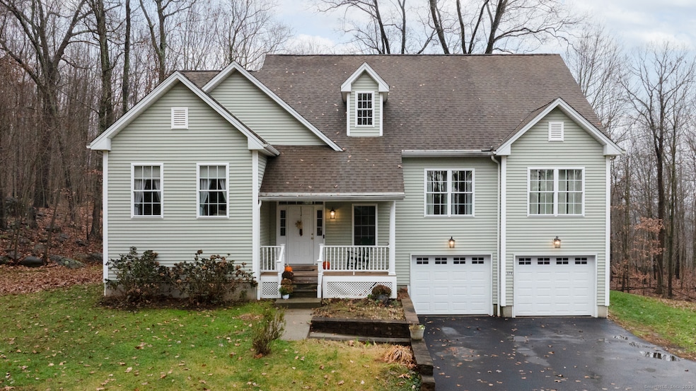
379 Wooster St Naugatuck, CT 06770
Estimated payment $3,737/month
Highlights
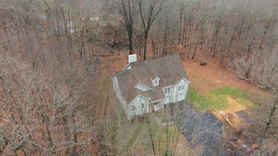
- 1.79 Acre Lot
- Ranch Style House
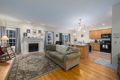
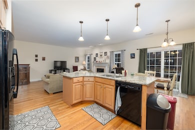
- 1 Fireplace
- Deck
- Attic
- Central Air
About This Home
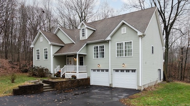
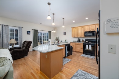
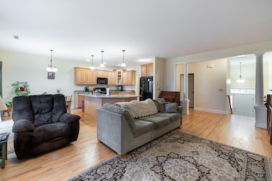
Welcome to 379 Wooster St. Nicely set on an interior lot, this property offers exceptional privacy while remaining close to local amenities. Although designed as a ranch for convenient one-level living, the home presents a colonial-style exterior that adds strong curb appeal. The layout features a comfortable main living area with good natural light and a practical flow throughout. The quiet setting makes this a great option for buyers seeking a peaceful location without sacrificing accessibility. Ample outdoor space and parking enhance the overall usability of the property. A well-maintained home with a unique blend of ranch functionality and colonial charm-ready for its next owner.
Listing Agent
eXp Realty Brokerage Phone: (203) 910-7602 License #REB.0794843 Listed on: 12/04/2025

Home Details
Home Type
- Single Family
Est. Annual Taxes
- $12,116
Year Built
- Built in 2008
Lot Details
- 1.79 Acre Lot
- Property is zoned Per town
Home Design
- Ranch Style House
- Concrete Foundation
- Frame Construction
- Asphalt Shingled Roof
- Vinyl Siding
Interior Spaces
- 1 Fireplace
- Partially Finished Basement
- Basement Fills Entire Space Under The House
- Attic or Crawl Hatchway Insulated
- Electric Range
Bedrooms and Bathrooms
- 3 Bedrooms
Laundry
- Dryer
- Washer
Parking
- 2 Car Garage
- Parking Deck
- Private Driveway
Outdoor Features
- Deck
- Rain Gutters
Schools
- Hop Brook Elementary School
- City Hill Middle School
- Cross St Middle School
- Naugatuck High School
Utilities
- Central Air
- Heating System Uses Oil Above Ground
- Heating System Uses Propane
- Private Water Source
- Electric Water Heater
Listing and Financial Details
- Assessor Parcel Number 2538265
Map
Home Values in the Area
Average Home Value in this Area
Tax History
| Year | Tax Paid | Tax Assessment Tax Assessment Total Assessment is a certain percentage of the fair market value that is determined by local assessors to be the total taxable value of land and additions on the property. | Land | Improvement |
|---|---|---|---|---|
| 2025 | $12,116 | $304,500 | $45,010 | $259,490 |
| 2024 | $12,725 | $304,500 | $45,010 | $259,490 |
| 2023 | $13,626 | $304,500 | $45,010 | $259,490 |
| 2022 | $10,088 | $211,270 | $47,530 | $163,740 |
| 2021 | $10,088 | $211,270 | $47,530 | $163,740 |
| 2020 | $10,088 | $211,270 | $47,530 | $163,740 |
| 2019 | $9,983 | $211,270 | $47,530 | $163,740 |
| 2018 | $9,516 | $196,820 | $59,550 | $137,270 |
| 2017 | $9,556 | $196,820 | $59,550 | $137,270 |
| 2016 | $9,382 | $196,820 | $59,550 | $137,270 |
| 2015 | $8,969 | $196,820 | $59,550 | $137,270 |
| 2014 | $8,869 | $196,820 | $59,550 | $137,270 |
| 2012 | $9,242 | $275,460 | $71,320 | $204,140 |
Property History
| Date | Event | Price | List to Sale | Price per Sq Ft |
|---|---|---|---|---|
| 12/04/2025 12/04/25 | For Sale | $520,000 | -- | $175 / Sq Ft |
Purchase History
| Date | Type | Sale Price | Title Company |
|---|---|---|---|
| Warranty Deed | $369,900 | -- |
Mortgage History
| Date | Status | Loan Amount | Loan Type |
|---|---|---|---|
| Open | $255,703 | Unknown | |
| Closed | $12,000 | No Value Available | |
| Closed | $295,920 | No Value Available | |
| Closed | $295,920 | Purchase Money Mortgage |
Source: SmartMLS
MLS Number: 24143135
APN: NAUG-000444-000019-E005272-000002
Disclaimer: Certain information contained herein is derived from information provided by parties other than Homes.com. All information provided is deemed reliable, but is not guaranteed to be accurate and should be independently verified.
![]() IDX information is provided exclusively for personal, non-commercial use, and may not be used for any purpose other than to identify prospective properties consumers may be interested in purchasing. Information is deemed reliable but not guaranteed.
IDX information is provided exclusively for personal, non-commercial use, and may not be used for any purpose other than to identify prospective properties consumers may be interested in purchasing. Information is deemed reliable but not guaranteed.
- 142 Applewood Ln
- 24 Windview Dr
- 51 Brook St Unit 6A
- 51 Brook St Unit 5A
- 317 City Hill St
- 426 City Hill St
- 137 Maple Hill Rd
- 834 May St
- 84 Ruela Dr
- 21 Acushnet St
- 32 Stanley St
- 190 Auburn St
- 194 Maple Hill Rd
- 35 Monahan Ln
- 29 Ramsey Ave
- 187 Lincoln St
- 465 N Main St
- 101 Adella St
- 46 Mulberry St
- 631 High St
- 504 Prospect St
- 4 Cobblestone Ct
- 117 Golden Hill St
- 25 Golden Hill St Unit 2
- 20 Myrtle Ave
- 223 N Main St Unit 2
- 61 School St
- 68 Anderson St Unit 3R
- 35 Washington St
- 44 Culver St
- 22 Oak St
- 270 Spring St
- 181 High St Unit 2
- 223 Meadow St
- 162 High St Unit 2nd floor
- 182 Jersey St Unit 2nd
- 128 Millville Ave Unit 2
- 141 Millville Ave
- 54 High St Unit 1
- 38 Highland Ave