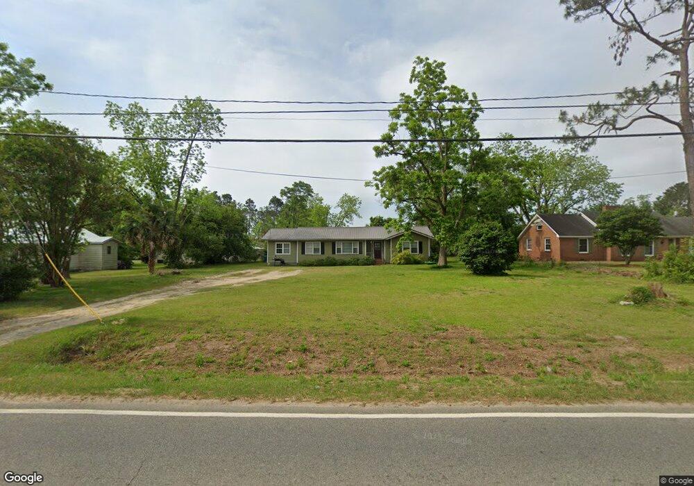
3790 Ga Highway 268 W Broxton, GA 31519
Estimated Value: $62,000 - $113,000
--
Bed
1
Bath
1,358
Sq Ft
$63/Sq Ft
Est. Value
About This Home
This home is located at 3790 Ga Highway 268 W, Broxton, GA 31519 and is currently estimated at $85,164, approximately $62 per square foot. 3790 Ga Highway 268 W is a home located in Coffee County with nearby schools including Broxton-Mary Hayes Elementary School, Coffee Middle School, and Coffee County High School.
Ownership History
Date
Name
Owned For
Owner Type
Purchase Details
Closed on
Nov 4, 2005
Sold by
Harper Mamie Frances M
Bought by
Bounds Kevin W and Bounds Amber M
Current Estimated Value
Home Financials for this Owner
Home Financials are based on the most recent Mortgage that was taken out on this home.
Original Mortgage
$51,211
Outstanding Balance
$27,819
Interest Rate
5.9%
Mortgage Type
New Conventional
Estimated Equity
$57,345
Purchase Details
Closed on
Mar 14, 2005
Sold by
Harper Mamie Frances Moore
Bought by
Harper Mamie Frances Moore
Create a Home Valuation Report for This Property
The Home Valuation Report is an in-depth analysis detailing your home's value as well as a comparison with similar homes in the area
Home Values in the Area
Average Home Value in this Area
Purchase History
| Date | Buyer | Sale Price | Title Company |
|---|---|---|---|
| Bounds Kevin W | $45,000 | -- | |
| Harper Mamie Frances Moore | -- | -- |
Source: Public Records
Mortgage History
| Date | Status | Borrower | Loan Amount |
|---|---|---|---|
| Open | Bounds Kevin W | $51,211 |
Source: Public Records
Tax History Compared to Growth
Tax History
| Year | Tax Paid | Tax Assessment Tax Assessment Total Assessment is a certain percentage of the fair market value that is determined by local assessors to be the total taxable value of land and additions on the property. | Land | Improvement |
|---|---|---|---|---|
| 2024 | $475 | $14,543 | $1,129 | $13,414 |
| 2023 | $422 | $14,542 | $1,129 | $13,414 |
| 2022 | $460 | $14,543 | $1,129 | $13,414 |
| 2021 | $460 | $14,543 | $1,129 | $13,414 |
| 2020 | $460 | $14,543 | $1,129 | $13,414 |
| 2019 | $460 | $14,543 | $1,129 | $13,414 |
| 2018 | $460 | $14,543 | $1,129 | $13,414 |
| 2017 | $462 | $14,543 | $1,129 | $13,414 |
| 2016 | $462 | $14,543 | $1,129 | $13,414 |
| 2015 | $464 | $14,542 | $1,129 | $13,414 |
| 2014 | $466 | $14,542 | $1,129 | $13,414 |
Source: Public Records
Map
Nearby Homes
- 504 Miller Ave
- 1020 Alabama St N
- 744 Lotts Crossing
- 4653 Douglas Braxton Hwy
- 407 Broxton West Green Hwy
- 310 Leyland Dr
- 2002 Apache Trail
- 161 Green Tree Dr
- 699 Twin Lakes Dr
- 5495 Cross Rd
- 126 Oscar Patton Estates
- 1671 Warren Carter Rd
- 3459 Douglas Broxton Hwy (North Hwy 441)
- 3751 Douglas Braxton Hwy
- 550 Isaac Brigmond Rd
- 3459 Douglas Braxton Hwy
- 00 Rocky Pond Rd
- 0 Hwy 301 Hwy Unit 1635753
- 1428 Cross Rd
- 423 Fort Valley Rd
- 3768 Ga Highway 268 W
- 102 Byrd St
- 104 Byrd St E
- 901 Alabama St N
- 903 Alabama St N
- 106 Byrd St E
- 103 Byrd St E
- 100 Duval St
- 00 Alabama St Unit n/a
- 817 Alabama St N
- 803 Alabama St N
- 104 Duval St
- 200 Byrd St E
- 900 Alabama St N
- 802 Alabama St N
- 907 Alabama St N
- 3692 Ga Highway 268 W
- 709 Railroad St
- 904 Alabama St N
- 707 Railroad St N