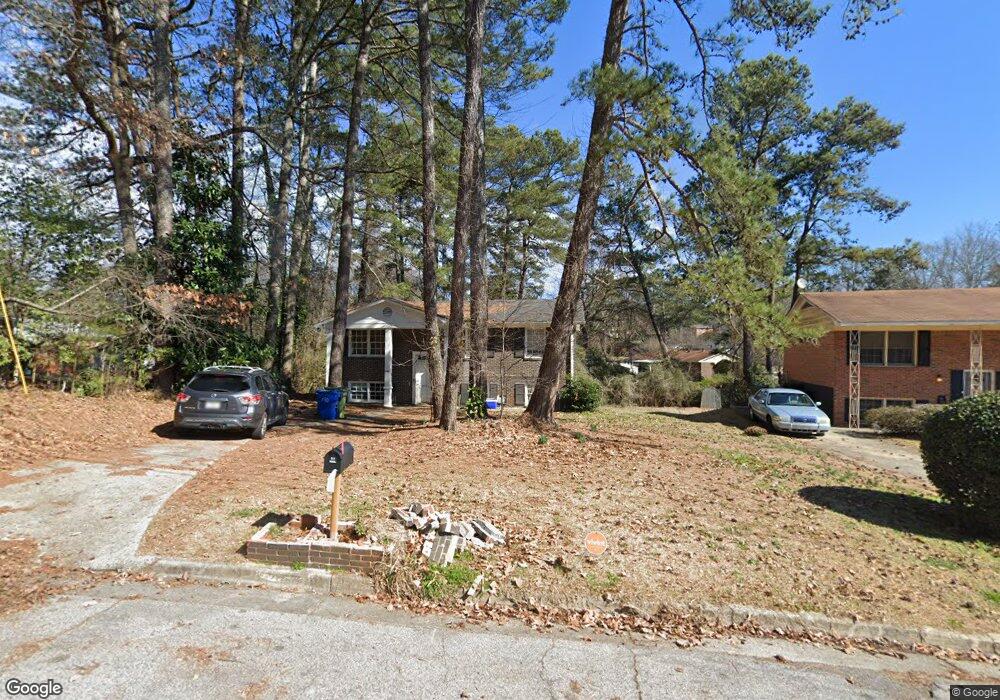
3791 Rockport Place SW Atlanta, GA 30331
Adamsville NeighborhoodEstimated Value: $230,000 - $245,539
4
Beds
2
Baths
1,000
Sq Ft
$240/Sq Ft
Est. Value
About This Home
This home is located at 3791 Rockport Place SW, Atlanta, GA 30331 and is currently estimated at $239,635, approximately $239 per square foot. 3791 Rockport Place SW is a home located in Fulton County with nearby schools including L.P. Miles Elementary School, Young Middle School, and Mays High School.
Ownership History
Date
Name
Owned For
Owner Type
Purchase Details
Closed on
May 5, 2022
Sold by
Fleischer Caroline
Bought by
Seven D Ventures Llc
Current Estimated Value
Purchase Details
Closed on
Jun 17, 2011
Sold by
Federal Natl Mtg Assn Fnma
Bought by
Fleischer Caroline
Purchase Details
Closed on
Apr 5, 2011
Sold by
Bac Home Loans Servicing Lp
Bought by
Federal Natl Mtg Assn Fnma
Purchase Details
Closed on
Jun 7, 2007
Sold by
Hutch One Properties Llc
Bought by
Wright Jeanette
Home Financials for this Owner
Home Financials are based on the most recent Mortgage that was taken out on this home.
Original Mortgage
$111,150
Interest Rate
6.16%
Mortgage Type
New Conventional
Purchase Details
Closed on
Dec 3, 2002
Sold by
National City Mortgage Co
Bought by
Hud & Housing Of Urban Development
Create a Home Valuation Report for This Property
The Home Valuation Report is an in-depth analysis detailing your home's value as well as a comparison with similar homes in the area
Home Values in the Area
Average Home Value in this Area
Purchase History
| Date | Buyer | Sale Price | Title Company |
|---|---|---|---|
| Seven D Ventures Llc | -- | -- | |
| Fleischer Caroline | -- | -- | |
| Federal Natl Mtg Assn Fnma | -- | -- | |
| Bac Home Loans Servicing Lp | $92,166 | -- | |
| Wright Jeanette | $117,000 | -- | |
| Hud & Housing Of Urban Development | -- | -- | |
| National City Mortgage Co | $118,417 | -- |
Source: Public Records
Mortgage History
| Date | Status | Borrower | Loan Amount |
|---|---|---|---|
| Previous Owner | Wright Jeanette | $111,150 |
Source: Public Records
Tax History Compared to Growth
Tax History
| Year | Tax Paid | Tax Assessment Tax Assessment Total Assessment is a certain percentage of the fair market value that is determined by local assessors to be the total taxable value of land and additions on the property. | Land | Improvement |
|---|---|---|---|---|
| 2025 | $1,682 | $94,600 | $23,280 | $71,320 |
| 2023 | $2,183 | $52,720 | $12,200 | $40,520 |
| 2022 | $2,134 | $52,720 | $12,200 | $40,520 |
| 2021 | $826 | $52,720 | $12,200 | $40,520 |
| 2020 | $836 | $20,400 | $3,000 | $17,400 |
| 2019 | $487 | $20,400 | $3,000 | $17,400 |
| 2018 | $497 | $23,200 | $3,000 | $20,200 |
| 2017 | $518 | $12,000 | $4,800 | $7,200 |
| 2016 | $520 | $12,000 | $4,800 | $7,200 |
| 2015 | $999 | $12,000 | $4,800 | $7,200 |
| 2014 | $417 | $16,240 | $4,800 | $11,440 |
Source: Public Records
Map
Nearby Homes
- 3798 Bakers Ferry Rd SW
- 3833 Bakers Ferry Rd SW
- 3877 Bakers Ferry
- 3911 Cornell Blvd SW
- 259 Tarragon Way SW
- 3727 Bakers Ferry Rd SW
- 3961 Cornell Blvd SW
- 273 Fennel Way SW
- 305 Fennel Way SW
- 3790 Brook Way SW
- 3981 Rutgers Dr SW
- 7098 Chara Ln SW
- 4015 Bakers Ferry Rd SW
- 3669 Martin Luther King Junior Dr SW
- 4063 Cornell Blvd SW
- 247 Howell Dr SW
- 246 Argus Cir NW
- 3697 Wisteria Ln SW
- 4039 Codel St SW
- 230 Argus Cir NW
- 3785 Rockport Place SW
- 474 Oakside Dr SW
- 466 Oakside Dr SW
- 449 Charter Oak Dr SW
- 460 Oakside Dr SW
- 467 Charter Oak Dr SW
- 3765 Rockport Place SW
- 3779 Rockport Place SW
- 467 Charte Sw Dr
- 459 Charter Oak Dr SW
- 490 Oakside Dr SW
- 443 Charter Oak Dr SW
- 3786 Rockport Place SW Unit 36
- 473 Charter Oak Dr SW
- 3773 Rockport Place SW
- 0 Oakside Dr SW Unit 7433520
- 0 Oakside Dr SW Unit 8037622
- 0 Oakside Dr SW Unit 7606663
- 0 Oakside Dr SW Unit 8982207
- 0 Oakside Dr SW Unit 7082625