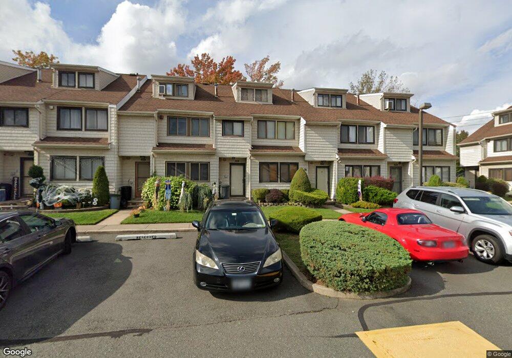
379C Signs Rd Unit 65 Staten Island, NY 10314
Bulls Head NeighborhoodEstimated Value: $548,508 - $618,000
--
Bed
--
Bath
1,476
Sq Ft
$388/Sq Ft
Est. Value
About This Home
This home is located at 379C Signs Rd Unit 65, Staten Island, NY 10314 and is currently estimated at $572,877, approximately $388 per square foot. 379C Signs Rd Unit 65 is a home located in Richmond County with nearby schools including P.S. 060 Alice Austen School, Is 72 Rocco Laurie, and Port Richmond High School.
Ownership History
Date
Name
Owned For
Owner Type
Purchase Details
Closed on
Mar 21, 2014
Sold by
Depierro Jeanne
Bought by
Collins Jennifer and Jeanne Depierro Trust
Current Estimated Value
Purchase Details
Closed on
Nov 14, 2001
Sold by
Appuzzio Louis
Bought by
Depierro Jeanne
Purchase Details
Closed on
Apr 21, 1995
Sold by
Federal Home Loan Mortgage Corporation
Bought by
Appuzzio Louis
Home Financials for this Owner
Home Financials are based on the most recent Mortgage that was taken out on this home.
Original Mortgage
$92,700
Interest Rate
8.33%
Create a Home Valuation Report for This Property
The Home Valuation Report is an in-depth analysis detailing your home's value as well as a comparison with similar homes in the area
Home Values in the Area
Average Home Value in this Area
Purchase History
| Date | Buyer | Sale Price | Title Company |
|---|---|---|---|
| Collins Jennifer | -- | Commonwealth Land Title Insu | |
| Depierro Jeanne | $230,000 | Commonwealth Land Title Ins | |
| Appuzzio Louis | $104,500 | -- |
Source: Public Records
Mortgage History
| Date | Status | Borrower | Loan Amount |
|---|---|---|---|
| Previous Owner | Appuzzio Louis | $92,700 |
Source: Public Records
Tax History Compared to Growth
Tax History
| Year | Tax Paid | Tax Assessment Tax Assessment Total Assessment is a certain percentage of the fair market value that is determined by local assessors to be the total taxable value of land and additions on the property. | Land | Improvement |
|---|---|---|---|---|
| 2025 | $4,151 | $32,192 | $1,949 | $30,243 |
| 2024 | $4,163 | $26,319 | $2,365 | $23,954 |
| 2023 | $1,830 | $20,820 | $2,395 | $18,425 |
| 2022 | $1,582 | $21,835 | $2,821 | $19,014 |
| 2021 | $1,647 | $20,768 | $2,821 | $17,947 |
| 2020 | $3,627 | $23,358 | $2,821 | $20,537 |
| 2019 | $3,554 | $23,017 | $2,821 | $20,196 |
Source: Public Records
Map
Nearby Homes
- 80 Dinsmore St Unit A
- 180 Dinsmore St Unit E
- 149 Forest St
- 108 Forest St
- 3 Nostrand Ave
- 57 Speedwell Ave
- 4 Gary Place
- 96 Amsterdam Ave
- 20 Toddy Ave
- 87 Amsterdam Ave
- 72 Toddy Ave
- 35 Sideview Ave
- 18 Signs Rd
- 6 Mulberry Ave
- 96 Paulding Ave
- 31 Plank Rd
- 94 Gary Place
- 45 Sommer Ave
- 8 Rockville Ave
- 15 Berglund Ave
- 379 Signs Rd Unit E
- 379 Signs Rd Unit A
- 379 Signs Rd Unit F
- 379 Signs Rd Unit C
- 379 Signs Rd Unit D
- 379 Signs Rd Unit B
- 379B Signs Rd Unit 64
- 379A Signs Rd
- 379D Signs Rd Unit 66
- 379F Signs Rd Unit 68
- 379E Signs Rd
- 385F Signs Rd
- 385E Signs Rd
- 385D Signs Rd
- 385C Signs Rd
- 361B Signs Rd
- 373K Signs Rd Unit 62
- 373J Signs Rd
- 361D Signs Rd Unit 50
- 361 Signs Rd Unit D