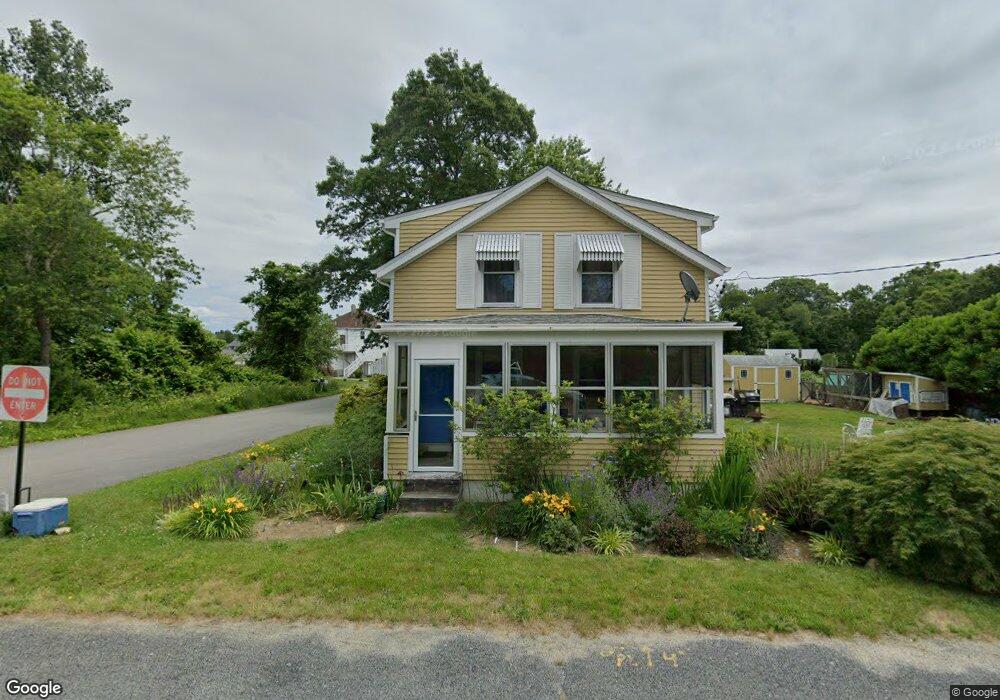
38 Arlington Ave Westport, MA 02790
North Westport NeighborhoodEstimated Value: $335,000 - $416,000
2
Beds
2
Baths
1,056
Sq Ft
$365/Sq Ft
Est. Value
About This Home
This home is located at 38 Arlington Ave, Westport, MA 02790 and is currently estimated at $385,962, approximately $365 per square foot. 38 Arlington Ave is a home located in Bristol County with nearby schools including Alice A. Macomber Primary School, Westport Elementary School, and Westport Middle-High School.
Ownership History
Date
Name
Owned For
Owner Type
Purchase Details
Closed on
May 18, 2009
Sold by
Plechaty Kenneth R
Bought by
Nadeau Terry L and Nadeau Erica L
Current Estimated Value
Home Financials for this Owner
Home Financials are based on the most recent Mortgage that was taken out on this home.
Original Mortgage
$182,095
Outstanding Balance
$115,052
Interest Rate
4.85%
Mortgage Type
Purchase Money Mortgage
Estimated Equity
$270,910
Create a Home Valuation Report for This Property
The Home Valuation Report is an in-depth analysis detailing your home's value as well as a comparison with similar homes in the area
Home Values in the Area
Average Home Value in this Area
Purchase History
| Date | Buyer | Sale Price | Title Company |
|---|---|---|---|
| Nadeau Terry L | $185,000 | -- |
Source: Public Records
Mortgage History
| Date | Status | Borrower | Loan Amount |
|---|---|---|---|
| Open | Nadeau Terry L | $182,095 | |
| Previous Owner | Nadeau Terry L | $10,400 |
Source: Public Records
Tax History Compared to Growth
Tax History
| Year | Tax Paid | Tax Assessment Tax Assessment Total Assessment is a certain percentage of the fair market value that is determined by local assessors to be the total taxable value of land and additions on the property. | Land | Improvement |
|---|---|---|---|---|
| 2025 | $2,219 | $297,800 | $142,300 | $155,500 |
| 2024 | $2,211 | $286,000 | $131,900 | $154,100 |
| 2023 | $2,129 | $260,900 | $119,600 | $141,300 |
| 2022 | $2,025 | $238,800 | $113,600 | $125,200 |
| 2021 | $1,964 | $227,900 | $103,300 | $124,600 |
| 2020 | $1,843 | $218,600 | $94,000 | $124,600 |
| 2019 | $1,705 | $206,200 | $94,000 | $112,200 |
| 2018 | $1,422 | $174,100 | $80,700 | $93,400 |
| 2017 | $1,413 | $177,300 | $86,300 | $91,000 |
| 2016 | $1,367 | $172,800 | $81,800 | $91,000 |
| 2015 | $1,343 | $169,400 | $94,000 | $75,400 |
Source: Public Records
Map
Nearby Homes
- 116 Gifford Rd
- 15 S Breault St
- 80 Gifford Rd
- 16 S Berryman St
- 23 Donna St
- 380 Gifford Rd
- 565 Highland Ave
- 79 Center St
- 100 D Dr
- 27 Dias Ave
- 3 Diane Way
- 96 Forge Rd
- 1276 Old Fall River Rd
- 29 Union Ave
- 56 Lakeside Ave
- 2 Donna Marie Dr
- 92 Benoit St
- 55 Lakeside Ave
- 818 Reed Rd
- 3 Roller Coaster Way Unit Lot 1
- 44 Arlington Ave
- 2 Osborn St
- 43 Arlington Ave
- 29 Arlington Ave
- 27 Greenwood Ave Unit 29
- 29 Greenwood Ave
- 27 Greenwood Ave Unit 2
- 10 1st Ave
- 28 Greenwood Ave
- 35 Glenwood Ave
- 23 Osborn St
- 26 Greenwood Ave
- 9 Oakland Ave
- 20 Arlington Ave
- 16 School St
- 16 School St
- 28 Osborn St
- 7 1st Ave
- 9 Oakland Ave
- 27 Glenwood Ave