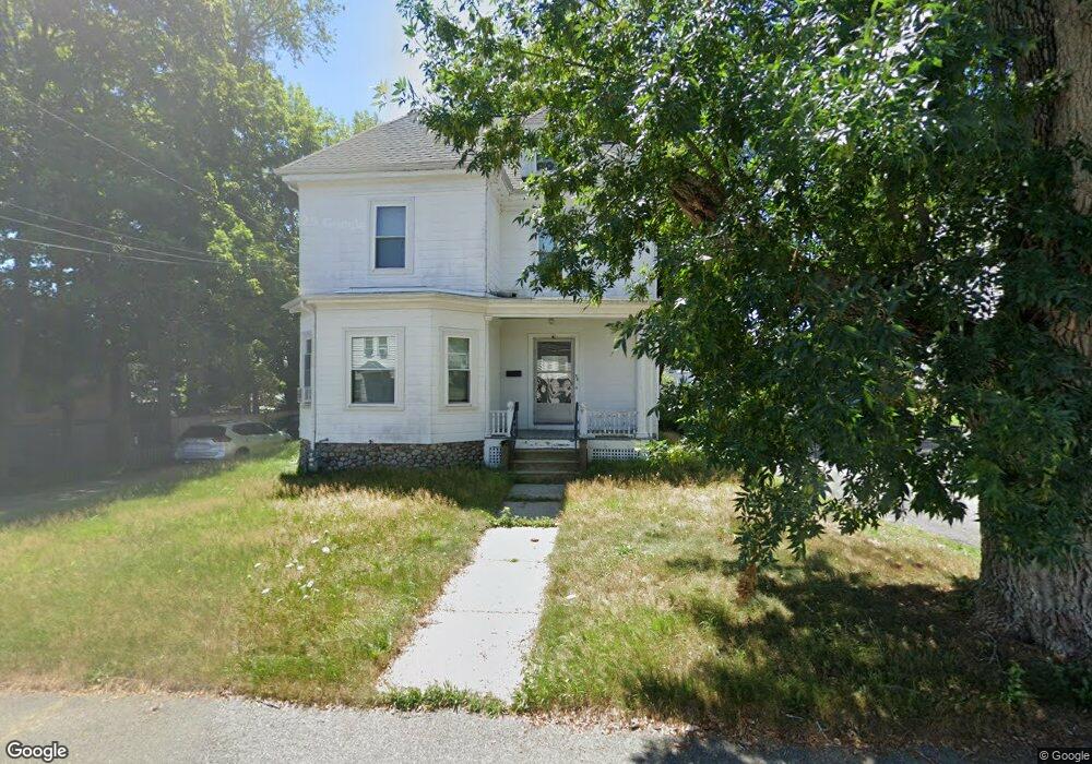
38 Battles St Brockton, MA 02301
Estimated Value: $504,000 - $608,000
3
Beds
1
Bath
1,920
Sq Ft
$287/Sq Ft
Est. Value
About This Home
This home is located at 38 Battles St, Brockton, MA 02301 and is currently estimated at $551,764, approximately $287 per square foot. 38 Battles St is a home located in Plymouth County with nearby schools including Louis F Angelo Elementary School, Manthala George Jr. School, and Raymond K-8 Elementary School.
Ownership History
Date
Name
Owned For
Owner Type
Purchase Details
Closed on
May 27, 2011
Sold by
Levaggi Laurel A
Bought by
Shakir Jameel
Current Estimated Value
Home Financials for this Owner
Home Financials are based on the most recent Mortgage that was taken out on this home.
Original Mortgage
$164,520
Outstanding Balance
$113,363
Interest Rate
4.62%
Mortgage Type
FHA
Estimated Equity
$438,401
Create a Home Valuation Report for This Property
The Home Valuation Report is an in-depth analysis detailing your home's value as well as a comparison with similar homes in the area
Home Values in the Area
Average Home Value in this Area
Purchase History
| Date | Buyer | Sale Price | Title Company |
|---|---|---|---|
| Shakir Jameel | $168,800 | -- |
Source: Public Records
Mortgage History
| Date | Status | Borrower | Loan Amount |
|---|---|---|---|
| Open | Shakir Jameel | $164,520 |
Source: Public Records
Tax History Compared to Growth
Tax History
| Year | Tax Paid | Tax Assessment Tax Assessment Total Assessment is a certain percentage of the fair market value that is determined by local assessors to be the total taxable value of land and additions on the property. | Land | Improvement |
|---|---|---|---|---|
| 2025 | $5,854 | $483,400 | $140,600 | $342,800 |
| 2024 | $5,463 | $454,500 | $140,600 | $313,900 |
| 2023 | $5,213 | $401,600 | $106,800 | $294,800 |
| 2022 | $4,462 | $319,400 | $97,100 | $222,300 |
| 2021 | $4,527 | $312,200 | $81,200 | $231,000 |
| 2020 | $4,024 | $265,600 | $75,500 | $190,100 |
| 2019 | $4,134 | $266,000 | $73,500 | $192,500 |
| 2018 | $3,951 | $246,000 | $73,500 | $172,500 |
| 2017 | $3,875 | $240,700 | $73,500 | $167,200 |
| 2016 | $3,383 | $194,900 | $71,400 | $123,500 |
| 2015 | $2,844 | $156,700 | $71,400 | $85,300 |
| 2014 | $2,837 | $156,500 | $71,400 | $85,100 |
Source: Public Records
Map
Nearby Homes
- 44 Battles St
- 34 Battles St
- 35 Division St
- 47 Battles St
- 41 Division St Unit 2R
- 41 Division St
- 4 Richmond St
- 28 Battles St
- 31 Battles St
- 47 Division St
- 22 Battles St
- 37 Battles St
- 43 Battles St
- 53 Division St
- 25 Battles St
- 8 Richmond St
- 8 Richmond St Unit 2
- 25 Division St
- 57 Division St
- 49 Battles St