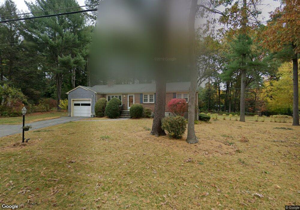
38 Bent Rd Sudbury, MA 01776
Estimated Value: $824,268 - $937,000
3
Beds
3
Baths
1,235
Sq Ft
$705/Sq Ft
Est. Value
About This Home
This home is located at 38 Bent Rd, Sudbury, MA 01776 and is currently estimated at $870,567, approximately $704 per square foot. 38 Bent Rd is a home located in Middlesex County with nearby schools including Israel Loring Elementary School, Ephraim Curtis Middle School, and Lincoln-Sudbury Regional High School.
Ownership History
Date
Name
Owned For
Owner Type
Purchase Details
Closed on
Nov 29, 1995
Sold by
Ready David
Bought by
Johnson Richard T and Johnson Susanne H
Current Estimated Value
Purchase Details
Closed on
Nov 23, 1987
Sold by
Perry Ronald K
Bought by
Ready David C
Create a Home Valuation Report for This Property
The Home Valuation Report is an in-depth analysis detailing your home's value as well as a comparison with similar homes in the area
Home Values in the Area
Average Home Value in this Area
Purchase History
| Date | Buyer | Sale Price | Title Company |
|---|---|---|---|
| Johnson Richard T | $237,158 | -- | |
| Ready David C | $235,000 | -- |
Source: Public Records
Mortgage History
| Date | Status | Borrower | Loan Amount |
|---|---|---|---|
| Open | Ready David C | $150,000 | |
| Closed | Ready David C | $119,000 |
Source: Public Records
Tax History Compared to Growth
Tax History
| Year | Tax Paid | Tax Assessment Tax Assessment Total Assessment is a certain percentage of the fair market value that is determined by local assessors to be the total taxable value of land and additions on the property. | Land | Improvement |
|---|---|---|---|---|
| 2025 | $10,839 | $740,400 | $417,000 | $323,400 |
| 2024 | $10,462 | $716,100 | $404,800 | $311,300 |
| 2023 | $10,553 | $669,200 | $374,800 | $294,400 |
| 2022 | $10,263 | $568,600 | $344,000 | $224,600 |
| 2021 | $10,161 | $539,600 | $344,000 | $195,600 |
| 2020 | $9,956 | $539,600 | $344,000 | $195,600 |
| 2019 | $9,664 | $539,600 | $344,000 | $195,600 |
| 2018 | $9,168 | $511,300 | $366,800 | $144,500 |
| 2017 | $8,450 | $476,300 | $348,900 | $127,400 |
| 2016 | $8,151 | $457,900 | $335,600 | $122,300 |
| 2015 | $7,503 | $426,300 | $322,700 | $103,600 |
| 2014 | $7,484 | $415,100 | $313,200 | $101,900 |
Source: Public Records
Map
Nearby Homes
- 30 Rolling Ln
- 12 Hickory Rd
- 54 Stone Rd
- 0 Robbins Rd
- 25 Bridle Path
- 143 Peakham Rd
- 89 Bridle Path
- 7 Saddle Ridge Rd
- 0 Boston Post Rd
- 7 Adams Rd
- 24 Woodland Rd
- 14 Tanbark Rd
- 21 Summer St
- 1011 Boston Post Rd
- 128 Nobscot Rd
- 270 Old Lancaster Rd
- 123 Dutton Rd
- 30 Nobscot Rd Unit 14
- 36 Concord Rd
- 23 Massasoit Ave