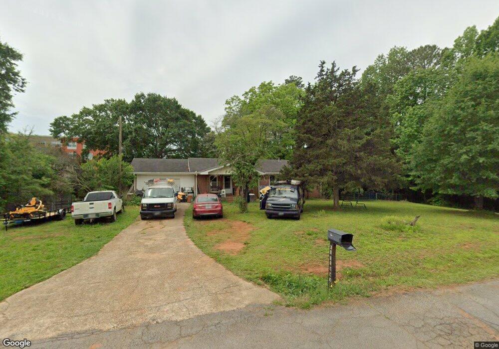
38 Brock St Carrollton, GA 30117
Estimated Value: $228,000 - $290,000
3
Beds
2
Baths
1,372
Sq Ft
$182/Sq Ft
Est. Value
About This Home
This home is located at 38 Brock St, Carrollton, GA 30117 and is currently estimated at $249,915, approximately $182 per square foot. 38 Brock St is a home located in Carroll County with nearby schools including Carrollton Elementary School, Carrollton Upper Elementary School, and Carrollton Middle School.
Ownership History
Date
Name
Owned For
Owner Type
Purchase Details
Closed on
May 28, 2025
Sold by
Engelhardt Carlin R
Bought by
Engelhardt Carlin Rae Trust and Carlin Rae Engelhardt Irrevocable Living
Current Estimated Value
Purchase Details
Closed on
Jan 28, 2010
Sold by
Abercrombie Jerry Glynn
Bought by
Abercrombie Jerry Glynn
Home Financials for this Owner
Home Financials are based on the most recent Mortgage that was taken out on this home.
Original Mortgage
$76,650
Interest Rate
3.5%
Mortgage Type
VA
Purchase Details
Closed on
Sep 2, 2004
Sold by
Husby Kenneth D
Bought by
Abercrombie Jerry G
Purchase Details
Closed on
Apr 26, 1999
Sold by
Husby Kenneth D
Bought by
Husby Kenneth D
Purchase Details
Closed on
Mar 16, 1986
Sold by
Waldrep
Bought by
Husby Kenneth D
Create a Home Valuation Report for This Property
The Home Valuation Report is an in-depth analysis detailing your home's value as well as a comparison with similar homes in the area
Home Values in the Area
Average Home Value in this Area
Purchase History
| Date | Buyer | Sale Price | Title Company |
|---|---|---|---|
| Engelhardt Carlin Rae Trust | -- | -- | |
| Abercrombie Jerry Glynn | -- | -- | |
| Abercrombie Jerry G | $76,500 | -- | |
| Husby Kenneth D | -- | -- | |
| Husby Kenneth D | $49,600 | -- |
Source: Public Records
Mortgage History
| Date | Status | Borrower | Loan Amount |
|---|---|---|---|
| Previous Owner | Abercrombie Jerry Glynn | $76,650 |
Source: Public Records
Tax History Compared to Growth
Tax History
| Year | Tax Paid | Tax Assessment Tax Assessment Total Assessment is a certain percentage of the fair market value that is determined by local assessors to be the total taxable value of land and additions on the property. | Land | Improvement |
|---|---|---|---|---|
| 2024 | $520 | $70,482 | $9,000 | $61,482 |
| 2023 | $504 | $65,330 | $9,000 | $56,330 |
| 2022 | $512 | $54,232 | $9,000 | $45,232 |
| 2021 | $1,172 | $47,803 | $9,000 | $38,803 |
| 2020 | $1,091 | $44,266 | $9,000 | $35,266 |
| 2019 | $1,047 | $41,968 | $9,000 | $32,968 |
| 2018 | $999 | $39,410 | $9,000 | $30,410 |
| 2017 | $1,004 | $39,410 | $9,000 | $30,410 |
| 2016 | $1,009 | $39,410 | $9,000 | $30,410 |
| 2015 | $821 | $30,590 | $9,000 | $21,590 |
| 2014 | $825 | $30,590 | $9,000 | $21,590 |
Source: Public Records
Map
Nearby Homes
- Plan 1643 at Windmill Park
- Plan 1830 at Windmill Park
- 203 Vineyard Walk Unit LOT 74
- Plan 2030 at Windmill Park
- 203 Vineyard Walk
- Plan 1727 at Windmill Park
- Plan 1400 at Windmill Park
- 113 Vineyard Walk
- 113 Vineyard Walk Unit LOT 77
- 111 Vineyard Walk
- 111 Vineyard Walk Unit LOT 78
- 50 Sue Alice Ln
- 128 Manor Way
- 116 Manor Way
- 50 Azalea Trail
- 121 Carson Place
- 400 Stripling Chapel Rd
- 977 Whooping Creek Rd
- 1250 Hays Mill Rd
- 117 Orion Terrace
- 54 Brock St
- 55 Brock St
- 1495 U S 27
- 71 Brock St
- 78 Brock St
- 1561 U S 27
- 86 Brock St
- 145 AC ON BROCK Brock St
- 1561 S Highway 27
- 33 Brock St
- 1512 S Highway 27
- 101 Brock St
- 0 Brock St Unit 7258863
- 0 Brock St Unit 7086331
- 1556 S Highway 27
- 118 Brock St
- 111 Brock St
- 1478 S Highway 27
- 1478 U S 27
- 1620 N Highway 27