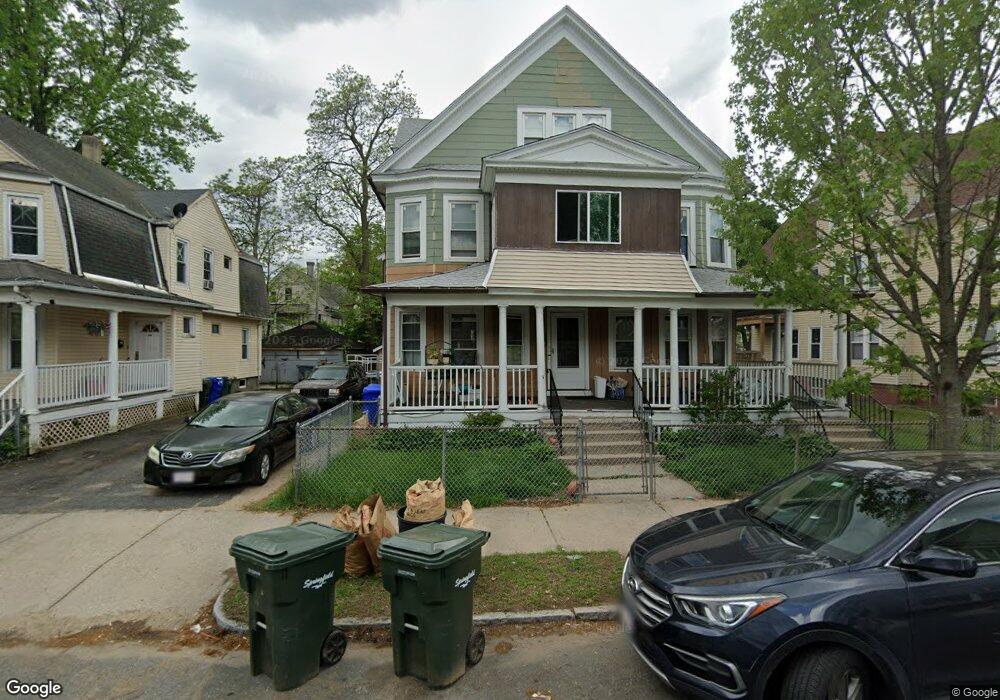
38 Dunmoreland St Unit 40 Springfield, MA 01109
Upper Hill NeighborhoodEstimated Value: $264,956 - $394,000
6
Beds
2
Baths
3,274
Sq Ft
$103/Sq Ft
Est. Value
About This Home
This home is located at 38 Dunmoreland St Unit 40, Springfield, MA 01109 and is currently estimated at $336,239, approximately $102 per square foot. 38 Dunmoreland St Unit 40 is a home located in Hampden County with nearby schools including Mary M. Walsh Elementary School, M Marcus Kiley Middle, and Springfield High School of Science and Technology.
Ownership History
Date
Name
Owned For
Owner Type
Purchase Details
Closed on
Oct 30, 1979
Bought by
Harris Sammy D and Harris Sharon J
Current Estimated Value
Create a Home Valuation Report for This Property
The Home Valuation Report is an in-depth analysis detailing your home's value as well as a comparison with similar homes in the area
Home Values in the Area
Average Home Value in this Area
Purchase History
| Date | Buyer | Sale Price | Title Company |
|---|---|---|---|
| Harris Sammy D | -- | -- |
Source: Public Records
Mortgage History
| Date | Status | Borrower | Loan Amount |
|---|---|---|---|
| Closed | Harris Sammy D | $32,910 |
Source: Public Records
Tax History
| Year | Tax Paid | Tax Assessment Tax Assessment Total Assessment is a certain percentage of the fair market value that is determined by local assessors to be the total taxable value of land and additions on the property. | Land | Improvement |
|---|---|---|---|---|
| 2025 | $3,203 | $204,300 | $31,100 | $173,200 |
| 2024 | $2,891 | $180,000 | $31,100 | $148,900 |
| 2023 | $2,759 | $161,800 | $28,300 | $133,500 |
| 2022 | $3,344 | $177,700 | $26,400 | $151,300 |
| 2021 | $2,895 | $153,200 | $18,700 | $134,500 |
| 2020 | $2,769 | $141,800 | $18,700 | $123,100 |
| 2019 | $2,580 | $131,100 | $16,000 | $115,100 |
| 2018 | $2,470 | $125,500 | $16,000 | $109,500 |
| 2017 | $2,363 | $120,200 | $15,000 | $105,200 |
| 2016 | $2,033 | $103,400 | $15,000 | $88,400 |
| 2015 | $2,000 | $101,700 | $15,000 | $86,700 |
Source: Public Records
Map
Nearby Homes
- 19 Westford Ave
- 67 Villa Pkwy
- 283 Wilbraham Rd
- 48-50 Dresden St
- 124-126 Westford Cir
- 21 Westford Cir
- 46 Mapledell St
- 62-64 Bristol St
- 65 Montrose St
- 52-56 Andrew St
- 135-137 Suffolk St
- 290 Quincy St
- 15 Kenyon St
- 145 Cambridge St
- 111 Marlborough St
- 90 Cambridge St
- 0 NS (24) Alden St
- 41 Olive St
- 163 Marion St
- 867 Roosevelt Ave
- 44-46 Dunmoreland St
- 32 Dunmoreland St Unit 34
- 44 Dunmoreland St Unit 46
- 39 Massachusetts Ave
- 37-39 Massachusetts Ave
- 37 Massachusetts Ave
- 26 Dunmoreland St Unit 28
- 50 Dunmoreland St Unit 52
- 43 Massachusetts Ave
- 31 Massachusetts Ave Unit 33
- 31 Massachusetts Ave Unit 3
- 37 Dunmoreland St Unit 39
- 25 Massachusetts Ave
- 45 Dunmoreland St
- 33 Dunmoreland St
- 51 Massachusetts Ave
- 56 Dunmoreland St Unit 58
- 20 Dunmoreland St Unit 22
- 20-22 Dunmoreland St
- 51 Dunmoreland St
Your Personal Tour Guide
Ask me questions while you tour the home.