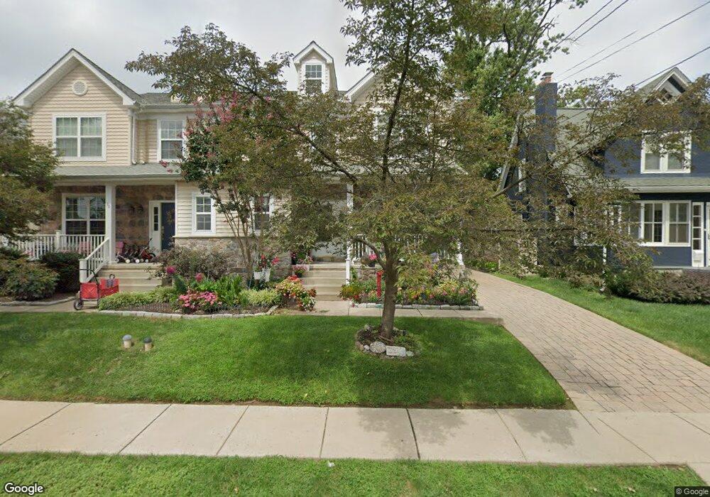
38 E Marthart Ave Havertown, PA 19083
Estimated Value: $612,000 - $820,000
4
Beds
3
Baths
3,219
Sq Ft
$232/Sq Ft
Est. Value
About This Home
This home is located at 38 E Marthart Ave, Havertown, PA 19083 and is currently estimated at $747,771, approximately $232 per square foot. 38 E Marthart Ave is a home located in Delaware County with nearby schools including Chestnutwold Elementary School, Haverford Middle School, and Haverford Senior High School.
Ownership History
Date
Name
Owned For
Owner Type
Purchase Details
Closed on
May 22, 2007
Sold by
Sposato Rayer Builders Inc
Bought by
Rodgers John J and Rodgers Joan
Current Estimated Value
Home Financials for this Owner
Home Financials are based on the most recent Mortgage that was taken out on this home.
Original Mortgage
$39,050
Interest Rate
5.98%
Mortgage Type
Stand Alone Second
Create a Home Valuation Report for This Property
The Home Valuation Report is an in-depth analysis detailing your home's value as well as a comparison with similar homes in the area
Home Values in the Area
Average Home Value in this Area
Purchase History
| Date | Buyer | Sale Price | Title Company |
|---|---|---|---|
| Rodgers John J | $390,500 | None Available |
Source: Public Records
Mortgage History
| Date | Status | Borrower | Loan Amount |
|---|---|---|---|
| Closed | Rodgers John J | $39,050 | |
| Open | Rodgers John J | $312,400 |
Source: Public Records
Tax History Compared to Growth
Tax History
| Year | Tax Paid | Tax Assessment Tax Assessment Total Assessment is a certain percentage of the fair market value that is determined by local assessors to be the total taxable value of land and additions on the property. | Land | Improvement |
|---|---|---|---|---|
| 2025 | $10,644 | $413,950 | $96,640 | $317,310 |
| 2024 | $10,644 | $413,950 | $96,640 | $317,310 |
| 2023 | $10,341 | $413,950 | $96,640 | $317,310 |
| 2022 | $10,100 | $413,950 | $96,640 | $317,310 |
| 2021 | $16,453 | $413,950 | $96,640 | $317,310 |
| 2020 | $11,090 | $238,595 | $48,940 | $189,655 |
| 2019 | $10,885 | $238,595 | $48,940 | $189,655 |
| 2018 | $10,698 | $238,595 | $0 | $0 |
| 2017 | $10,472 | $238,595 | $0 | $0 |
| 2016 | $1,309 | $238,595 | $0 | $0 |
| 2015 | $1,336 | $238,595 | $0 | $0 |
| 2014 | $1,309 | $238,595 | $0 | $0 |
Source: Public Records
Map
Nearby Homes
- 26 E Turnbull Ave
- 32 E Benedict Ave
- 231 Hastings Ave
- 25 Oak Ln
- 100 Brookline Blvd
- 13 Princeton Rd
- 16 Chelten Rd
- 1216 Darby Rd
- 1612 Earlington Rd
- 324 Brookline Blvd
- 2423 Hollis Rd
- 1615 Earlington Rd
- 41 W Hillcrest Ave
- 2300 Oakmont Ave
- 247 Sagamore Rd
- 2308 Poplar Rd
- 100 E Manoa Rd
- 1807 Earlington Rd
- 2424 Delchester Ave
- 421 E Eagle Rd
- 36 E Marthart Ave
- 42 E Marthart Ave
- 34 E Marthart Ave
- 46 E Marthart Ave
- 32 E Marthart Ave
- 48 E Marthart Ave
- 30 E Marthart Ave
- 43 E Turnbull Ave
- 35 E Turnbull Ave
- 28 E Marthart Ave
- 45 E Turnbull Ave
- 47 E Turnbull Ave
- 31 E Turnbull Ave
- 37 E Marthart Ave
- 41 E Marthart Ave
- 35 E Marthart Ave
- 24 E Marthart Ave
- 100 E Marthart Ave
- 45 E Marthart Ave
- 27 E Turnbull Ave