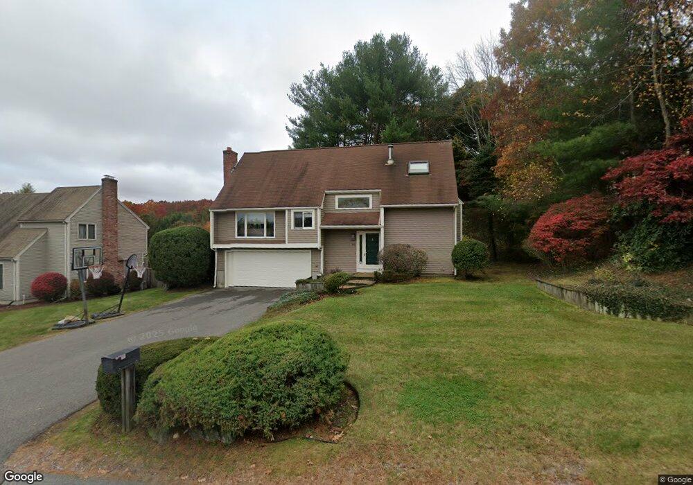
38 Estey Way Stoughton, MA 02072
Estimated Value: $607,000 - $648,185
3
Beds
2
Baths
1,301
Sq Ft
$486/Sq Ft
Est. Value
About This Home
This home is located at 38 Estey Way, Stoughton, MA 02072 and is currently estimated at $632,046, approximately $485 per square foot. 38 Estey Way is a home located in Norfolk County with nearby schools including Wilkins Elementary School, O'Donnell Middle School, and Stoughton High School.
Ownership History
Date
Name
Owned For
Owner Type
Purchase Details
Closed on
Nov 30, 2010
Sold by
Friedman Roberta E and Seronick Alvin J
Bought by
Friedman Roberta E
Current Estimated Value
Home Financials for this Owner
Home Financials are based on the most recent Mortgage that was taken out on this home.
Original Mortgage
$215,000
Outstanding Balance
$141,709
Interest Rate
4.25%
Mortgage Type
Purchase Money Mortgage
Estimated Equity
$490,337
Purchase Details
Closed on
Apr 29, 1994
Sold by
Pineault Conrad P
Bought by
Seronick Alvin J
Home Financials for this Owner
Home Financials are based on the most recent Mortgage that was taken out on this home.
Original Mortgage
$132,500
Interest Rate
7.7%
Mortgage Type
Purchase Money Mortgage
Create a Home Valuation Report for This Property
The Home Valuation Report is an in-depth analysis detailing your home's value as well as a comparison with similar homes in the area
Home Values in the Area
Average Home Value in this Area
Purchase History
| Date | Buyer | Sale Price | Title Company |
|---|---|---|---|
| Friedman Roberta E | -- | -- | |
| Friedman Roberta E | -- | -- | |
| Friedman Roberta E | -- | -- | |
| Seronick Alvin J | $187,500 | -- | |
| Seronick Alvin J | $187,500 | -- |
Source: Public Records
Mortgage History
| Date | Status | Borrower | Loan Amount |
|---|---|---|---|
| Open | Friedman Roberta E | $215,000 | |
| Closed | Seronick Alvin J | $215,000 | |
| Previous Owner | Seronick Alvin J | $132,500 |
Source: Public Records
Tax History Compared to Growth
Tax History
| Year | Tax Paid | Tax Assessment Tax Assessment Total Assessment is a certain percentage of the fair market value that is determined by local assessors to be the total taxable value of land and additions on the property. | Land | Improvement |
|---|---|---|---|---|
| 2025 | $6,862 | $554,300 | $222,200 | $332,100 |
| 2024 | $6,696 | $526,000 | $203,000 | $323,000 |
| 2023 | $6,642 | $490,200 | $185,500 | $304,700 |
| 2022 | $6,438 | $446,800 | $178,500 | $268,300 |
| 2021 | $6,170 | $408,600 | $157,500 | $251,100 |
| 2020 | $6,249 | $419,700 | $157,500 | $262,200 |
| 2019 | $6,291 | $410,100 | $157,500 | $252,600 |
| 2018 | $6,022 | $406,600 | $154,000 | $252,600 |
| 2017 | $5,651 | $390,000 | $152,200 | $237,800 |
| 2016 | $5,331 | $356,100 | $143,500 | $212,600 |
| 2015 | $5,255 | $347,300 | $134,700 | $212,600 |
| 2014 | $4,903 | $311,500 | $122,500 | $189,000 |
Source: Public Records
Map
Nearby Homes
- 545 Pearl St
- 27 Ward Well Rd
- 141 Shaw Farm Rd Unit 141
- 42 Amherst Rd
- 24 Amherst Rd
- 40 Horan Way
- 111 Ralph Mann Dr
- 69 Laarhoven Terrace
- 0 Washington St Unit 71897113
- 0 Washington St Unit 72888098
- 16 Meadowood Dr
- 25 Pine St Unit B
- 23 Pine St Unit K
- 54 Laurelwood Dr
- 59 Rosewood Dr
- 230 Greenbrook Dr
- 56 Laurelwood Dr
- 21 Pine St Unit E
- 40 Elderwood Dr
- 102 Ewing Dr