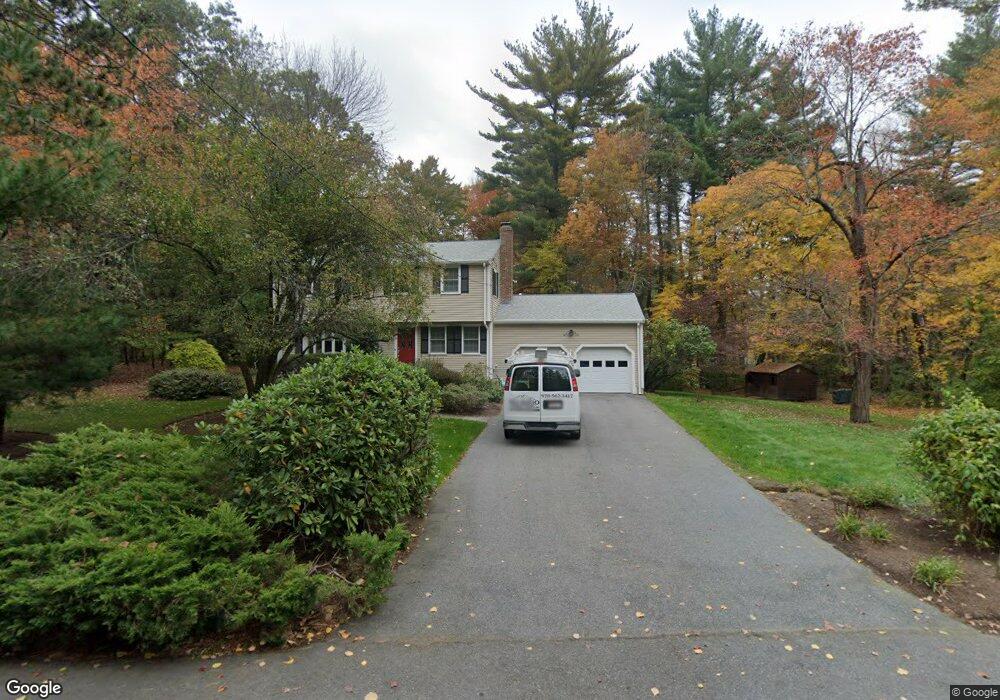
38 Flintlock Ln Sudbury, MA 01776
Estimated Value: $959,000 - $1,117,000
4
Beds
3
Baths
1,944
Sq Ft
$533/Sq Ft
Est. Value
About This Home
This home is located at 38 Flintlock Ln, Sudbury, MA 01776 and is currently estimated at $1,037,100, approximately $533 per square foot. 38 Flintlock Ln is a home located in Middlesex County with nearby schools including General John Nixon Elementary School, Ephraim Curtis Middle School, and Lincoln-Sudbury Regional High School.
Ownership History
Date
Name
Owned For
Owner Type
Purchase Details
Closed on
Jan 6, 1999
Sold by
Nelson Mark A and Nelson Debra L
Bought by
Marshall Martin D and Terzian Debra L
Current Estimated Value
Home Financials for this Owner
Home Financials are based on the most recent Mortgage that was taken out on this home.
Original Mortgage
$170,000
Interest Rate
6.8%
Mortgage Type
Purchase Money Mortgage
Purchase Details
Closed on
Feb 14, 1992
Sold by
Nagy Barbara G
Bought by
Nelson Mark A and Nelson Debra L
Create a Home Valuation Report for This Property
The Home Valuation Report is an in-depth analysis detailing your home's value as well as a comparison with similar homes in the area
Home Values in the Area
Average Home Value in this Area
Purchase History
| Date | Buyer | Sale Price | Title Company |
|---|---|---|---|
| Marshall Martin D | $380,000 | -- | |
| Nelson Mark A | $261,000 | -- | |
| Nelson Mark A | $261,000 | -- |
Source: Public Records
Mortgage History
| Date | Status | Borrower | Loan Amount |
|---|---|---|---|
| Open | Nelson Mark A | $90,000 | |
| Closed | Nelson Mark A | $52,000 | |
| Closed | Nelson Mark A | $170,000 |
Source: Public Records
Tax History
| Year | Tax Paid | Tax Assessment Tax Assessment Total Assessment is a certain percentage of the fair market value that is determined by local assessors to be the total taxable value of land and additions on the property. | Land | Improvement |
|---|---|---|---|---|
| 2025 | $14,258 | $973,900 | $462,400 | $511,500 |
| 2024 | $13,735 | $940,100 | $448,800 | $491,300 |
| 2023 | $13,047 | $827,300 | $415,600 | $411,700 |
| 2022 | $12,969 | $718,500 | $381,200 | $337,300 |
| 2021 | $12,518 | $664,800 | $381,200 | $283,600 |
| 2020 | $12,266 | $664,800 | $381,200 | $283,600 |
| 2019 | $11,907 | $664,800 | $381,200 | $283,600 |
| 2018 | $11,839 | $660,300 | $401,200 | $259,100 |
| 2017 | $11,586 | $653,100 | $396,400 | $256,700 |
| 2016 | $11,225 | $630,600 | $381,200 | $249,400 |
| 2015 | $10,752 | $610,900 | $366,400 | $244,500 |
| 2014 | $10,731 | $595,200 | $355,600 | $239,600 |
Source: Public Records
Map
Nearby Homes
- 6 Canterbury Dr
- 111 Willis Rd
- 55 Widow Rites Ln
- 45 Widow Rites Ln
- 8-10 Concord Road (&356 Bostonpost)
- 377 Willis Rd
- 42 Dakin Rd
- 427 Concord Rd
- 19 Skyview Ln
- 57 Longfellow Rd
- 8 Twillingate Rd
- 2 Skyview Ln
- 11 October Rd
- 26 Clark Rd
- 45 Webster Cir
- 8 Snowberry Ln
- 62 Churchill St
- 1B Quaboag Valley Co-Op St
- Lot 5 Sailaway Ln
- Lot 4 Sailaway Ln
Your Personal Tour Guide
Ask me questions while you tour the home.