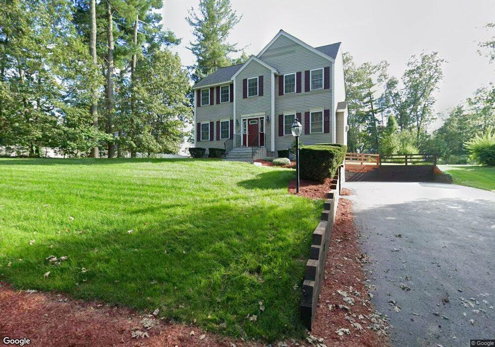
38 Forrest Rd Westford, MA 01886
Estimated Value: $864,919 - $1,111,000
3
Beds
3
Baths
2,151
Sq Ft
$439/Sq Ft
Est. Value
About This Home
This home is located at 38 Forrest Rd, Westford, MA 01886 and is currently estimated at $944,480, approximately $439 per square foot. 38 Forrest Rd is a home located in Middlesex County with nearby schools including Nabnasset Elementary, Abbot Elementary School, and Stony Brook School.
Ownership History
Date
Name
Owned For
Owner Type
Purchase Details
Closed on
Jan 31, 2002
Sold by
Universal Dev Llc
Bought by
Battezzato Paolo and Battezzato Daniela
Current Estimated Value
Purchase Details
Closed on
Aug 3, 2001
Sold by
Dooley Robert C and Dooley Taeomi Martyn
Bought by
Universal Dev Llc
Create a Home Valuation Report for This Property
The Home Valuation Report is an in-depth analysis detailing your home's value as well as a comparison with similar homes in the area
Home Values in the Area
Average Home Value in this Area
Purchase History
| Date | Buyer | Sale Price | Title Company |
|---|---|---|---|
| Battezzato Paolo | $390,000 | -- | |
| Universal Dev Llc | $105,000 | -- |
Source: Public Records
Mortgage History
| Date | Status | Borrower | Loan Amount |
|---|---|---|---|
| Open | Universal Dev Llc | $163,000 | |
| Open | Universal Dev Llc | $315,000 | |
| Closed | Universal Dev Llc | $300,000 |
Source: Public Records
Tax History Compared to Growth
Tax History
| Year | Tax Paid | Tax Assessment Tax Assessment Total Assessment is a certain percentage of the fair market value that is determined by local assessors to be the total taxable value of land and additions on the property. | Land | Improvement |
|---|---|---|---|---|
| 2025 | $10,651 | $773,500 | $307,000 | $466,500 |
| 2024 | $10,651 | $773,500 | $307,000 | $466,500 |
| 2023 | $10,088 | $683,500 | $292,200 | $391,300 |
| 2022 | $10,130 | $628,400 | $234,800 | $393,600 |
| 2021 | $626,753 | $567,500 | $234,800 | $332,700 |
| 2020 | $9,303 | $569,700 | $234,800 | $334,900 |
| 2019 | $8,740 | $527,800 | $220,500 | $307,300 |
| 2018 | $8,386 | $518,300 | $211,000 | $307,300 |
| 2017 | $8,084 | $492,600 | $211,000 | $281,600 |
| 2016 | $7,729 | $474,200 | $198,900 | $275,300 |
| 2015 | $7,571 | $466,200 | $190,200 | $276,000 |
| 2014 | $7,462 | $449,500 | $182,700 | $266,800 |
Source: Public Records
Map
Nearby Homes