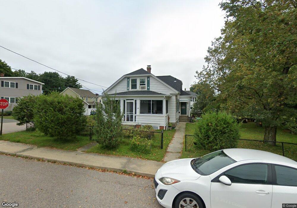
38 Goddard St Blackstone, MA 01504
Estimated Value: $418,096 - $487,000
3
Beds
2
Baths
1,326
Sq Ft
$338/Sq Ft
Est. Value
About This Home
This home is located at 38 Goddard St, Blackstone, MA 01504 and is currently estimated at $448,524, approximately $338 per square foot. 38 Goddard St is a home located in Worcester County with nearby schools including Blackstone-Millville Regional High School, Founders Academy, and Beacon Charter School.
Ownership History
Date
Name
Owned For
Owner Type
Purchase Details
Closed on
Jun 17, 1992
Sold by
Provost Wilfred J
Bought by
Parenteau Lucie I
Current Estimated Value
Home Financials for this Owner
Home Financials are based on the most recent Mortgage that was taken out on this home.
Original Mortgage
$75,000
Interest Rate
8.67%
Mortgage Type
Purchase Money Mortgage
Create a Home Valuation Report for This Property
The Home Valuation Report is an in-depth analysis detailing your home's value as well as a comparison with similar homes in the area
Home Values in the Area
Average Home Value in this Area
Purchase History
| Date | Buyer | Sale Price | Title Company |
|---|---|---|---|
| Parenteau Lucie I | $110,000 | -- |
Source: Public Records
Mortgage History
| Date | Status | Borrower | Loan Amount |
|---|---|---|---|
| Open | Parenteau Lucie I | $25,000 | |
| Closed | Parenteau Lucie I | $75,000 | |
| Closed | Parenteau Lucie I | $75,000 | |
| Previous Owner | Parenteau Lucie I | $30,000 |
Source: Public Records
Tax History Compared to Growth
Tax History
| Year | Tax Paid | Tax Assessment Tax Assessment Total Assessment is a certain percentage of the fair market value that is determined by local assessors to be the total taxable value of land and additions on the property. | Land | Improvement |
|---|---|---|---|---|
| 2025 | $4,791 | $317,300 | $132,300 | $185,000 |
| 2024 | $5,098 | $312,200 | $132,300 | $179,900 |
| 2023 | $4,983 | $308,000 | $132,300 | $175,700 |
| 2022 | $4,532 | $253,200 | $126,500 | $126,700 |
| 2021 | $4,868 | $225,700 | $115,000 | $110,700 |
| 2020 | $11,872 | $216,500 | $115,000 | $101,500 |
| 2019 | $3,962 | $209,500 | $105,800 | $103,700 |
| 2018 | $3,758 | $192,800 | $100,700 | $92,100 |
| 2017 | $3,475 | $180,400 | $100,700 | $79,700 |
| 2016 | $3,466 | $179,200 | $91,700 | $87,500 |
| 2015 | $3,366 | $172,800 | $91,700 | $81,100 |
Source: Public Records
Map
Nearby Homes
- 259 Main St
- 0 Main St
- 1 Tupperware Dr Unit 226
- 1 Tupperware Dr Unit 138
- 1 Tupperware Dr Unit 108
- 225-227 Main St
- 6 Old Mendon St
- 8 Old Mendon St Unit 8
- 122 Canal St
- 175 Saint Paul St
- 22 Colerick Ave
- 81 Fountain St
- 24 Reilly Ave
- 96 Main St Unit 1
- 12 Keough St
- 29 Graves Ave
- 470 Saint Paul St
- 4 Sharon Pkwy
- 15 Blackstone St
- 3 Federal St